Üüreg Lake
| Üüreg Lake Үүрэг нуур | |
| salt lake | |
 Satellite view of Üüreg Lake and its drainage basin | |
| Country | Mongolia |
|---|---|
| State | Uvs Province |
| District | Sagil, Uvs |
| Settlements | Üüregnuur |
| Elevation | 1,425 m (4,675 ft) |
| Coordinates | MN 50°10′N 91°00′E / 50.167°N 91.000°ECoordinates: MN 50°10′N 91°00′E / 50.167°N 91.000°E |
| Source | Kharig Gol Rus.: Kargy |
| Length | 20 km (12 mi), E-W |
| Width | 18 km (11 mi), N-S |
| Depth | 26.9 m (88 ft) |
| - Max. depth | 42 m (138 ft) |
| Volume | 6,419,000,000 m3 (2.26684845685×10¹¹ cu ft) |
| Area | 239 km2 (92 sq mi) |
| Discharge | |
| - average | 0 m3/s (0 cu ft/s) endorheic lake |
| islands | 0 |
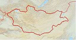
  Location in Mongolia
| |
Üüreg Lake (Mongolian: Үүрэг нуур, Üüreg nuur) is a lake in an endorheic basin in western Mongolia, north-west of the Great Lakes Hollow, near the western edge of the Uvs Nuur basin.
This article is issued from Wikipedia - version of the 4/4/2016. The text is available under the Creative Commons Attribution/Share Alike but additional terms may apply for the media files.