A3071 road
| |
|---|---|
| Route information | |
| Length: | 6.2 mi (10.0 km) |
| Major junctions | |
| West end: | St. Just |
|
| |
| East end: | A30 & Penzance |
| Location | |
| Primary destinations: | St. Just, Newbridge, Tremethick Cross & Penzance |
| Road network | |

The A3071 is a minor 'A' road in the English county of Cornwall.[1] It links St. Just to Penzance and the A30. It is 6.2 miles long.
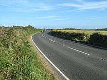
The A3071 near Tremayne farm
References
- ↑ "1 Inch Map of Land's End". Ordnance Survey. 1960. Retrieved 6 January 2012.
External links
This article is issued from Wikipedia - version of the 2/22/2015. The text is available under the Creative Commons Attribution/Share Alike but additional terms may apply for the media files.