Babase Island
| Babase | |
|---|---|
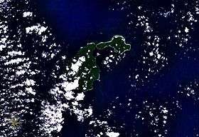 Feni Islands seen from space, with Ambitle (left) and Babase (right). | |
| Highest point | |
| Elevation | 200 m (660 ft) |
| Prominence | 200 m (660 ft) |
| Coordinates | 4°2′S 153°43′E / 4.033°S 153.717°E |
| Geography | |
| Location | Bismarck Archipelago, Papua New Guinea |
| Geology | |
| Mountain type | Stratovolcano |
| Last eruption | Unknown |
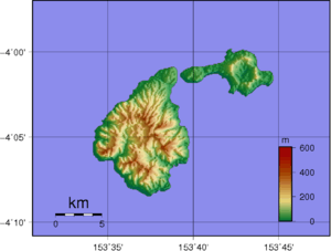
Topographic map of Feni Islands. Babase is on the right.
Babase Island is an island of the Feni Islands in Papua New Guinea, located east of New Ireland. It consists of a stratovolcano and a lava dome, joined by an isthmus.
References
This article is issued from Wikipedia - version of the 12/23/2015. The text is available under the Creative Commons Attribution/Share Alike but additional terms may apply for the media files.