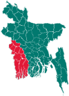
Bagherpara Upazila
| Bagherpara বাঘারপাড়া | |
|---|---|
| Upazila | |
 Bagherpara Location in Bangladesh | |
| Coordinates: 23°13′N 89°21′E / 23.217°N 89.350°ECoordinates: 23°13′N 89°21′E / 23.217°N 89.350°E | |
| Country |
|
| Division | Khulna Division |
| District | Jessore District |
| Area | |
| • Total | 308.29 km2 (119.03 sq mi) |
| Population (2011) | |
| • Total | 216,897 |
| • Density | 700/km2 (1,800/sq mi) |
| Time zone | BST (UTC+6) |
| Postal code | 7470 |
| Website | Official Map of Bagherpara |
Bagherpara (Bengali: বাঘারপাড়া) is an Upazila of Jessore District[1] in the Division of Khulna, Bangladesh.
Geography
Bagherpara is located at 23°13′00″N 89°21′00″E / 23.2167°N 89.3500°E. It has a total area of 308.29 km².
Demographics
As of the 2011 Bangladesh census, Bagherpara has a population of 216,897. In 1991 males constituted 51.21% of the population, and females 48.79%; this Upazila's eighteen-up population was 84303. Bagherpara has an average literacy rate of 34.5% (7+ years), and the national average of 32.4% literate.[2]
Administration
Bagherpara has 9 Unions/Wards, 156 Mauzas/Mahallas, and 191 villages. Unions Name
- Johorpur
- Bandobila
- Raipur
- Dohakula
- Dorajhat
- Narikelbaria
- Dholgrum
- Jamdia
- Basuria
Education
@ Kayal Khaly Govt. Primary School, Established 2004; Founder,Muhammad Hafizur Rahman, USA.
- Raipur Govt.Primary School
- East Paikpara Govt. Model Primary School
- Dohakula Govt. Primary School
- Bagherpara Pilot High School
- Bagherpara Pilot Girls High School
- Bagherpara Degree College
- Bagherpara Mohilla College
- Raipur School & College
- Selumpur High school
- Karimpur High School
- Bagherpara siddikiya fazil madrasha
- Azempur islamia alim madrasa
- Narikelbariya degree college
- Narikelbariya high school
- Inra primary school
- Inra high school
- Dayarampur Siddikya Senior Madrasha.
- Dayarampur Primary School,
- Borvagh high school.
- Borvagh primary school.
- MD. ABU HURIRA.
- Vitaballah High School.
Chhaibaria primary School. C.S.A.High School. Japan Bangladesh Friendship Agricultural College. Jamdia High School. Jamdia Hafijia Dakhil Madrasha Khalshe Girls School. Dargahpur Fazil Degree Madrasha Andul Baria High School Bir Protik Ishaqe College,Dhalgram
See also
References
- ↑ Biplab Sen (2012), "Bagherpara Upazila", in Sirajul Islam and Ahmed A. Jamal, Banglapedia: National Encyclopedia of Bangladesh (Second ed.), Asiatic Society of Bangladesh
- ↑ "Population Census Wing, BBS.". Archived from the original on 2005-03-27. Retrieved November 10, 2006.
