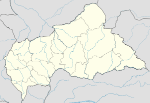
Bambari
| Bambari | |
|---|---|
 Bambari Location in Central African Republic | |
| Coordinates: 05°45′55″N 20°40′27″E / 5.76528°N 20.67417°E | |
| Country |
|
| Prefecture | Ouaka |
| Elevation | 465 m (1,526 ft) |
| Population (2012)[1] | |
| • Total | 41,486 |
Bambari is a town in the Central African Republic, lying on the Ouaka River. It has a population of 41,356 (2003 census) and is the capital of Ouaka prefecture. Bambari is an important market town and is home to Bambari Airport, and the Roman Catholic Diocese of Bambari.
Mining
Large deposits of iron ore have been discovered in the vicinity of Bambari, though the considerable distance to the sea — 1500 km — probably makes exploitatation of these reserves doubtful in the near future. A heavy duty railway and a deepwater port in a neighbouring country would be required.
The mining resource also includes iron deposits at Bakala.
Climate
Köppen-Geiger climate classification system classifies its climate as tropical wet and dry (Aw).[2]
| Climate data for Bambari | |||||||||||||
|---|---|---|---|---|---|---|---|---|---|---|---|---|---|
| Month | Jan | Feb | Mar | Apr | May | Jun | Jul | Aug | Sep | Oct | Nov | Dec | Year |
| Average high °C (°F) | 33.7 (92.7) |
35.3 (95.5) |
34.7 (94.5) |
32.4 (90.3) |
31.4 (88.5) |
30.5 (86.9) |
29.2 (84.6) |
29.7 (85.5) |
30.3 (86.5) |
31. (88) |
32.4 (90.3) |
33.1 (91.6) |
31.98 (89.57) |
| Daily mean °C (°F) | 25.3 (77.5) |
27.1 (80.8) |
27.5 (81.5) |
26.4 (79.5) |
25.8 (78.4) |
25.1 (77.2) |
24.4 (75.9) |
24.6 (76.3) |
24.7 (76.5) |
25.1 (77.2) |
24.7 (76.5) |
24.2 (75.6) |
25.41 (77.74) |
| Average low °C (°F) | 16.9 (62.4) |
19 (66) |
20.4 (68.7) |
20.5 (68.9) |
20.2 (68.4) |
19.7 (67.5) |
19.7 (67.5) |
19.5 (67.1) |
19.2 (66.6) |
19.2 (66.6) |
17.1 (62.8) |
15.3 (59.5) |
18.89 (66) |
| Average precipitation mm (inches) | 10 (0.39) |
30 (1.18) |
80 (3.15) |
105 (4.13) |
174 (6.85) |
171 (6.73) |
194 (7.64) |
221 (8.7) |
228 (8.98) |
209 (8.23) |
41 (1.61) |
8 (0.31) |
1,471 (57.9) |
| Source: Climate-Data.org, altitude: 442m[2] | |||||||||||||
See also
References
- ↑ "World Gazetteer".
- 1 2 "Climate: Bambari - Climate graph, Temperature graph, Climate table". Climate-Data.org. Retrieved 21 October 2013.
External links
Coordinates: 05°45′55″N 20°40′27″E / 5.76528°N 20.67417°E
