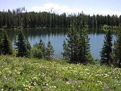
Bearpaw Lake (Teton County, Wyoming)
| Bearpaw Lake | |
|---|---|
 Bearpaw Lake | |
| Location | Grand Teton National Park, Teton County, Wyoming, US |
| Coordinates | 43°49′47″N 110°43′47″W / 43.82972°N 110.72972°WCoordinates: 43°49′47″N 110°43′47″W / 43.82972°N 110.72972°W[1] |
| Type | Glacial Lake |
| Basin countries | United States |
| Max. length | .20 mi (0.32 km) |
| Max. width | .10 mi (0.16 km) |
| Surface elevation | 6,848 ft (2,087 m) |
Bearpaw Lake is located in Grand Teton National Park, in the U. S. state of Wyoming.[2] Bearpaw Lake is south of Trapper Lake and north of Leigh Lake. Bearpaw Lake is an easy to moderate 8-mile (13 km) round trip hike along the Leigh Lake Trail.[3]
References
- ↑ "Bearpaw Lake". Geographic Names Information System. United States Geological Survey. Retrieved 2011-11-27.
- ↑ Jenny Lake, WY (Map). Topoquest (USGS Quads). Retrieved 2011-11-27.
- ↑ "Day Hikes" (pdf). Plan Your Visit. National Park Service. 2010. Retrieved 2011-11-28.
This article is issued from Wikipedia - version of the 12/31/2015. The text is available under the Creative Commons Attribution/Share Alike but additional terms may apply for the media files.