Bekal Fort
| Bekal Fort ബേക്കൽ കോട്ട | |
|---|---|
|
Bekal Fort in Kasargod, Kerala | |
 Bekal Fort  Bekal Fort | |
| Coordinates: 12°22′00″N 75°03′00″E / 12.3667°N 75.05°E | |
| Country |
|
| State | Kerala |
| District | Kasargod District |
| Region | North Malabar |
| Taluk | Kasargod |
| Language | Malayalam |
| Nearest cities | Mangalore, Kasargod |
| Time zone | IST (UTC+5:30) |
Bekal Fort (Malayalam: ബേക്കൽ കോട്ട), is the largest fort in Kerala, situated at Bekal village in Kasaragod district, North Kerala and it is 67 km from Mangalore spreading over 40 acres (160,000 m2).


Structure
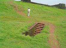
An important features of this fort is the water-tank with its flight of steps. The fort has a tunnel opening towards the south and a magazine for keeping ammunition with broad steps leading to the Observation Tower. From there one has an ample view of towns in the vicinity like Kanhangad, Pallikkara, Bekal, Kottikkulam, and Uduma. The nearest railway stations are Bekal Fort, Kotikulam, Kanhangad, and Kasargod. This observation center had strategic significance in discovering even the smallest movements of the enemy and ensuring the safety of the Fort.[1]
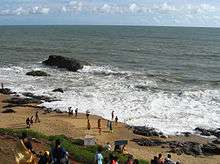
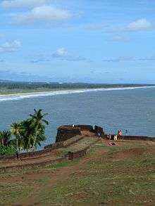
The Fort appears to have been built up from the sea since almost three fourths of its exterior is drenched and the waves continually stroke the citadel. The Mukhyaprana Temple of Hanuman and the ancient Muslim mosque nearby bear testimony to the age-old religious harmony that prevailed in the area. The zigzag entrance and the trenches around the fort show the defense strategy inherent in the fort.
Unlike most other Indian forts, Bekal Fort was not a center of administration, for no remains of any palace, mansion or such buildings are found within the fort. Arguably the fort was built especially for fulfilling defence requirements. The holes on the outer walls of the fort are specially designed to defend the fort effectively. The holes at top were meant for aiming at the farthest points; the holes below for striking when the enemy was nearer and the holes underneath facilitated attacking when the enemy was very near to the fort. This is remarkable evidence of technology in defense strategy.[2]
Recorded history

Shivappa Nayaka of Bednore constructed the Bekal Fort in 1650 CE. During the Perumal Age Bekal was a part of Mahodayapuram. The Kodavalam inscription (Pullur, 7 km from Kanhangad) of Bhasakara Ravi II (the King of Mahodayapuram) illustrate the undisputed political sway of Mahodayapuram over this region. Following the political decline of Mahodayapuram Perumals by the 12th century AD, North Kerala including Bekal, came under the sovereignty of Mushika or Kolathiri or Chirakkal Royal Family (who were a secondary royal family at that point to the Cheras, Pandyas and Cholas).[3] The maritime importance of Bekal increased much under the Kolathiris and it became an important port town of Tulunadu and Malabar.
It was usual in older days for every royal palace to be protected by a fort. The Bekal fort might have, therefore, existed even from early days of the Chirakkal Rajas. While writing a description of the Kolathiri Kingdom in his Kerala History, K.P. Padmanabha Menon writes: "The eldest of the male members reigned as sovereign Kolathiri. The next in succession, the heir apparent, was the Thekkelamkur. The residence assigned to him was the Vadakara fort. The third in succession was the Vadakkelamkur in charge of Vekkolath fort. This V(B)ekkolath fort is identified by some scholars as the present Bekal."[3]
H.A. Stuart, in his Handbook of South Canara (1985), makes this observation: "Several forts were built by the Shivappa Nayaks of Badnore between 1650 and 1670. The two forts of Bekal and Chandragiri were originally under the Kolathiri or Chirakkal Rajas until the time of Shivappa Nayaka's invasion. Perhaps, the Bednore rulers might have rebuilt and improved it."[3]
The Battle of Talikota in 1565 led to the decline of the mighty Vijayanagara Empire and many feudatory chieftains rose in political prominence including the Keladi Nayakas (Ikkeri Nayaks). The Nayakas realized the political and economic importance of Tulunadu (which is the region comprising modern-day Udupi and Dakshina Kannada districts along with the northernmost part of Kasargod District ) and attacked and annexed the region. Bekal served as a nucleus in establishing the dominance of the Nayakas in Malabar. The economic importance of the port town prompted the Nayakas to fortify Bekal subsequently. Hiriya Venkatappa Nayaka initiated the construction of the fort and it was completed during the period of Shivappa Nayaka. The speedy completion of the port was aimed at the defense of the fort from overseas attack and to strengthen their attack on Malabar. Chandragiri fort near Kasargod was also constructed during this period.[4]
Somashekhara Nayak captured Manjeswar and Taliparamba and built a fort at Kanhangad called Hosdurg which literally means 'New Fort' in Kannada/Tulu. The other forts found in Kasargod are constructed on the coastal region and on the route to Madikeri (Mercara in Coorg). It is believed that the 'Koteyar'/'Ramakshatriya' community found in Bekal, Panayal and other places in Kasargod were brought to this land by the Nayaks to strengthen and defend the fort. There was a prolonged struggle between the Kolathiries and Nayaks to recapture and maintain their hold over this area. These battles came to an end with the rise of Hyder Ali who conquered the Nayakas. Subsequently Bekal fell into the hands of Mysore kings.[4]
Bekal served as an important military station of Tipu Sultan when he led the great military expedition to capture Malabar. The coins and other artifacts unearthed by the archaeological excavation conducted recently at Bekal fort is a manifestation of the strong presence of the Mysore Sulthans. The death of Tipu Sultan in Fourth Anglo-Mysore War in 1799 saw the end of Mysorean control and subsequently the fort came under the British East India Company.[4][5]
During the reign of the Company Bekal became the headquarters of the newly organized Bekal Taluk of South Canara District in Bombay presidency. South Canara became a part of the Madras presidency in 1799 and Kasargod Taluk was up in the place of Bekal Taluk. Gradually the political and economic importance of Bekal and its port declined considerably. Kasargod became part of Kerala with the state reorganization in 1956.[6]
Its solid construction resembles the St. Angelo Fort at Kannur built by the Dutch and also the Thalassery Fort. The Ikkeri Nayakas had not developed guns to defend themselves from the invaders approaching from the Arabean sea route. But the western part of the fort is built in a solid manner with numerous slits on the walls for defending the fort from the naval power of other rulers. So it is believed that the present look of fort was the outcome of the conflict between European powers. Modification to the fort was made by all the rulers who ruled the land from before the time of the Ikkeri Nayakas. Moreover, a number of forts built by the Ikkeri Nayakas have failed to stand the test of time and perished. Located at the centre of the fort is an Observation Tower built by Tipu Sultan,[4] which offers a scenic view of the coastline. Also in existence is a rest-house built by the British Government. Presently the protection and preservation of Bekal fort has been entrusted to the Archaeological Survey of India.[7]
Tourism
In 1992 the Government of India declared Bekal Fort as a special tourism area.[8] In the year 1995 the government formed Bekal Tourism Development Corporation for transforming Bekal Fort into international tourism centre.[9] Tourism promotion activities have been taking place of late in the areas surrounding the fort, under the Bekal Resorts Development Corporation (BRDC). The song 'Uyire' (Tamil) from the movie Bombay (film) directed by Mani Ratnam has been shot at Bekal Fort. Many such films, music albums, and commercial advertisements are being shot at Bekal Fort.
The Mangrove Trail of Malabar is a day trippers visiting place about 45 km from Bakel. It is a coastal Jungle trail offering hiking, birding and boating.
Transportation
Local roads have access to NH.66 which connects to Mangalore in the north and Calicut in the south. The nearest railway station is Kanhangad on Mangalore-Palakkad line. There are airports at Mangalore and Calicut.

See also
- Mangalore
- Kasargod
- Kanhangad
- Kannur Fort
- Thalassery Fort
- Mysore invasion of Kerala
- SI-MET College of Nursing, Uduma
Notes
- ↑ https://www.tripadvisor.in/Attraction_Review-g1809068-d1204887-Reviews-Bekal_Fort-Kasaragod_Kerala.html
- ↑ https://www.keralatourism.org/destination/bekal-kasaragod/259/
- 1 2 3 The Hindu, 22 Oct 2005
- 1 2 3 4 Kasargod: History & Society
- ↑ Madras District Manual
- ↑ States Reorganisation Act
- ↑ ASI
- ↑ "Bastions of valour and victory" (Bangalore). Deccan Herald. 29 July 2014. Retrieved 19 January 2015.
- ↑ "BEKAL".
References
- Sturrock, John (1894). History of the Tuluvas. Madras District Manual. Madras Gazette.
- C, Balan (2001). Kasargod: History & Society. District Panchayat, Kasargod.
- Prashanth G.N. (2005-10-22). "Fort by the Sea". The Hindu.
- "Bekal Fort, Kasargod". Archaeological Survey of India.
External links
| Wikimedia Commons has media related to Bekal Fort. |
Coordinates: 12°23′32″N 75°1′57″E / 12.39222°N 75.03250°E
