Belaya River (Kama)
For other uses, see Belaya River (disambiguation).
| Belaya River, Ağidel, Aghidhel River | |
|---|---|
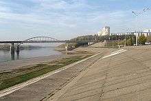 Belaya River in Ufa | |
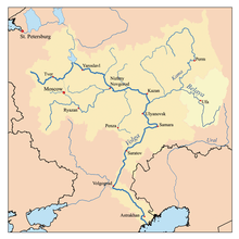
 Belaya River basin | |
| Country | Bashkortostan, Russia |
| Basin | |
| Main source |
Iremel mountain 54°33′0″N 59°3′0″E / 54.55000°N 59.05000°E |
| River mouth |
Kama, Nizhnekamsk Reservoir 55°53′14″N 53°36′14″E / 55.88722°N 53.60389°ECoordinates: 55°53′14″N 53°36′14″E / 55.88722°N 53.60389°E |
| Basin size | 142,000 km2 (55,000 sq mi) |
| Physical characteristics | |
| Length | 1,430 km (890 mi) |
| Discharge |
|
Belaya River (Russian: Бе́лая, Belaja; Bashkir: Ағиҙел, Ağiźel [ä.ʁi̠.ˈðɪ̞l], ![]() pronunciation ; Tatar: Cyrillic Агыйдел, Latin Ağídel, Arabic اعىدئل [ˌʌɣiˈdel]) is a river in Bashkortostan, Russian Federation. Its source lies in the south-western Ural Mountains.
pronunciation ; Tatar: Cyrillic Агыйдел, Latin Ağídel, Arabic اعىدئل [ˌʌɣiˈdel]) is a river in Bashkortostan, Russian Federation. Its source lies in the south-western Ural Mountains.
It is 1,430 kilometres (890 mi) long.[1]
Settlements along the Belaya include Beloretsk, Sterlitamak, Ufa (at the confluence with the Ufa River), and Birsk. The Belaya flows into the Kama River near Neftekamsk.
Map of the Volga watershed with the Belaya highlighted
References
- ↑ "Belaya River". Britannica.com. Retrieved 30 May 2016.
| Wikimedia Commons has media related to Belaya River. |
Left tributary of the Volga River | ||
| Tributaries | 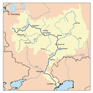 | |
| Reservoirs | ||
| Hydroelectric stations | ||
This article is issued from Wikipedia - version of the 6/21/2016. The text is available under the Creative Commons Attribution/Share Alike but additional terms may apply for the media files.