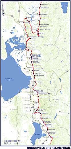
Bonneville Shoreline Trail
Coordinates: 41°00′N 111°53′W / 41.000°N 111.883°W


The Bonneville Shoreline Trail is a mixed use (biking/hiking) recreation trail in Utah that will follow the shoreline of the ancient Lake Bonneville where today the Wasatch Front plays host to a growing region of outdoor enthusiasts. Some sections of the trail are complete and some are under developed. The Bonneville Shoreline Trail efforts hope to one day stretch from the Idaho border North of Logan, Utah run South all the way to Nephi, Utah. 150 miles (240 km) apart, but will weave in and out of many canyons of the Wasatch Mountains, totaling 305+ miles of dirt and paved trails. If completed the trail would be located within 20 miles (32 km) of 80% of the population of Utah.[1]

References
External links
![]() Media related to Bonneville Shoreline Trail at Wikimedia Commons
Media related to Bonneville Shoreline Trail at Wikimedia Commons