Boykin Mill Complex
|
Boykin Mill Complex | |
|
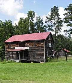
Boykin Mill Complex, September 2012 | |
  | |
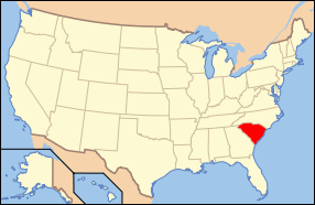
| Location | 8 miles south of Camden at the junction of South Carolina Highway 261 and County Road 2, near Camden, South Carolina |
|---|---|
| Coordinates | 34°07′42″N 80°34′17″W / 34.12833°N 80.57139°WCoordinates: 34°07′42″N 80°34′17″W / 34.12833°N 80.57139°W |
| Area | 886.3 acres (358.7 ha) |
| Architectural style | Mid 19th Century Revival, Bungalow/craftsman, Greek Revival |
| NRHP Reference # | 92001230[1] |
| Added to NRHP | September 10, 1992 |
Boykin Mill Complex, also known as Mill Tract Plantation, is a national historic district located near Camden, Kershaw County, South Carolina. The district encompasses nine contributing buildings, two contributing sites, and four contributing structures. “Boykin Mill” denotes a community which consists of an old post office (ca. 1875), an old general store (ca. 1905), a ca. 1905 grist mill, mill pond, mill dam, gates, and canals. The community also includes an early 19th century Greek Revival style Baptist church (ca. 1827), one mid-19th century residence, three 20th century residences (ca. 1935) built for mill workers, and a smoke house. An American Civil War battle site is also a part of the Boykin Mill community. The Battle of Boykin's Mill took place on April 17, 1865.[2][3]
It was listed on the National Register of Historic Places in 1992.[1]
References
- 1 2 National Park Service (2010-07-09). "National Register Information System". National Register of Historic Places. National Park Service.
- ↑ Katherine H. Richardson (May 1991). "Boykin Mill Complex" (pdf). National Register of Historic Places - Nomination and Inventory. Retrieved June 2014. Check date values in:
|access-date=(help) - ↑ "Boykin Mill Complex, Kershaw County (S.C. Hwy. 261, Boykin vicinity)". National Register Properties in South Carolina. South Carolina Department of Archives and History. Retrieved June 2014. Check date values in:
|access-date=(help)


