Carașova
| Carașova Karaševo | |
|---|---|
| Commune | |
|
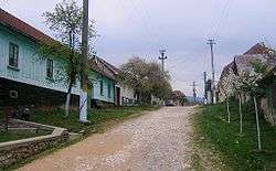
Road in Iabalcea village | |
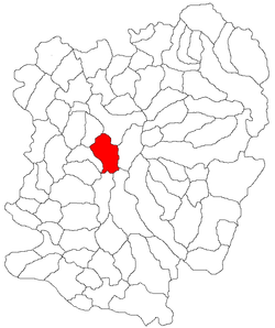
 Location in Caraș-Severin County | |
 Carașova Location in Romania | |
| Coordinates: 45°12′N 21°52′E / 45.200°N 21.867°E | |
| Country |
|
| County | Caraș-Severin County |
| Population (2011)[1] | |
| • Total | 3,071 |
| Time zone | EET (UTC+2) |
| • Summer (DST) | EEST (UTC+3) |
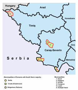
Carașova (Croatian: Karaševo; Hungarian: Krassóvár) is a commune in Caraș-Severin County, Romania. It is known especially for its geographical placement and for the origin of its Croatian inhabitants, the Krashovani. The population of the commune numbered 3,260 people at the 2002 census. The commune is composed of three villages: Carașova, Iabalcea (Jabalče; Krassóalmás) and Nermed (Neremić; Nermed).
Location
Carașova is located in Caraș-Severin County, in the historical region of Banat, at a distance of 15 kilometers from Reșița. It is found in a mountainous area, near the entrance to the Semenic-Cheile Carașului National Park.
Demographics

According to the 2011 census in Romania, the population of Carașova municipality comprises 78.28% Croats, 7.58% Romanians, 6.93% others (presumably declared Krashovani), and 5.6% Romani.
Most of the ethnic Krashovani declared themselves as Croats in the 2002 and 2011 censuses, although in the past they mostly were declaring themselves as Krashovani.
Language
The commune is officially bilingual, with both Romanian and Croatian being used as working languages on public signage and in administration, education and justice.
Religion
Most of the inhabitants of the commune (92.54%) are Roman Catholics.
History
The first time attested in 1333 under the name of Karasow. Other similar names were later used, depending on which administration used them (Nog Carassou and Kyskarassou - 1358, led by the knyaz Bozorad, Krassowcz - 1535, Crassowcz - 1550, Crasso - 1597, Karasevo - 1690-1700, Karasova - 1717, etc.).
Due to the citadel built nearby, Carașova was in the past an important administrative, political and religious centre. In 1333, Carașova was the headquarters of a Roman Catholic diocese which appears to have existed since 1285, but ceased to exist after the events of 1537, and was restored only in 1860, to be disbanded again in 1913.
In various documents of early 18th century, such as the census of 1690-1700 and the conscription of 1717, Carașova was mentioned as having 400 houses, being one of the largest settlements in the area between the Tisa, Mureș and the Danube, being surpassed only by Timişoara and Caransebeş.
In the mid-18th century, according to the administrative organization prior to the Military Frontier of 1768, Carașova was part of the Vršac county and it was the capital of the administrative circle with the same name which included 32 towns, including Reșița, Dognecea, Bocşa, and here were located an administrative office, an Eastern Orthodox church, and Roman Catholic church.
Krashovani
Most of the people of Carașova are Krashovani, which are named by the Banat Romanians cârșoveni, carașoveni, cotcoreți and cocoși, while the Croats call themselves Krašovani, Karašovani, Karaševci.
Until 1989, most of the people called themselves carașoveni and their language carașoveană and considered themselves a people distinct to the other Slavic peoples around the area, such as Serbian, Croatian or Bulgarian.
After 1989, due to some political, economic, social and cultural factors, the vast majority started identifying themselves as Croats, while a few still continued to call themselves Krašovani. Today, many Krashovani chose the Croatian ethnicity, partly due to the attention given to them by the Croatian state (which also awards them the Croatian citizenship).
References
- ↑ (Romanian) "Caraşova" Archived July 16, 2011, at the Wayback Machine., at the Erdélyi Magyar Adatbank's Recensământ 2002 Archived March 20, 2012, at the Wayback Machine.; retrieved August 21, 2009
External links
- Union of Croats in Romania (Croatian) (Romanian)
- Carasova.net (Croatian)
Coordinates: 45°12′N 21°52′E / 45.200°N 21.867°E

