Chester Bridge
| Chester Bridge | |
|---|---|
 | |
| Coordinates | 37°54′11″N 89°50′11″W / 37.90306°N 89.83639°W |
| Carries |
2 lanes of |
| Crosses | Mississippi River |
| Locale | Perryville, Missouri and Chester, Illinois |
| Characteristics | |
| Design | Continuous truss bridge |
| Total length | 2,826 feet (861 m) |
| Width | 22 feet (7 m) |
| Longest span | 670 feet (204 m) |
| Clearance below | 104 feet (32 m) |
| History | |
| Opened | August 23, 1942 |
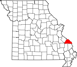
The Chester Bridge is a continuous truss bridge connecting Missouri's Route 51 with Illinois Route 150 across the Mississippi River between Perryville, Missouri and Chester, Illinois. It is the only motor-traffic bridge spanning the Mississippi River between St. Louis and Cape Girardeau, Missouri.[1]
History
Located at river mile marker 109.5, the Chester Bridge is a two-lane traffic truss bridge which was constructed by Sverdrup and Parcel and Associates, Inc. of St. Louis, Missouri. Construction began in 1941 and was finished in 1942 at a cost of $1,385,000 (1942 dollars).[2] The bridge opened on August 23, 1942 and operated as a toll bridge until January 1, 1989.[3] The main span was destroyed by a severe tornadic force thunderstorm on July 29, 1944, and reconstructed 2 years later. The bridge serves about 6,400 vehicles per day.[4]
Chester Welcome Center

The Chester Welcome Center is located in Segar Park next to the Chester Bridge and overlooks the Mississippi River. The park was dedicated to E. C. Segar who was born on December 8, 1894, in Chester, Illinois.[5] Segar is most noted for his cartoon comic "Popeye” which he created in 1929 from his recollections of a local scrapper on the Mississippi River. A six foot “life-size” bronze statue of Popeye stands near the bridge.[6][7]
Popular Culture
The Chester Bridge can be seen in the 1967 film In the Heat of the Night, although in the film a highway sign for the (non-existent) "Arkansas 49" highway appears on the east (Illinois) side of the bridge.
Gallery
-

Lewis and Clark
-

Chester Bridge plaque
-

Mighty Mississippi River plaque
-

Flood of 1993 plaque
See also
References
- ↑ "City of Chester, Illinois". Retrieved 2015-07-08.
- ↑ "City of Chester, Illinois". Retrieved 2015-07-08.
- ↑ Map of the Missouri State Highway System as of January 1, 1953
- ↑ "Bridgehunter.com". Retrieved 2015-07-08.
- ↑ "Popeye Character Trail Map" (PDF). City of Chester, Illinois. July 2012. Retrieved July 8, 2015.
- ↑ Jerry Hay (2013). "Mississippi River: Historic Sites and Interesting Places". ISBN 9781467562508.
- ↑ Jerome Pohlen (2012). "Oddball Illinois". ISBN 9781613740354.
External links
- Historic Bridges of the U.S. | Chester Bridge | Randolph County, Illinois and Perry County, Missouri
