Cliffwood Beach, New Jersey
| Cliffwood Beach, New Jersey | |
|---|---|
| Census-designated place | |
|
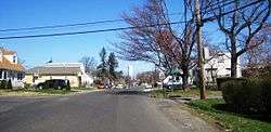
Intersection of Shore Concourse and Sweetbriar Street in Cliffwood Beach | |
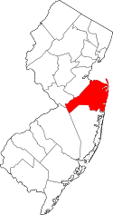
 Map of Cliffwood Beach in Monmouth County. Inset: Location of Monmouth County in New Jersey. | |
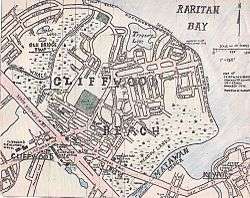 Hand drawn map of Cliffwood Beach, by Matt Furmato | |
| Coordinates: 40°26′36″N 74°13′05″W / 40.443266°N 74.217960°WCoordinates: 40°26′36″N 74°13′05″W / 40.443266°N 74.217960°W | |
| Country |
|
| State |
|
| County | Monmouth[1] |
| Township | Aberdeen |
| Area[2] | |
| • Total | 0.960 sq mi (2.486 km2) |
| • Land | 0.908 sq mi (2.353 km2) |
| • Water | 0.052 sq mi (0.133 km2) 5.42% |
| Elevation[3] | 59 ft (18 m) |
| Population (2010)[4] | |
| • Total | 3,194 |
| • Density | 3,516.4/sq mi (1,357.7/km2) |
| Time zone | Eastern (EST) (UTC-5) |
| • Summer (DST) | Eastern (EDT) (UTC-4) |
| ZIP code | 07735[5] |
| Area code(s) | 732/848 |
| FIPS code | 3413630[2][6] |
| GNIS feature ID | 02389331[2][7] |
Cliffwood Beach is an unincorporated community and census-designated place (CDP) located within Aberdeen Township, in Monmouth County, New Jersey, United States.[8][9] As of the 2010 United States Census, the CDP's population was 17,011.[4] As of the 2010 United States Census, the CDP's population was 3,194.[4]
History

Matawan Township was incorporated on February 23, 1857. This included the village of Middletown Point, Mt. Pleasant, and Matavan including Matavan beach. The beach area of Matavan was later renamed Cliffwood Beach.[10]
A "Cliffwood Beach" directional sign is seen briefly in the 1939 documentary The City (with music by Aaron Copland). An unending traffic jam getting to the beach is used in the film as an endemic problem of unplanned growth.
Cliffwood Beach was a popular resort until the 1960s, with a boardwalk, saltwater swimming pool, dining and dancing at The Cat 'n Fiddle, and other amusements. The beachfront facilities were destroyed by Hurricane Donna in September 1960. All that remains is the swimming pool, though it is currently buried in a sand dune that helps support part of the sea wall.[11]
Cliffwood Beach was an early recipient of aid through the New Jersey Department of Environmental Protection's Green Acres Program , which was established in 1961. The township received funds to build a park near the Cliffwood Beach waterfront. The tennis courts have since been converted to an enclosed in-line skating arena, and the original playground equipment and two basketball courts have been upgraded.
It was featured in Weird NJ magazine's Issue #28. The article, "Cliffwood Beach: A Forgotten Resort", recounted the abrupt manner in which the town was forgotten.[12]
Nothing remains for any of the boardwalk amusements, except for the large swimming pool, which lies abandoned and filled with debris.[13]
The beachfront is currently slated for redevelopment, and has been for years. Many of the residents, however, doubt the local government will actually do anything because little has been done over the years to actually help improve the area.[14]
Geography
According to the United States Census Bureau, the CDP had a total area of 0.960 square miles (2.486 km2), including 0.908 square miles (2.353 km2) of land and 0.052 square miles (0.133 km2) of water (5.42%).[2][15]
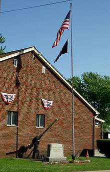
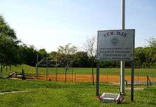
Cliffwood Beach is located north of Route 35 and is bounded by Keyport on the east and Laurence Harbor on the west. The community faces Raritan Bay, including a portion of Keyport Harbor, and Matawan Creek separates Cliffwood Beach from Keyport. To the west, a section of Cliffwood Beach is part of Old Bridge Township in neighboring Middlesex County. The counties are separated by Whale Creek, which is spanned near the bayfront by a concrete bridge. Cliffwood Beach is the home of Guadalcanal Veterans of Foreign Wars (VFW) Post Number 4745, which is used as a community hall, rental facility, and polling place for elections. Adjacent to the VFW Post is Veterans of Foreign Wars Park (VFW Park), which contains Alvin Ross Memorial Field. The field, which has two softball diamonds, backstops, team benches and bleachers, is used for local children's and adults' softball and soccer leagues scheduled by the Aberdeen Township Department of Parks and Recreation. The Aberdeen Township Public Service Facility on Lenox Road is the maintenance and recycling facility for the township.
Education
Cliffwood Beach, as a part of Aberdeen, is served by the Matawan-Aberdeen Regional School District.
Cliffwood Beach is also home of the Yeshiva Gedolah of Cliffwood, an institution for advanced Talmudic studies. Headed by Rabbi Shimon Alster, who founded the Yeshiva in September 2004,[16] this institution supplies guidance for young rabbinic scholars, in the areas of Talmudic exegesis, Jewish law and ethics, and intensive Bible study.
Demographics
| Historical population | |||
|---|---|---|---|
| Census | Pop. | %± | |
| 1990 | 3,543 | — | |
| 2000 | 3,538 | −0.1% | |
| 2010 | 3,194 | −9.7% | |
| Population sources: 1990-2010[8] 2000[17] 2010[4] | |||
Census 2010
At the 2010 United States Census, there were 3,194 people, 1,127 households, and 854.3 families residing in the CDP. The population density was 3,516.4 per square mile (1,357.7/km2). There were 1,165 housing units at an average density of 1,282.6 per square mile (495.2/km2). The racial makeup of the CDP was 75.77% (2,420) White, 13.68% (437) Black or African American, 0.22% (7) Native American, 3.16% (101) Asian, 0.03% (1) Pacific Islander, 4.29% (137) from other races, and 2.85% (91) from two or more races. Hispanics or Latinos of any race were 14.43% (461) of the population.[4]
There were 1,127 households, of which 31.8% had children under the age of 18 living with them, 55.9% were married couples living together, 15.4% had a female householder with no husband present, and 24.2% were non-families. 18.4% of all households were made up of individuals, and 5.1% had someone living alone who was 65 years of age or older. The average household size was 2.82 and the average family size was 3.21.[4]
In the CDP, 23.2% of the population were under the age of 18, 8.7% from 18 to 24, 27.6% from 25 to 44, 31.4% from 45 to 64, and 9.1% who were 65 years of age or older. The median age was 38.4 years. For every 100 females there were 96.8 males. For every 100 females age 18 and over, there were 94.3 males.[4]
Census 2000
As of the 2000 United States Census[6] there were 3,538 people, 1,149 households, and 881 families residing in the CDP. The population density was 1,468.8/km2 (3,809.2/mi2). There were 1,178 housing units at an average density of 489.1/km2 (1,268.3/mi2). The racial makeup of the CDP was 78.60% White, 15.04% African American, 0.31% Native American, 1.36% Asian, 2.88% from other races, and 1.81% from two or more races. Hispanic or Latino of any race were 9.78% of the population.[17]
There were 1,149 households out of which 38.1% had children under the age of 18 living with them, 57.2% were married couples living together, 14.1% had a female householder with no husband present, and 23.3% were non-families. 16.4% of all households were made up of individuals and 4.9% had someone living alone who was 65 years of age or older. The average household size was 2.99 and the average family size was 3.37.[17]
In the CDP the population was spread out with 26.5% under the age of 18, 7.5% from 18 to 24, 33.7% from 25 to 44, 22.5% from 45 to 64, and 9.8% who were 65 years of age or older. The median age was 36 years. For every 100 females there were 98.3 males. For every 100 females age 18 and over, there were 94.2 males.[17]
The median income for a household in the CDP was $57,098, and the median income for a family was $61,875. Males had a median income of $44,856 versus $32,714 for females. The per capita income for the CDP was $22,874. About 5.0% of families and 5.5% of the population were below the poverty line, including 7.2% of those under age 18 and 6.5% of those age 65 or over.[17]
Transportation
New Jersey Transit provides local bus service on the 817 route.[18]
References
- ↑ "Detailed map of New Jersey" (PDF). United States Census Bureau. 2000. Retrieved November 16, 2010.
- 1 2 3 4 Gazetteer of New Jersey Places, United States Census Bureau. Accessed July 21, 2016.
- ↑ U.S. Geological Survey Geographic Names Information System: Cliffwood Beach Census Designated Place, Geographic Names Information System. Accessed August 4, 2012.
- 1 2 3 4 5 6 7 DP-1 - Profile of General Population and Housing Characteristics: 2010 Demographic Profile Data for Cliffwood Beach CDP, New Jersey, United States Census Bureau. Accessed August 4, 2012.
- ↑ Look Up a ZIP Code for Cliffwood Beach, NJ, United States Postal Service. Accessed August 4, 2012.
- 1 2 American FactFinder, United States Census Bureau. Accessed September 4, 2014.
- ↑ US Board on Geographic Names, United States Geological Survey. Accessed September 4, 2014.
- 1 2 New Jersey: 2010 - Population and Housing Unit Counts - 2010 Census of Population and Housing (CPH-2-32), United States Census Bureau, August 2012. Accessed December 14, 2012.
- ↑ GCT-PH1 - Population, Housing Units, Area, and Density: 2010 - County -- County Subdivision and Place from the 2010 Census Summary File 1 for Monmouth County, New Jersey, United States Census Bureau. Accessed December 14, 2012.
- ↑ "Aberdeen Township". Aberdeen Township, New Jersey. Retrieved 2013-01-30.
... on February 23, 1857, Matavan Township was incorporated. This included the village of Middletown Point, Mt. Pleasant, and Matavan. The Township was named for the creek as well as the village of Matavan. The spelling of "Matawan" or "Matavan" had been interchangeable, however, when the act was published "Matavan", a Lenape word meaning "where two rivers come together" had been used.
- ↑ Hlavenka, Jacqueline. " A sea change for the Cliffwood Beach waterfront; Railing will complete Aberdeen sea walk", Independent, November 18, 2010. Accessed December 14, 2012. "In the early 1900s, Cliffwood Beach was once a popular resort town with a bustling boardwalk, saltwater pools and an amusement zone, similar to neighboring areas such as Keansburg and Coney Island, N.Y. In 1960 the severe winds and high tides of Hurricane Donna destroyed the boardwalk and caused severe beach erosion in Cliffwood, which subsequently decimated the local economy."
- ↑ "Cliffwood Beach: A Forgotten Resort", Weird NJ, Issue #28
- ↑ YouTube - Horrorflicks:(2) Matawan Shark Attack {Part 1}
- ↑ Bowes, Karen E. "Turning the tide at Cliffwood Beach: Aberdeen hopes to upgrade and beautify beachfront, seawall", Holmdel Independent, September 26, 2007. Accessed September 29, 2007.
- ↑ US Gazetteer files: 2010, 2000, and 1990, United States Census Bureau. Accessed September 4, 2014.
- ↑ Bernstein, Dovid (14 July 2009). "Rav Shimon Alster to Address Yeshiva of Cliffwood Brooklyn Reception Tonight". matzav.com. Retrieved April 13, 2013.
- 1 2 3 4 5 DP-1 - Profile of General Demographic Characteristics: 2000 from the Census 2000 Summary File 1 (SF 1) 100-Percent Data for Woodbridge CDP, New Jersey, United States Census Bureau. Accessed December 14, 2012.
- ↑ Monmouth County Bus / Rail connections, New Jersey Transit, backed up by the Internet Archive as of July 26, 2010. Accessed August 4, 2012.
External links
| Look up ladies auxiliary in Wiktionary, the free dictionary. |
