Curcy-sur-Orne
| Curcy-sur-Orne | |
|---|---|
 | |
 Curcy-sur-Orne | |
|
Location within Normandy region 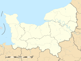 Curcy-sur-Orne | |
| Coordinates: 49°00′33″N 0°31′01″W / 49.0092°N 0.5169°WCoordinates: 49°00′33″N 0°31′01″W / 49.0092°N 0.5169°W | |
| Country | France |
| Region | Normandy |
| Department | Calvados |
| Arrondissement | Caen |
| Canton | Thury-Harcourt |
| Intercommunality | Suisse Normande |
| Government | |
| • Mayor (2008–2014) | Jacques Collin |
| Area1 | 13.57 km2 (5.24 sq mi) |
| Population (2008)2 | 416 |
| • Density | 31/km2 (79/sq mi) |
| Time zone | CET (UTC+1) |
| • Summer (DST) | CEST (UTC+2) |
| INSEE/Postal code | 14213 / 14220 |
| Elevation |
16–227 m (52–745 ft) (avg. 150 m or 490 ft) |
|
1 French Land Register data, which excludes lakes, ponds, glaciers > 1 km² (0.386 sq mi or 247 acres) and river estuaries. 2 Population without double counting: residents of multiple communes (e.g., students and military personnel) only counted once. | |
Curcy-sur-Orne is a former commune in the Calvados department in the Normandy region in northwestern France. On 1 January 2016, it was merged into the new commune of Le Hom.[1]
Population
| Historical population | ||
|---|---|---|
| Year | Pop. | ±% |
| 1962 | 312 | — |
| 1968 | 292 | −6.4% |
| 1975 | 276 | −5.5% |
| 1982 | 312 | +13.0% |
| 1990 | 327 | +4.8% |
| 1999 | 382 | +16.8% |
| 2008 | 416 | +8.9% |
See also
References
- ↑ Arrêté préfectoral 22 December 2015 (French)
| Wikimedia Commons has media related to Curcy-sur-Orne. |
This article is issued from Wikipedia - version of the 3/22/2016. The text is available under the Creative Commons Attribution/Share Alike but additional terms may apply for the media files.