Davik
| Davik herred | |
|---|---|
| Former Municipality | |
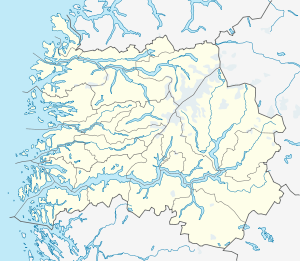
 Davik herred Location in Sogn og Fjordane county | |
| Coordinates: 61°53′29″N 05°31′50″E / 61.89139°N 5.53056°ECoordinates: 61°53′29″N 05°31′50″E / 61.89139°N 5.53056°E | |
| Country | Norway |
| Region | Western Norway |
| County | Sogn og Fjordane |
| District | Nordfjord |
| Municipality ID | NO-1442 |
| Adm. Center | Davik |
| Time zone | CET (UTC+01:00) |
| • Summer (DST) | CEST (UTC+02:00) |
| Created as | Formannskapsdistrikt in 1838 |
| Split into |
Bremanger, Eid, and Vågsøy in 1964 |
| Website | http://www.davik.no |
Davik is a former municipality in the traditional district of Nordfjord in Sogn og Fjordane county, Norway. The former municipality existed from 1838 until 1964. It encompassed all the lands surrounding the outer part of the large Nordfjorden on both sides of the fjord. Davik was located in parts of the present-day municipalities of Vågsøy, Bremanger, and Eid. The administrative center of the former municipality was the village of Davik which is located on the southern shore of the Nordfjorden, although some of the municipal services were based out of the village of Bryggja on the north side of the fjord, since that village was the largest village in Davik municipality.[1]
Davik Church was the main church for the municipality, and it was located in the village of Davik, in the central part of the municipality. Rugsund Church (in the village of Rugsund) served the western part of the municipality and Ålfoten Church (in the village of Ålfoten) served the eastern part of the municipality.
Name
The municipality (originally the parish) is named after the old Davik farm (Old Norse: Dafvíkr), since the church (Davik Church) was located there. The first element (Old Norse: dafi) means "spear" and the last element (Old Norse: víkr) is identical with the word vik which means "inlet", so the name appears to be referring to the long, skinny spear-like shape of the local fjord. Historically, the municipal name was spelled Davigen or Davig, using the old spelling forms that have changed over time.[2]
History
Davik was established as a municipality on 1 January 1838 (see formannskapsdistrikt). On 1 January 1913, the Mettenes farm (population: 3, located on the south shore of the Nordfjorden in extreme eastern Davik) was transferred to the municipality of Gloppen. On 1 January 1964, Davik municipality ceased to exist and its territory was divided between the neighboring municipalities of Bremanger, Eid, and Vågsøy as follows:
- Husevågøya, Grindøya, Gangsøya, Risøya, and all of Davik that was north of the Nordfjorden and east of the village of Lefdal went to the new Vågsøy municipality. The population of this area was 1,216 at the time of the merger.
- All of Davik south of the Nordfjorden and all the islands that did not go to Vågsøy Municipality went to Bremanger Municipality. The population of this area was 1,567 at the time of the merger.
- All of Davik north of the Nordfjorden and east of the village of Lefdal (including Lefdal) went to Eid Municipality. The population of this area was 654 at the time of the merger.[3]
References
- ↑ "Komunehistoria i Bremanger" (in Norwegian). NRK. Retrieved 2013-10-29.
- ↑ Rygh, Oluf (1919). Norske gaardnavne: Nordre Bergenhus amt (in Norwegian) (12 ed.). Kristiania, Norge: W. C. Fabritius & sønners bogtrikkeri. pp. 408–409.
- ↑ Jukvam, Dag (1999). "Historisk oversikt over endringer i kommune- og fylkesinndelingen" (PDF) (in Norwegian). Statistisk sentralbyrå.
External links
 Sogn og Fjordane travel guide from Wikivoyage
- 1905 map of the municipality of Davik
- Weather information for Davik (Norwegian)