Deadwood, South Dakota
| Deadwood, South Dakota Owáyasuta | |
|---|---|
| City | |
|
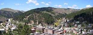
Modern Deadwood viewed from Mount Moriah | |
 Location in Lawrence County and the state of South Dakota | |
| Coordinates: 44°22′36″N 103°43′45″W / 44.37667°N 103.72917°WCoordinates: 44°22′36″N 103°43′45″W / 44.37667°N 103.72917°W | |
| Country | United States |
| State | South Dakota |
| County | Lawrence |
| Founded | 1876 |
| Government | |
| • Type | City Commission |
| • Mayor | Chuck Turbiville (elected 2013)[1] |
| Area[2] | |
| • Total | 3.83 sq mi (9.92 km2) |
| • Land | 3.83 sq mi (9.92 km2) |
| • Water | 0 sq mi (0 km2) |
| Elevation | 4,531 ft (1,381 m) |
| Population (2010)[3] | |
| • Total | 1,270 |
| • Estimate (2015)[4] | 1,258 |
| • Density | 331.6/sq mi (128.0/km2) |
| Time zone | Mountain (MST) (UTC-7) |
| • Summer (DST) | MDT (UTC-6) |
| ZIP code | 57732 |
| Area code(s) | 605 |
| FIPS code | 46-15700[5] |
| GNIS feature ID | 1265180[6] |
| Website |
deadwood |


Deadwood (Lakota: Owáyasuta;[7] "To approve or confirm things") is a city in South Dakota, United States, and the county seat of Lawrence County. It is named after the dead trees found in its gulch.[8] The population was 1,270 according to the 2010 census. The city includes the Deadwood Historic District, a National Historic Landmark District.
History
19th century
The settlement of Deadwood began illegally in the 1870s on land which had been granted to American Indians in the 1868 Treaty of Laramie. The treaty had guaranteed ownership of the Black Hills to the Lakota people and land disputes were endemic, having reached the United States Supreme Court on several occasions. However, in 1874, Colonel George Armstrong Custer led an expedition into the Black Hills and announced the discovery of gold on French Creek near present-day Custer, South Dakota. This announcement triggered the Black Hills Gold Rush and gave rise to the new and lawless town of Deadwood, which quickly reached a population of around 5,000.
In early 1876, frontiersman Charlie Utter and his brother Steve led a wagon train to Deadwood containing what were deemed to be needed commodities to bolster business. The gamblers and prostitutes resulted in the establishment of several profitable ventures. Madame Mustache and Dirty Em were on the wagon train and set up shop in what was referred to as Deadwood Gulch.[9] Demand for women was high and the business of prostitution proved to have a good market. Madam Dora DuFran would eventually become the most profitable brothel owner in Deadwood, closely followed by Madam Mollie Johnson. Businessman Tom Miller opened the Bella Union Saloon in September 1876.

A saloon called the Gem Variety Theater, opened on April 7, 1877 by Al Swearengen who also controlled the opium trade. The saloon was destroyed by a fire and rebuilt in 1879. It burned down again in 1899, causing Swearengen to leave the town. Deadwood became known for its lawlessness, during which time murder was common and punishment for murders not always fair and impartial. The town attained further notoriety for the murder of gunman Wild Bill Hickok. Mount Moriah Cemetery is the final resting place of Hickok and Calamity Jane, as well as slightly less notable figures such as Seth Bullock. Hickok's murderer, Jack McCall, was prosecuted twice, despite the U.S. Constitution's prohibition against double jeopardy, because of a ruling that Deadwood was an illegal town in Indian Territory and thus lacked the jurisdiction to prosecute or acquit McCall. This decision moved McCall's trial to a Dakota Territory court ("Indian Court"), where he was found guilty of murder and hanged.
As the economy changed from gold panning to deep mining, Deadwood lost its rough and rowdy character and developed into a prosperous town. In 1876, a smallpox epidemic swept through, with so many falling ill that tents were erected to quarantine the stricken. In 1876, General George Crook pursued the Sioux Indians from the Battle of Little Big Horn on an expedition that ended in Deadwood and is known as the Horsemeat March. The Homestake Mine in nearby Lead was established in 1877. For years, it was the longest continuously operating gold mine in the United States. Gold mining operations ceased in 2002 but the mine is still open to tourists. On September 26, 1879, a fire devastated Deadwood, destroying more than three hundred buildings and consuming the belongings of many inhabitants. Many of the newly impoverished left town to start again.
Thomas Edison demonstrated the incandescent lamp in New Jersey in 1879. Judge Squire P. Romans took a gamble and founded the "Pilcher Electric Light Company of Deadwood" on September 17, 1883. He ordered an Edison dynamo, wiring and 15 incandescent lights with globes. After delays the equipment arrived without the globes. Romans had been advertising the event and decided to continue with the lighting, which was a success and the company grew. Deadwood had electricity less than four years after the invention, less than a year after commercial service was started in Roselle, New Jersey and which was around the same time as much larger cities around the country.[10]
A narrow-gauge railroad, the Deadwood Central Railroad, was founded by resident J.K.P. Miller and his associates in 1888, in order to serve their mining interests. The railroad was purchased by the Chicago, Burlington and Quincy Railroad in 1893. A portion of the railroad between Deadwood and Lead was electrified in 1902 for operation as an interurban passenger system, which operated until 1924. The railroad was abandoned in 1930, apart from a portion from Kirk to Fantail Junction, which was converted to standard gauge. The remaining section was abandoned by the successor Burlington Northern Railroad in 1984.[11]
Some of the other early town residents and frequent visitors included Al Swearengen, E. B. Farnum, Charlie Utter, Sol Star, Martha Bullock, A. W. Merrick, Samuel Fields, Calamity Jane, Dr. Valentine McGillycuddy, the Reverend Henry Weston Smith, Aaron Dunn and Wild Bill Hickok.
Chinatown
The gold rush attracted Chinese immigrants to the area. Their population peaked at 250.[12] A few engaged in mining; most worked in service enterprises. A Chinese quarter arose on Main Street, encouraged by the lack of restrictions on foreign property ownership in Dakota Territory and a relatively high level of tolerance. Wong Fee Lee arrived in Deadwood in 1876 and became a leading merchant. He was a community leader among the Chinese Americans until his death in 1921.[13]
The quarter's residents also included African-Americans and Americans of European extraction.[14] The state sponsored an archeological dig in the area during the 2000s.[15]
20th and 21st centuries
Another major fire in September 1959 came close to destroying the town again. About 4,500 acres were burned and an evacuation order was issued. Nearly 3,600 volunteer and professional firefighters, including personnel from the Homestake Mine, Ellsworth Air Force Base, and the South Dakota National Guard's 109th Engineer Battalion worked to contain the fire, which resulted in a major regional economic downturn.[16][17]
In 1961, the entire town was designated a National Historic Landmark, but the town continued to decline for the next two decades.[18] Interstate 90 bypassed Deadwood in 1964 and its brothels were shut down after a 1980 raid.[18] A fire in December 1987 destroyed the historic Syndicate Building and a neighboring structure.[18]
The fire fueled interest in the area and spurred the "Deadwood Experiment", in which gambling was tested as a means of revitalizing a city center.[18][19] At the time, gambling was legal only in the state of Nevada and in Atlantic City.[20] Deadwood was the first small community in the U.S. to seek legal gambling revenues as a way of maintaining local historic qualities.[20] Gambling was legalized in Deadwood in 1989 and immediately brought significant new revenues and development.[21] The pressure of development since then may have an effect on the historical integrity of the landmark district.[21]
Geography
Deadwood is located at 44°22′36″N 103°43′45″W / 44.37667°N 103.72917°W.[22]
According to the United States Census Bureau, the city has a total area of 3.83 square miles (9.92 km2), all of it land.[2]
Deadwood has been assigned the ZIP code 57732 and the FIPS place code 15700.
Recreation
In the summer, there are numerous trails for hiking, mountain biking, and horse back riding. The northern end of the George S. Mickelson Trail starts in Deadwood and runs south through the Black Hills to Edgemont. Several man made lakes, including Sheridan Lake, provide fishing and swimming. Spearfish Canyon to the north has many places to rock climb. In early June the Mickelson Trail Marathon and 5K, as well as accompanying races for children, are held.
During the winter there are two ski areas just a few miles outside of nearby Lead, SD – Terry Peak and Deer Mountain.
The Midnight Star casino in Deadwood is owned by American film actor Kevin Costner, who had directed and starred in the 1990 Academy Award-winning film Dances With Wolves, which was filmed mainly in South Dakota. International versions of many of his films' posters line its walls.
Climate
Deadwood's climate varies considerably from the rest of the state and surrounding areas. While most of the state receives less than 25 inches of precipitation per year, annual precipitation amounts in the Lead-Deadwood area reach nearly 30 inches. Most of these 30 inches fall in the winter as snow, although snow can occur as early as September and last until late May. Spring is brief and is characterized by large wet snow storms and periods of rain.
| Climate data for Deadwood, South Dakota | |||||||||||||
|---|---|---|---|---|---|---|---|---|---|---|---|---|---|
| Month | Jan | Feb | Mar | Apr | May | Jun | Jul | Aug | Sep | Oct | Nov | Dec | Year |
| Record high °F (°C) | 65 (18) |
67 (19) |
74 (23) |
91 (33) |
94 (34) |
101 (38) |
103 (39) |
103 (39) |
101 (38) |
86 (30) |
75 (24) |
64 (18) |
103 (39) |
| Average high °F (°C) | 33 (1) |
37 (3) |
44 (7) |
53 (12) |
64 (18) |
74 (23) |
81 (27) |
80 (27) |
70 (21) |
57 (14) |
42 (6) |
35 (2) |
55.8 (13.4) |
| Average low °F (°C) | 11 (−12) |
15 (−9) |
21 (−6) |
29 (−2) |
39 (4) |
48 (9) |
54 (12) |
52 (11) |
42 (6) |
32 (0) |
21 (−6) |
13 (−11) |
31.4 (−0.3) |
| Record low °F (°C) | −28 (−33) |
−29 (−34) |
−18 (−28) |
−4 (−20) |
4 (−16) |
23 (−5) |
32 (0) |
34 (1) |
17 (−8) |
−7 (−22) |
−19 (−28) |
−30 (−34) |
−30 (−34) |
| Average precipitation inches (mm) | 1.30 (33) |
1.19 (30.2) |
2.36 (59.9) |
3.62 (91.9) |
4.51 (114.6) |
3.95 (100.3) |
2.69 (68.3) |
2.03 (51.6) |
1.79 (45.5) |
2.18 (55.4) |
1.42 (36.1) |
1.39 (35.3) |
28.43 (722.1) |
| Average snowfall inches (cm) | 13.8 (35.1) |
15.9 (40.4) |
19.9 (50.5) |
16.6 (42.2) |
3.3 (8.4) |
0.4 (1) |
0 (0) |
0 (0) |
0.8 (2) |
6.6 (16.8) |
14.1 (35.8) |
15.6 (39.6) |
107 (272) |
| Source #1: South Dakota State University[23] | |||||||||||||
| Source #2: National Oceanic and Atmospheric Administration[24] | |||||||||||||
Demographics
| Historical population | |||
|---|---|---|---|
| Census | Pop. | %± | |
| 1880 | 3,777 | — | |
| 1890 | 2,366 | −37.4% | |
| 1900 | 3,408 | 44.0% | |
| 1910 | 3,653 | 7.2% | |
| 1920 | 2,403 | −34.2% | |
| 1930 | 2,559 | 6.5% | |
| 1940 | 4,100 | 60.2% | |
| 1950 | 3,288 | −19.8% | |
| 1960 | 3,045 | −7.4% | |
| 1970 | 2,409 | −20.9% | |
| 1980 | 2,035 | −15.5% | |
| 1990 | 1,830 | −10.1% | |
| 2000 | 1,380 | −24.6% | |
| 2010 | 1,270 | −8.0% | |
| Est. 2015 | 1,258 | [25] | −0.9% |
| U.S. Decennial Census[26] 2015 Estimate[4] | |||
2000 census
As of the census[5] of 2000, there were 1,380 people, 669 households, and 341 families residing in the city. The population density was 365.4 people per square mile (141.0/km²). There were 817 housing units at an average density of 216.3 per square mile (83.5/km²). The racial makeup of the city was 95.87% White, 1.88% Native American, 0.36% Asian, 0.65% from other races, and 1.23% from two or more races. Hispanic or Latino of any race were 2.75% of the population. 29.8% were of German, 9.6% Irish, 9.5% English, 9.5% Norwegian and 8.7% American ancestry.
There were 669 households out of which 20.5% had children under the age of 18 living with them, 37.7% were married couples living together, 10.9% had a female householder with no husband present, and 48.9% were non-families. 40.1% of all households were made up of individuals and 14.6% had someone living alone who was 65 years of age or older. The average household size was 2.01 and the average family size was 2.71.
In the city the population was spread out with 19.3% under the age of 18, 8.7% from 18 to 24, 27.3% from 25 to 44, 27.8% from 45 to 64, and 16.8% who were 65 years of age or older. The median age was 42 years. For every 100 females there were 93.8 males. For every 100 females age 18 and over, there were 92.6 males.
As of 2000 the median income for a household in the city was $28,641, and the median income for a family was $37,132. Males had a median income of $28,920 versus $18,807 for females. The per capita income for the city was $17,673. About 6.9% of families and 10.8% of the population were below the poverty line, including 19.4% of those under age 18 and 8.3% of those age 65 or over.
2010 census
As of the census[3] of 2010, there were 1,270 people, 661 households, and 302 families residing in the city. The population density was 331.6 inhabitants per square mile (128.0/km2). There were 803 housing units at an average density of 209.7 per square mile (81.0/km2). The racial makeup of the city was 94.9% White, 0.2% African American, 1.8% Native American, 0.5% Asian, 0.6% from other races, and 2.0% from two or more races. Hispanic or Latino of any race were 3.4% of the population.
There were 661 households of which 17.2% had children under the age of 18 living with them, 33.4% were married couples living together, 7.4% had a female householder with no husband present, 4.8% had a male householder with no wife present, and 54.3% were non-families. 44.6% of all households were made up of individuals and 12.7% had someone living alone who was 65 years of age or older. The average household size was 1.88 and the average family size was 2.60.
The median age in the city was 48 years. 15% of residents were under the age of 18; 5.9% were between the ages of 18 and 24; 23.3% were from 25 to 44; 37.9% were from 45 to 64; and 17.8% were 65 years of age or older. The gender makeup of the city was 52.5% male and 47.5% female.
Media
In popular culture
- Deadwood Dick is a fictional character who appears in a series of stories published between 1877 and 1897 by Edward Lytton Wheeler (1854/5–1885). These types of books were meant to be exciting and lurid and earned the popular name 'dime novels.' Several men associated with the city used this nickname at various times of their lives.
- The 1953 Warner Bros. movie musical Calamity Jane starring Doris Day was set in Deadwood City.
- The Adam-12 1969 episode, "The Long Walk" features an old man who reminisces about his early life in Deadwood.
- A 1978 children's book in the Choose Your Own Adventure series is set in Deadwood City.[27]
- In Flashman and the Redskins, a 1982 novel by George MacDonald Fraser, the eponymous hero, an acquaintance of Wild Bill Hickok, ends his adventure in Deadwood in 1876, shortly before Hickok's death.
- Deadwood's history and inhabitants are the foundation of Pete Dexter's 1986 novel, Deadwood, in which Charles Utter, Wild Bill Hickok, and Calamity Jane are the central characters.
- The film Dances With Wolves (1990) was filmed in the area and featured several nearby locations.[28]
- In the Star Trek: The Next Generation 1992 episode "A Fistful of Datas", a holodeck program takes place in 19th-century Deadwood.
- Dead Man in Deadwood, Book #87 in the Hardy Boys Casefiles series and published in 1994, is set in Deadwood.
- Setting for part of the 1995 TV film Buffalo Girls
- Deadwood, an HBO TV series that ran from 2004 to 2006, had the town's early history as its setting.
- The three Tales from Deadwood novels (2005–07) by Mike Jameson are set in Deadwood and feature Wild Bill Hickok, Calamity Jane, Al Swearengen and other historical figures.
- Showed as a haunted town in American Sci/Fi, Horror TV series Supernatural in the 2nd Season's 21st and 22nd Episode named "All Hell Breaks Loose (Part 1)" and "All Hell Breaks Loose (Part 2)"
- The Doctor Who comic book story Dead Man's Hand, published by IDW, takes place in Deadwood several years after the burial of "Wild Bill" Hickock.
- In the 2012 video game Borderlands 2, The town of Lynchwood is a space western-themed homage to Deadwood. The town includes a large mining operation near Main Street, as well as a "Gunslinger's Corner", where the main character faces off against the town sheriff and her posse.
Notable people
Noted people who were born, lived, or have resided in Deadwood, South Dakota.
- Granville G. Bennett, (1833–1910), lawyer and politician
- Jerry Bryant, historian
- Seth Bullock, (1849–1919), sheriff, entrepreneur
- Calamity Jane (Martha Jane Canary), (1852–1903), frontierswoman
- Philip S. Van Cise, (1884–1969), Colorado district attorney
- William H. Clagett, (1838–1901), lawyer and politician
- Charles Badger Clark, (1883–1957), poet
- Richard Clarke, (1845–1930), frontiersman
- Rowland Crawford, (1902–1973), architect
- Gary Mule Deer, (b. 1939), comedian and country musician
- Charles Henry Dietrich, (1853–1924), 11th Governor of Nebraska
- Dora DuFran, (1868–1934), brothel owner in Deadwood
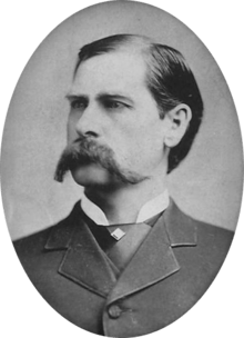
- Wyatt Earp, (1848–1929), American investor and law enforcement officer who lived in Deadwood from 1876 to 1877
- E. B. Farnum, (1826–1878), pioneer
- Samuel Fields, supposed Civil War figure and prospector
- Arthur De Wint Foote, (1849–1933), engineer
- Mary Hallock Foote, (1847–1938), author and illustrator
- George Hearst, U.S. Senator from California
- Wild Bill Hickok, (1837–1876), gambler and gunslinger
- Amy Hill (b. 1953), Japanese-Finnish-American actress
- Carole Hillard, (1936–2007), Lieutenant Governor of South Dakota 1995–2003
- Mollie Johnson, (d. after 1883), madam in Deadwood
- Freeman Knowles, (1846–1910), politician
- Joseph Ladue (1855–1901), prospector, businessman, and founder of Dawson City, Yukon
- Ward Lambert, (1888–1958), college basketball coach, mostly with Purdue University
- Jack Langrishe, (died 1895), actor
- Kitty Leroy, (1850–1878), gambler, trick shooter, and frontierswoman
- H. R. Locke, (1856–1927), photographer
- Madame Moustache, (1834–1879), gambler
- William H. Parker (1905–1966), former Chief of Police of Los Angeles, California
- Dorothy Provine (1937–2010), actress and dancer
- Craig Puki, former linebacker for the San Francisco 49ers and St. Louis Cardinals
- Angelo Rizzuto (1906–67), photographer
- Bill Russell, (b. 1949), lyricist
- Bob Schloredt (b. 1939), former college football player for the Washington Huskies
- Jim Scott, (1888–1957), played with the Chicago White Sox
- Henry Weston Smith, (1827–1876), early frontiersman and preacher
- Sol Star, entrepreneur, politician
- William Randolph Steele, (1842–1901), former resident, mayor of Deadwood, lawyer, soldier, and politician
- Al Swearengen, (1845–1904), entertainment entrepreneur
- Charlie Utter, (c. 1838-aft. 1912), frontiersman
- Alfred L. Werker, (1896–1975), film director
- Cris Williamson (b. 1947), singer/musician
References
- ↑ "Mayor of the city of Deadwood". Retrieved January 2, 2014.
- 1 2 "US Gazetteer files 2010". United States Census Bureau. Retrieved 2012-06-21.
- 1 2 "American FactFinder". United States Census Bureau. Retrieved 2012-06-21.
- 1 2 "Population Estimates". United States Census Bureau. Retrieved June 7, 2016.
- 1 2 "American FactFinder". United States Census Bureau. Retrieved 2008-01-31.
- ↑ "US Board on Geographic Names". United States Geological Survey. 2007-10-25. Retrieved 2008-01-31.
- ↑ Ullrich, Jan F. (2014). New Lakota Dictionary (2nd ed.). Bloomington, IN: Lakota Language Consortium. ISBN 978-0-9761082-9-0.
- ↑ "Discover the History of the Real Deadwood, South Dakota".
- ↑ "The Painted Ladies of Deadwood Gulch". Legends of America. 2003. Retrieved October 18, 2015.
- ↑ "Illuminating The Frontier" (PDF). blackhillscorp. pp. 1–20. Retrieved October 11, 2015.
- ↑ Hilton, George W. (1990). American Narrow Gauge Railroads. Stanford, California: Stanford University Press. ISBN 0-8047-2369-9.
- ↑ "Chinese". City of Deadwood. Retrieved November 15, 2010.
- ↑ Edith C. Wong et al., "Deadwood's Pioneer Merchant," South Dakota History (2009) 39#4 pp 283–335
- ↑ David J. Wishart (2004). Encyclopedia of the Great Plains. University of Nebraska Press. pp. 140, 141. ISBN 978-0-8032-4787-1.
- ↑ "Where East Met (Wild) West". Smithsonian (magazine). Retrieved November 13, 2010.
- ↑ "Historic Wildfire in the Black Hills – Deadwood 1959" (PDF). National Fire Protection Association. Retrieved July 26, 2009.
- ↑ "National Guard engineers end 77 years in Sturgis". Rapid City Journal. August 16, 2007. Retrieved 2014-08-21.
- 1 2 3 4 "Deadwood gambling spurred change, but the town's evolution continues". Rapid City Journal. November 1, 2009. Retrieved November 18, 2009.
- ↑ Perret, Geoffrey. ""The Town That Took a Chance" American Heritage, April/May 2005.
- 1 2 "Deadwood, South Dakota – Gambling, Historic Preservation, and Economic Revitalization" (PDF). USDA. Retrieved November 18, 2009.
- 1 2 "National Historic Landmarks Program: Deadwood Historic District". National Park Service. Retrieved January 10, 2008.
- ↑ "US Gazetteer files: 2010, 2000, and 1990". United States Census Bureau. 2011-02-12. Retrieved 2011-04-23.
- ↑ "Precipitation Normals 1971–2000". April 2012. Retrieved April 13, 2012.
- ↑ "Climatography of the U.S. Deadwood 1971–2000" (PDF). April 2012. Retrieved April 13, 2012.
- ↑ "Annual Estimates of the Resident Population for Incorporated Places: April 1, 2010 to July 1, 2015". Retrieved July 2, 2016.
- ↑ United States Census Bureau. "Census of Population and Housing". Retrieved October 4, 2014.
- ↑ Granger, Edward Packard ; illustrated by Paul (1978). Deadwood City. Toronto: Bantam. ISBN 0-553-13994-0.
- ↑ "Dances with Wolves". 21 November 1990 – via IMDb.
External links
| Wikimedia Commons has media related to Deadwood, South Dakota. |
| Wikivoyage has a travel guide for Deadwood. |
- Deadwood Chamber of Commerce
- Deadwood Historic Preservation Commission
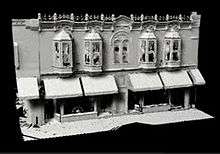
- Deadwood Digital Media Archive (creative commons-licensed photos, laser scans, panoramas), data from a DHPC/CyArk partnership
- Adams House and Museum
- Enjoy Deadwood South Dakota


.jpg)

