Dreieck Havelland
| Dreieck Havelland | |
|---|---|
| Autobahndreieck Havelland, AD Havelland | |
| Location | |
| Oberkrämer, Kremmen, Germany | |
| Coordinates: | 52°42′47″N 13°0′43″E / 52.71306°N 13.01194°ECoordinates: 52°42′47″N 13°0′43″E / 52.71306°N 13.01194°E |
| Roads at junction: | |
| Construction | |
| Type: | Directional T |
| Lanes: | 2x3/2x3 |
| Opened: | 1979 (Reconstructed 2012-2014) |
| Map | |
 | |
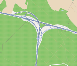
The Dreieck Havelland (German: Autobahndreieck Havelland, abbreviated AD Havelland) is a trumpet interchange in the German state of Brandenburg in the metropolitan region of Berlin.
The interchange connects the A24 coming from Hamburg to the A10, the Berlin-beltway.[1]
Geography
The interchange lies in the region of Havelland after which it is named, in the municipal area of Oberkrämer and Kremmen in the Landkreis Oberhavel. The nearby towns are Schönwalde-Glien und Nauen. It lies approximately 30 km northwest of the Berlin city centre.
History
Dreieck Havelland was built as a trumpet interchange between 1972 and 1979, as they were extending the Berlin-beltway.[2]
In July 2011, the plans were made to widen the road from junction Neuruppin (A24) to junction Oberkrämer (A10) into 2x3 lanes. Together with this plan they reconstructed the interchange.[3] On 17 September 2012 the work not part Dreieck Havelland–Kremmen began.[4]
The official opening of the interchange to traffic was on 18 November 2014.[2][5]
Traffic near the interchange
Manual traffic counts near the interchange in 2010:
| Fram | To | average traffic at the interchange | Percentage heavy trafffic at the interchange[6] |
|---|---|---|---|
| AS Falkensee (A 10) | AD Havelland | | |
| AD Havelland | AS Oberkrämer (A 10) | | |
| AS Kremmen (A 24) | AD Havelland | | |
In 2025 they forecast 65,000 vehicles per day in every direction.[2]
References
- ↑ "AD Havelland". Autobahnkreuze & Autobahndreiecke in Deutschland. 2011. Retrieved 2013-02-01.
- 1 2 3 "Der Weg nach Norden ist frei" (in German), Berliner Morgenpost: pp. 15, 17 November 2014, http://www.morgenpost.de/brandenburg-aktuell/article134403001/Autobahndreieck-Havelland-Der-Weg-nach-Norden-ist-frei.html. Retrieved 2014-12-09
- ↑ "Planfeststellungsbeschluss für den 6-streifigen Ausbau der Bundesautobahn (BAB) 24 und der BAB 10". Land Brandenburg, Ministerium für Infrastruktur und Landwirtschaft. 26 July 2011. Retrieved 2012-04-06.
- ↑ "Spatenstich für leistungsfähiges Autobahndreieck Havelland". Bundesministerium für Verkehr, Bau und Stadtentwicklung. 17 September 2012. Retrieved 2012-10-02.
- ↑ "Weitere EU-Mittel für den Ausbau der A 10 gesichert". w:de:Bundesministerium für Verkehr, Bau und Stadtentwicklung. 29 May 2012. Retrieved 2012-06-10.
- ↑ "Manuelle Verkehrszählung BAB 2010". BASt Statistik. 2010. Retrieved 2012-11-05. (PDF-Datei; 336 KB)
External links
- Hintergrundinformationen zum Ausbau: Landesbetrieb Straßenwesen Brandenburg
- Baustellendokumentation Fotos und Videos: laufend ergänzte Luftbilddokumentation