Fort de Caluire
| Fort de Caluire | |
|---|---|
| Caluire-et-Cuire | |
|
Entrance of fort | |
 Fort de Caluire | |
| Coordinates | 45°47′35″N 4°50′13″E / 45.793°N 4.837°E |
| Type | Fort |
| Site history | |
| Built | 1831 |
| Architect | Hubert Rohault de Fleury (architect) |
| In use | 1933 |
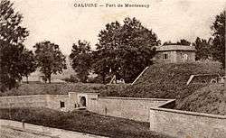
The Fort Caluire is an ancient fortification situated in Caluire-and-Bake. Now disappeared, it was part of the first belt of forts protecting Lyon.
History

Built in 1831 It was connected to the fort de Montessuy through a long chamber, with which it prohibited access to the plateau Croix-Rousse along the road to the Dombes.
Placed on the slope of the Saône it defended the river, along with Fort Loyasse, Fort Duchère and Fort Saint-Jean.
It was square with a bastion at each corner.
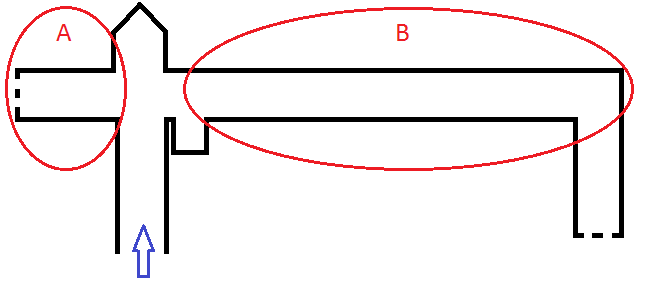
In the 1860s the original horse shelter became a mushroom farm, and operated within the enclosure connecting the two forts.[1] The entrance was in the middle of the enclosure. It consisted of 61 pieces occupying the Bunker:

- Blue arrow Entry to mushroom farm
- A:6 4.5m X4.5 pieces
- B: 55 pieces of 4.5 x 4.5m
Today
The fort was demolished in 1933 to make way for the construction of the current Henri Cochet stadium.
Some rare physical and topographical features are currently present at the site, such as the climb to the Forts; the entrance to the fort is in effect the current crossing between the rise at the Forts and the avenue Paul Doumer.
References
- ↑ Association OCRA-LYON, ed. (7 November 2009), Visite de l'ancienne champignonnière de Caluire-et-Cuire (PDF) (in French), Lyon, retrieved 28 July 2012.
Bibliography
- Dallemagne, François; Georges Fessy (2006). Les défenses de Lyon: enceintes et fortifications (in French). Lyon: Éditions Lyonnaises d'Art et d'Histoire. pp. 124–126. ISBN 2-84147-177-2.
