Frohburg
| Frohburg | ||
|---|---|---|
|
Saint Michael Church | ||
| ||
 Frohburg | ||
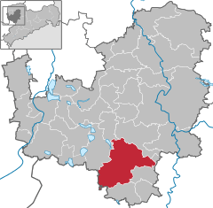
Location of Frohburg within Leipzig district 
 | ||
| Coordinates: 51°3′22″N 12°33′18″E / 51.05611°N 12.55500°ECoordinates: 51°3′22″N 12°33′18″E / 51.05611°N 12.55500°E | ||
| Country | Germany | |
| State | Saxony | |
| District | Leipzig | |
| Government | ||
| • Mayor | Wolfgang Hiensch | |
| Area | ||
| • Total | 108.06 km2 (41.72 sq mi) | |
| Population (2015-12-31)[1] | ||
| • Total | 10,204 | |
| • Density | 94/km2 (240/sq mi) | |
| Time zone | CET/CEST (UTC+1/+2) | |
| Postal codes | 04654 | |
| Dialling codes | 034348 | |
| Vehicle registration | L | |
| Website | www.frohburg.de | |
Frohburg is a town in the Leipzig district, in the Free State of Saxony, Germany. It is situated 11 km northeast of Altenburg, and 34 km southeast of Leipzig. It includes the village of Flößberg.
History
During World War II, there was a satellite camp of Buchenwald concentration camp just outside the village of Flößberg. The slave labor camp was a factory of the Leipzig-based arms manufacturer, Hugo Schneider AG (HASAG).[2]
Geography and Transport
Geography
Frohburg lies approximately halfway between Leipzig and Chemnitz, ca. 35 km south of Leipzig and 10 km south of Borna. The stream Wyhra flows through Frohburg.
Transport
The B 95 runs through Frohburg. South of Frohburg it crosses the B 7. The train line Leipzig–Neukieritzsch-Chemnitz (served by Connex) also runs through the town. Frohburg has a direct connection to the A 72 (under construction).
Sons and daughters of the town

- Johannes Schmidt (1861-1926) German classical philologist and high school teacher.
- Otto Nuschke (1883-1957), politician and CDU - chairman in the Soviet occupation zone
- Guntram Vesper (born 1941), writer, his novel Frohburg received the Preis der Leipziger Buchmesse in 2016
- Richard Schröder (born 1943), theologian and philosopher
Personalities who have worked on the ground
- Kunz von Kauffungen (1410-1455), Saxon nobleman, knigt and military commander, lived from 1552 to 1555 in Wolftitz castle
- Hans Pfitzner (1869-1949), German composer, conductor and author of political and theoretical writings, honorary citizen of Frohburg
- Conrad Felixmüller (1897-1977), painter, lived in Tautenhain from 1944 to 1967 and created in 1951/52 the galleries for the church
- Frauke Petry (born 1975), chemist, politician, AfD - chairman, lived in the district of Tautenhain
References
- ↑ "Aktuelle Einwohnerzahlen nach Gemeinden 2015] (Einwohnerzahlen auf Grundlage des Zensus 2011)" (PDF). Statistisches Landesamt des Freistaates Sachsen (in German). July 2016.
- ↑ Thomas Lang, "Jüdische Gemeinden gegen Umbettung von Toten des KZ-Außenlagers Flößberg" Leipziger Volkszeitung online. (July 19, 2010). Retrieved March 29, 2011 (German)

