Garraun (marilyn)
| Garraun | |
|---|---|
| Maolchnoc | |
 Lower slopes of Garraun | |
| Highest point | |
| Elevation | 598 m (1,962 ft) [1] |
| Prominence | 553 m (1,814 ft) [1] |
| Listing | Marilyn |
| Coordinates | 53°35′N 9°52′W / 53.583°N 9.867°WCoordinates: 53°35′N 9°52′W / 53.583°N 9.867°W |
| Geography | |
 Garraun Location in Ireland | |
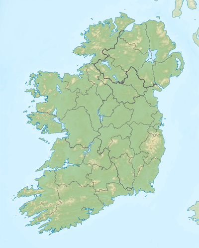
| Location | County Galway, Republic of Ireland |
| Parent range | Twelve Bens |
| OSI/OSNI grid | L767610 |
Garraun (Irish: Maolchnoc, meaning "bald hill") is a hill in the Twelve Bens area in Connemara, Ireland, located just to the south of Killary Harbour.[2][3][4] Its height is 598m, its prominence is 553 m[1] (making it a Marilyn, as its topographic prominence exceeds 150m).
References
- 1 2 3 "Twelve Bens Area - Garraun Mountain". MountainViews. Ordnance Survey Ireland. Retrieved May 24, 2015.
- ↑ Saturday Walkers' Club - Garraun
- ↑ Saturday Walkers' Club - Ireland : Connemara to South Mayo
- ↑ Garraun South Top
Mountains and hills of Connacht | ||
|---|---|---|
| Achill Island | 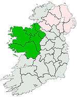 | |
| Dartry Mountains | ||
| Maumturks | ||
| Nephin Range | ||
| Ox Mountains | ||
| Partry Mountains | ||
| Sheeffry Range | ||
| Twelve Bens | ||
| Others | ||
Lists of Marilyns | |
|---|---|
This article is issued from Wikipedia - version of the 7/12/2015. The text is available under the Creative Commons Attribution/Share Alike but additional terms may apply for the media files.