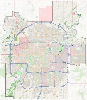
170 Street, Edmonton

For the road in south Edmonton, see 170 Street SW, Edmonton.
170 Street
Gervais Road, Hebert Road
Maintained by the City of Edmonton
and City of St. Albert
Length 16.1 km (10.0 mi)
Location Edmonton
St. Albert
South end Callingwood Road / Wanyandi Road
Major
junctions
Callingwood Road, Whitemud Drive, 87 Avenue, 100 Avenue, Stony Plain Road, 107 Avenue, 118 Avenue, Yellowhead Trail, 137 Avenue, St. Albert Trail, Boudreau Road
North end Boudreau Road
Start/End points of 170 Street

170 Street is a major arterial road in west Edmonton, Alberta, Canada. It serves residential, commercial and industrial areas. Gervais / Hebert Road is a major arterial road in south St. Albert, Alberta, Canada. It serves residential and commercial areas.

The portion of 170 Street between Whitemud Drive and Yellowhead Trail is part of Edmonton's Inner Ring Road. As such, it is a major artery used for moving people and goods around the city.

West Edmonton Mall is located on the west side of 170 Street between 87 Avenue and 90 Avenue. The Misericordia Community Hospital is located on the east side of 170 Street between 87 Avenue and 90 Avenue. A pedestrian footbridge connects the hospital grounds to the mall.

Prior to Anthony Henday Drive being extended to Yellowhead Trail, 170 Street between Whitemud Drive and Yellowhead Trail was designated as part of Highway 2. In addition, prior to Highway 16X being renumbered to Highway 16, 170 Street between Stony Plain Road and Yellowhead Trail was designated as part of Highway 16.

Neighbourhoods

List of neighbourhoods 170 Street runs through, in order from south to north:[1]

Edmonton

St. Albert

Interchanges and intersections

This is a list of major intersections, starting at the south end of 170 Street.[1]

Municipality Intersecting road Notes Coordinates
Edmonton Callingwood Road / Wanyandi Road At-grade (traffic lights) 53°29′51″N 113°36′55″W / 53.49750°N 113.61528°W / 53.49750; -113.61528 (170 x Callingwood)
Hwy 2 / Whitemud Drive Divided diamond interchange 53°30′44″N 113°36′55″W / 53.51222°N 113.61528°W / 53.51222; -113.61528 (170 x Whitemud)
87 AvenueMisericordia Community Hospital At-grade (traffic lights) 53°31′10″N 113°36′55″W / 53.51944°N 113.61528°W / 53.51944; -113.61528 (170 x 87)
West Edmonton Mall access Flyover, northbound exit only 53°31′14″N 113°36′55″W / 53.520427°N 113.615218°W / 53.520427; -113.615218 (170 x WEM_s)
West Edmonton Mall access At-grade (traffic lights), no northbound exit 53°31′24″N 113°36′55″W / 53.523197°N 113.615204°W / 53.523197; -113.615204 (170 x WEM_n)
90 Avenue At-grade (traffic lights) 53°31′29″N 113°36′55″W / 53.52472°N 113.61528°W / 53.52472; -113.61528 (170 x 90)
95 Avenue At-grade (traffic lights) 53°31′54″N 113°36′55″W / 53.53167°N 113.61528°W / 53.53167; -113.61528 (170 x 95)
100 AvenueCity Centre Split intersection 53°32′21″N 113°36′58″W / 53.53917°N 113.61611°W / 53.53917; -113.61611 (170 x 100)
Stony Plain Road to Hwy 16A west Split intersection 53°32′29″N 113°36′58″W / 53.54139°N 113.61611°W / 53.54139; -113.61611 (170 x Stony)
Mayfield Road At-grade Y intersection (traffic lights) 53°32′36″N 113°36′56″W / 53.54333°N 113.61556°W / 53.54333; -113.61556 (170 x Mayfield)
107 Avenue At-grade (traffic lights) 53°33′12″N 113°36′55″W / 53.55333°N 113.61528°W / 53.55333; -113.61528 (170 x 107)
111 Avenue At-grade (traffic lights) 53°33′34″N 113°36′55″W / 53.55944°N 113.61528°W / 53.55944; -113.61528 (170 x 111)
114 Avenue At-grade (traffic lights) 53°33′47″N 113°36′55″W / 53.56306°N 113.61528°W / 53.56306; -113.61528 (170 x 114)
118 Avenue At-grade (traffic lights) 53°34′14″N 113°36′55″W / 53.57056°N 113.61528°W / 53.57056; -113.61528 (170 x 118)
Hwy 16 (TCH) / Yellowhead Trail (Exit 381) Diamond interchange 53°34′24″N 113°36′55″W / 53.57333°N 113.61528°W / 53.57333; -113.61528 (170 x Yellowhead)
137 Avenue At-grade (traffic lights) 53°35′58″N 113°36′54″W / 53.59944°N 113.61500°W / 53.59944; -113.61500 (170 x 137)
Hwy 216 / Anthony Henday Drive Flyover 53°36′32″N 113°36′54″W / 53.60889°N 113.61500°W / 53.60889; -113.61500 (170 x Henday)
St. Albert Becomes Gervais Road
Levasseur Road At-grade (traffic lights)
Gervais Road turns northeast
53°36′51″N 113°36′55″W / 53.61417°N 113.61528°W / 53.61417; -113.61528 (Gervais x Levasseur)
Hwy 2 / St. Albert Trail At-grade (traffic lights) 53°37′17″N 113°36′34″W / 53.62139°N 113.60944°W / 53.62139; -113.60944 (Gervais x Albert)
Becomes Hebert Road
Arlington Road At-grade (traffic lights) 53°37′31″N 113°36′18″W / 53.62528°N 113.60500°W / 53.62528; -113.60500 (Hebert x Arlington)
Cunningham Road At-grade (traffic lights) 53°37′43″N 113°36′3″W / 53.62861°N 113.60083°W / 53.62861; -113.60083 (Hebert x Cunningham)
Falstaff Avenue / Akins Drive At-grade (traffic lights) 53°37′53″N 113°35′50″W / 53.63139°N 113.59722°W / 53.63139; -113.59722 (Hebert x Akins)
Boudreau Road At-grade (traffic lights) 53°38′11″N 113°35′23″W / 53.63639°N 113.58972°W / 53.63639; -113.58972 (Hebert x Boudreau)

References

  1. 1 2 "City of Edmonton map utility". Archived from the original on 2009-06-25. Retrieved 2009-06-23.
This article is issued from Wikipedia - version of the 9/12/2016. The text is available under the Creative Commons Attribution/Share Alike but additional terms may apply for the media files.