Gimmelwald
| Gimmelwald | ||
|---|---|---|
|
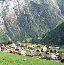
Panorama of Gimmelwald. | ||
| ||
 Gimmelwald | ||
|
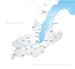
Location of Gimmelwald  | ||
| Coordinates: 46°32′N 7°53′E / 46.533°N 7.883°ECoordinates: 46°32′N 7°53′E / 46.533°N 7.883°E | ||
| Country | Switzerland | |
| Canton | Bern | |
| District | Interlaken-Oberhasli | |
| Area | ||
| • Total | 30.4 km2 (11.7 sq mi) | |
| Elevation | 1,367 m (4,485 ft) | |
| Population (December 2015) | ||
| • Total | 130 | |
| • Density | 4.3/km2 (11/sq mi) | |
| Postal code | 3826 | |
| Surrounded by | Wengen, Mürren, Isenfluh, Stechelberg, Lauterbrunnen | |
| Website |
www | |
Gimmelwald is a small village in the Bernese Oberland in Switzerland, halfway up the mountain between Stechelberg and Mürren, at an elevation of 1363 meters (4472 feet). The village is at the foot of the UNESCO World Heritage site, the Jungfrau-Aletsch Protected Area. Gimmelwald is an allemanic linear village and a walser settlement first mentioned in a bill of sale in 1346.[1] Because of its very typical and exceptional townscape, Gimmelwald is part of the inventory of swiss heritage.[2]
Gimmelwald is one of the few villages left in Switzerland where access by car is not possible (there is not road connection) and which is therefore traffic free. The Schilthorn cable car stops in Gimmelwald where it is possible to board another cable car which runs between Gimmelwald and Mürren. Farming and tourism are the main source of income today. Farmers raise hay on tiny plots of land to feed small herds of cows. In winter farmers often work as well for the Schilthorn cable car such as running ski lifts or ski-slope grooming.
In the year 2003 the population of Gimmelwald was 130. The local school closed in 2010 due to the small number of students and students now attend the school in Lauterbrunnen.
Traffic and accessibility
There is a walking path between Gimmelwald and Mürren, but lacking connection to the main road system, the main transportation to Gimmelwald is the Luftseilbahn Stechelberg-Mürren-Schilthorn (LSMS) aerial tramway. The cable car travels down from Murren to Stechelberg on the floor of the Lauterbrunnen valley. At the bottom of the valley there is a bus to Lauterbrunnen where there are connections to the rest of Switzerland, and up to the town of Mürren and the Schilthorn.
Politics
Gimmelwald, together with Wengen, Mürren, Isenfluh, Stechelberg, and Lauterbrunnen, belongs to the municipality of Lauterbrunnen. The parish, or Kirchgemeinde, covers the entire valley.
Tourism
The main source of income for Gimmelwald is tourism because of its spectacular views and special geographic setting. Gimmelwald has a small hotel, former pension (now a British run hotel), a bed & breakfast and the Mountain Hostel. Gimmelwald was stopped from being developed into a large ski resort by having it declared an avalanche zone which is only partly the case.[3] In summer, Gimmelwald is mostly visited from tourists from North America where as in winter Gimmelwald is mostly visited by European and Swiss tourists for winter sports.
Gimmelwald has a 2.2 km long via ferrata connecting the neighbouring village of Mürren.[4]
- The Jungfrau seen from Gimmelwald
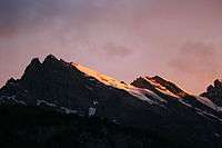
 The Gspaltenhorn seen from Gimmelwald
References
- ↑ Michel Hans (1962): Buch der Talschaft Lauterbrunnen. 1240-1949. Verlag P. Ruch-Daulte Wengen.
- ↑ BAK (2015): List of townscapes with national significance. http://www.bak.admin.ch/isos/03198/03215/index.html?lang=de#sprungmarke0_5
- ↑ Steves, Rick (August 2008). "Switzerland". Rick Steves' Best of Europe 2009. Rick Steves' Europe. Berkeley: Avalon Travel. p. 1100. ISBN 978-1-59880-105-7.
- ↑ Homepage Via Ferrata Gimmelwald-Mürren http://www.klettersteig-muerren.ch/
External links
| Wikimedia Commons has media related to Gimmelwald. |
- Gimmelwald tourism
- Gimmelwald Mountain Hostel
- Klettersteig/Via Ferrata Mürren–Gimmelwald
- Rick Steves Gimmelwald
 Gimmelwald travel guide from Wikivoyage

