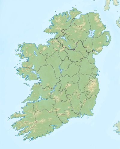
Glen Lough
| Glen Lough Loch an Ghleanna | |
|---|---|
 Location in Ireland | |
| Location | County Donegal |
| Coordinates | 55°6′43″N 7°50′15″W / 55.11194°N 7.83750°WCoordinates: 55°6′43″N 7°50′15″W / 55.11194°N 7.83750°W |
| Lake type | Glacial lake |
| Primary inflows | Owencarrow River |
| Primary outflows | Lackagh River |
| Catchment area | 124.22 km2 (48.0 sq mi) |
| Basin countries | Ireland |
| Max. length | 3.4 km (2 mi) |
| Max. width | 0.5 km (0.3 mi) |
| Surface area | 1.68 km2 (0.65 sq mi) |
| Average depth | 4.9 m (16 ft) |
| Max. depth | 21 m (69 ft) |
| Surface elevation | 27 m (89 ft) |
| References | [1][2][3] |
Glen Lough (Irish: Loch an Ghleanna)[4] is a freshwater lake in the northwest of Ireland. It is located in north County Donegal near the village of Creeslough.
Geography
Glen Lough is about 5 kilometres (3 mi) east of Creeslough.[3] It measures about 3 km (2 mi) long and 0.5 km (0.3 mi) wide and lies just north of Lough Beagh and Glenveagh National Park.[2] The Derryveagh Mountains begin on the lake's western side and the Glendowan Mountains begin on the lake's southern end.[5]
Hydrology
Glen Lough is fed mainly by the Owencarrow River entering at its southern end. The lake drains northwards into the Lackagh River, which in turn enters Sheephaven Bay. The Owencarrow connects the lake with its southern neighbour, Lough Beagh.[2][3]
Natural history
Fish species in Glen Lough include brown trout (including sea trout), Arctic char, salmon, minnow and the critically endangered European eel.[3]
See also
References
- ↑ "A Reference Based Typology and Ecological Assessment System for Irish Lakes" (PDF). Environmental Protection Agency (Ireland). 2006. p. 12. Retrieved 16 Aug 2015.
- 1 2 3 Google (16 Aug 2015). "Glen Lough" (Map). Google Maps. Google. Retrieved 16 Aug 2015.
- 1 2 3 4 "Water Framework Directive Fish Stock Survey of Glen Lough" (PDF). Inland Fisheries Ireland. August 2013. Retrieved 16 Aug 2015.
- ↑ "Loch an Ghleanna/Glen Lough". Placenames Database of Ireland. Government of Ireland - Department of Arts, Heritage and the Gaeltacht and Dublin City University. Retrieved 16 Aug 2015.
- ↑ "Explanatory Memoir" (PDF). Irish historical geological maps. Geological Survey of Ireland. 1891. p. 6. Retrieved 16 Aug 2015.