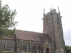
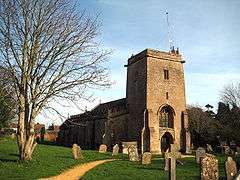
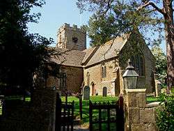
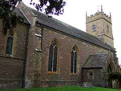
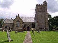
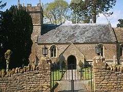
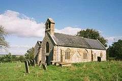
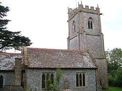
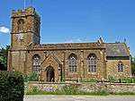
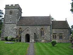
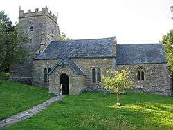
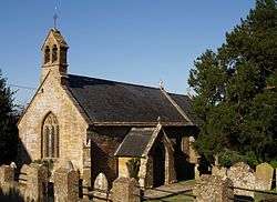
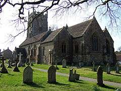
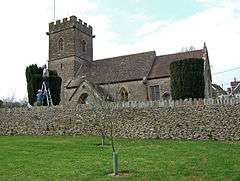
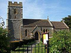
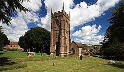
Grade II* listed buildings in South Somerset

South Somerset shown within the ceremonial county of Somerset

South Somerset is a local government district in the English county of Somerset. The South Somerset district occupies an area of 370 square miles (958 km2),[1] stretching from its borders with Devon and Dorset to the edge of the Somerset Levels. The district has a population of about 158,000,[2] and has Yeovil as its administrative centre.

In the United Kingdom, the term listed building refers to a building or other structure officially designated as being of special architectural, historical or cultural significance; Grade II* structures are those considered to be "particularly significant buildings of more than local interest".[3] Listing was begun by a provision in the Town and Country Planning Act 1947. Once listed, severe restrictions are imposed on the modifications allowed to a building's structure or its fittings. In England, the authority for listing under the Planning (Listed Buildings and Conservation Areas) Act 1990[4] rests with Historic England, a non-departmental public body sponsored by the Department for Culture, Media and Sport; local authorities have a responsibility to regulate and enforce the planning regulations.

There are 266 Grade II* listed buildings in South Somerset.

Buildings

Name Location Type Completed [note 1] Grid ref.[note 2]
Geo-coordinates
Entry number [note 3]ImageRef.
1–2 Castle Cottages Chilthorne Domer Semi Detached House Early-mid 17th century ST5241319269
50°58′15″N 2°40′45″W / 50.97086°N 2.679103°W / 50.97086; -2.679103 (1–2 Castle Cottages)
1057244
[5]
Abbey House South Cadbury House 15th century ST6237624867
51°01′19″N 2°32′16″W / 51.021935°N 2.5378°W / 51.021935; -2.5378 (Abbey House)
1258892 [6]
Admiral Hood Monument Compton Dundon Commemorative Monument Early 19th century ST4959233808
51°06′05″N 2°43′17″W / 51.101346°N 2.721304°W / 51.101346; -2.721304 (Admiral Hood Monument)
1056743
[7]
Ansford Lodge Ansford House Late 18th century ST6415432918
51°05′40″N 2°30′48″W / 51.094442°N 2.513252°W / 51.094442; -2.513252 (Ansford Lodge)
1307605
[8]
Ashford House Ilton Cross Passage House Probably 17th century ST3567118959
50°57′59″N 2°55′03″W / 50.966443°N 2.917458°W / 50.966443; -2.917458 (Ashford House)
1057048 [9]
Ashington Manor Chilton Cantelo Manor House 15th century ST5611521473
50°59′27″N 2°37′36″W / 50.990972°N 2.62665°W / 50.990972; -2.62665 (Ashington Manor)
1056833 [10]
Ashlar House (formerly listed with The Clerks House as The Cedars) and boundary railings to North and East Martock Semi Detached House Early 18th century ST4610419113
50°58′08″N 2°46′08″W / 50.9689°N 2.768924°W / 50.9689; -2.768924 (Ashlar House (formerly listed with The Clerks House as The Cedars) and boundary railings to North and East)
1265440 [11]
Avishays Chaffcombe Cross Wing House 17th century ST3521609255
50°52′45″N 2°55′20″W / 50.879141°N 2.92221°W / 50.879141; -2.92221 (Avishays)
1366399 [12]
Balsam House Wincanton House 17th century ST7168228520
51°03′19″N 2°24′19″W / 51.055318°N 2.405411°W / 51.055318; -2.405411 (Balsam House)
1238556
[13]
Baptist Church Chard Schoolroom Later 19th century ST3218408499
50°52′19″N 2°57′55″W / 50.871995°N 2.96516°W / 50.871995; -2.96516 (Baptist Church)
1206076
[14]
Bromes House Isle Abbotts Farmhouse 1627 ST3515620792
50°58′58″N 2°55′30″W / 50.982866°N 2.925119°W / 50.982866; -2.925119 (Bromes House)
1249589 [15]
Burton Pynsent House Curry Rivel House Pre- Circa 1756 ST3725724598
51°01′02″N 2°53′45″W / 51.017319°N 2.895851°W / 51.017319; -2.895851 (Burton Pynsent House)
1373913 [16]
Candle Cottage and garden walls and railing to East Crewkerne House Late 15th century ST4423009817
50°53′06″N 2°47′39″W / 50.885136°N 2.794185°W / 50.885136; -2.794185 (Candle Cottage and garden walls and railing to East)
1202997 [17]
Cathanger Fivehead Country House 1988 ST3423922881
51°00′06″N 2°56′19″W / 51.001544°N 2.938559°W / 51.001544; -2.938559 (Cathanger)
1263673 [18]
Chapel Cross South Cadbury House 20th century ST6308226316
51°02′06″N 2°31′40″W / 51.03501°N 2.527883°W / 51.03501; -2.527883 (Chapel Cross)
1258890
[19]
Chard Manor Farmhouse Chard Farmhouse 15th or early 16th century ST3226208164
50°52′08″N 2°57′50″W / 50.868992°N 2.963989°W / 50.868992; -2.963989 (Chard Manor Farmhouse)
1197429 [20]
Chard School Chard House 1583 ST3245208656
50°52′24″N 2°57′41″W / 50.873438°N 2.961381°W / 50.873438; -2.961381 (Chard School)
1205594
[21]
Charlton House Charlton Mackrell House Extended ST5295029075
51°03′33″N 2°40′22″W / 51.059076°N 2.672731°W / 51.059076; -2.672731 (Charlton House)
1056766 [22]
Church Cross in Churchyard of St James' Church Yeovil Cross Possibly 15th century ST5347916220
50°56′37″N 2°39′49″W / 50.943531°N 2.663532°W / 50.943531; -2.663532 (Church Cross in Churchyard of St James' Church)
1173415 [23]
Church House with integral orangery Yeovil Town house c. 1770 ST5561516020
50°56′31″N 2°37′59″W / 50.941902°N 2.633107°W / 50.941902; -2.633107 (Church House with integral orangery)
1055715 [24]
Church of All Saints Castle Cary Anglican Church 19th century And 20th century ST6391632055
51°05′12″N 2°31′00″W / 51.086667°N 2.516564°W / 51.086667; -2.516564 (Church of All Saints)
1056241
[25]
Church of All Saints Closworth Church 13th century ST5639310059
50°53′18″N 2°37′17″W / 50.888361°N 2.62132°W / 50.888361; -2.62132 (Church of All Saints)
1057233
[26]
Church of All Saints Kingsdon Church 15th century ST5157026203
51°01′59″N 2°41′31″W / 51.033137°N 2.692036°W / 51.033137; -2.692036 (Church of All Saints)
1223613
[27]
Church of All Saints Kingweston Parish Church Some Medieval Fragments ST5251731324
51°04′45″N 2°40′45″W / 51.079262°N 2.679205°W / 51.079262; -2.679205 (Church of All Saints)
1307683
[28]
Church of All Saints Lopen Church 17th or 18th century ST4271414498
50°55′37″N 2°48′59″W / 50.927077°N 2.81647°W / 50.927077; -2.81647 (Church of All Saints)
1056994
[29]
Church of All Saints Merriott Anglican Church 1860 ST4427212844
50°54′44″N 2°47′39″W / 50.912358°N 2.794051°W / 50.912358; -2.794051 (Church of All Saints)
1175447
[30]
Church of St Andrew Aller Church 11th century ST3963228805
51°03′19″N 2°51′46″W / 51.0554°N 2.862699°W / 51.0554; -2.862699 (Church of St Andrew)
1227327
[31]
Church of St Bartholomew Yeovilton Church c. 1300 ST5468023013
51°00′17″N 2°38′50″W / 51.004708°N 2.647287°W / 51.004708; -2.647287 (Church of St Bartholomew)
1056787
[32]
Church of St John Baptist Pitney Church 13th century ST4446328502
51°03′11″N 2°47′37″W / 51.053164°N 2.793732°W / 51.053164; -2.793732 (Church of St John Baptist)
1056546
[33]
Church of St Margaret West and Middle Chinnock Church 12th century ST4721213129
50°54′55″N 2°45′08″W / 50.915197°N 2.752277°W / 50.915197; -2.752277 (Church of St Margaret)
1057169
[34]
Church of St Martin of Tours West Coker Church 13th or 14th century ST5164913573
50°55′10″N 2°41′21″W / 50.91958°N 2.689225°W / 50.91958; -2.689225 (Church of St Martin of Tours)
1345829
[35]
Church of St Mary Hardington Mandeville Church Early Foundation-Pre 1123 ST5123211932
50°54′17″N 2°41′42″W / 50.904789°N 2.694937°W / 50.904789; -2.694937 (Church of St Mary)
1345795
[36]
Church of St Mary Magdalene Barwick Church 13th century ST5580413856
50°55′21″N 2°37′49″W / 50.922458°N 2.630154°W / 50.922458; -2.630154 (Church of St Mary Magdalene)
1057217
[37]
Church of St Michael East Coker Church Late 12th century ST5388312190
50°54′26″N 2°39′26″W / 50.907327°N 2.657271°W / 50.907327; -2.657271 (Church of St Michael)
1345781
[38]
Church of St Roch Pendomer, Closworth Church 14th century ST5213410394
50°53′28″N 2°40′55″W / 50.891035°N 2.681908°W / 50.891035; -2.681908 (Church of St Roch)
1307971
[39]
Church of St Stephen Charlton Musgrove Sundial 1916 ST7201329909
51°04′04″N 2°24′03″W / 51.067825°N 2.400796°W / 51.067825; -2.400796 (Church of St Stephen)
1346185
[40]
Church of St Andrew Ansford Anglican Church 15th century ST6382332909
51°05′40″N 2°31′05″W / 51.09434°N 2.517977°W / 51.09434; -2.517977 (Church of St Andrew)
1307553
[41]
Church of St Andrew Thorne Coffin Church 1613 ST5260417604
50°57′21″N 2°40′34″W / 50.955905°N 2.676166°W / 50.955905; -2.676166 (Church of St Andrew)
1263070
[42]
Church of St Andrew Compton Dundon Parish Church Early 14th century ST4794232532
51°05′23″N 2°44′41″W / 51.089726°N 2.744683°W / 51.089726; -2.744683 (Church of St Andrew)
1176782
[43]
Church of St Andrew Dowlish Wake Anglican Church 19th century ST3756612944
50°54′45″N 2°53′22″W / 50.912569°N 2.889443°W / 50.912569; -2.889443 (Church of St Andrew)
1366405
[44]
Church of St Andrew Northover, Ilchester Tower 14th century and later ST5234823141
51°00′20″N 2°40′50″W / 51.00567°N 2.680538°W / 51.00567; -2.680538 (Church of St Andrew)
1267315
[45]
Church of St Andrew Puckington Anglican Church 19th century ST3770118288
50°57′38″N 2°53′18″W / 50.960633°N 2.888438°W / 50.960633; -2.888438 (Church of St Andrew)
1057727
[46]
Church of St Catherine Montacute Anglican Church 19th century ST4967316952
50°56′59″N 2°43′04″W / 50.949793°N 2.717802°W / 50.949793; -2.717802 (Church of St Catherine)
1253547
[47]
Church of St David Barton St David Parish Church 12th century To 15th century ST5397231699
51°04′58″N 2°39′31″W / 51.082752°N 2.658484°W / 51.082752; -2.658484 (Church of St David)
1176035
[48]
Church of St James East Lambrook, Kingsbury Episcopi Anglican Church 19th century ST4317218665
50°57′53″N 2°48′38″W / 50.96459°N 2.810605°W / 50.96459; -2.810605 (Church of St James)
1056883
[49]
Church of St James with its South boundary wall Yeovil Church 1420 ST5347516235
50°56′37″N 2°39′49″W / 50.943666°N 2.663591°W / 50.943666; -2.663591 (Church of St James with its South boundary wall)
1346135
[50]
Church of St John the Baptist South Brewham Church 13th century ST7196436143
51°07′26″N 2°24′07″W / 51.123877°N 2.401981°W / 51.123877; -2.401981 (Church of St John the Baptist)
1056463
[51]
Church of St John the Baptist Horsington Parish Church 15th century fragments ST7029723861
51°00′48″N 2°25′29″W / 51.013355°N 2.424788°W / 51.013355; -2.424788 (Church of St John the Baptist)
1238063
[52]
Church of St John the Baptist North Cheriton Parish Church 14th-century origins ST6872625826
51°01′51″N 2°26′50″W / 51.03094°N 2.447351°W / 51.03094; -2.447351 (Church of St John the Baptist)
1274277
[53]
Church of St John the Evangelist and All Saints Kingstone Church Post 1540 ST3788213637
50°55′08″N 2°53′06″W / 50.918834°N 2.885067°W / 50.918834; -2.885067 (Church of St John the Evangelist and All Saints)
1057025
[54]
Church of St Lawrence Cucklington Parish Church 13th century ST7552227775
51°02′56″N 2°21′02″W / 51.048797°N 2.350573°W / 51.048797; -2.350573 (Church of St Lawrence)
1274765
[55]
Church of St Mary Abbas and Templecombe Parish Church 12th century ST7085922669
51°00′10″N 2°25′00″W / 51.002665°N 2.41668°W / 51.002665; -2.41668 (Church of St Mary)
1366329
[56]
Church of St Mary Buckland St Mary Parish Church Earlier ST2708313408
50°54′56″N 3°02′19″W / 50.91551°N 3.038623°W / 50.91551; -3.038623 (Church of St Mary)
1277983
[57]
Church of St Mary Charlton Mackrell Parish Church 13th century Origins ST5282728336
51°03′09″N 2°40′28″W / 51.052421°N 2.674389°W / 51.052421; -2.674389 (Church of St Mary)
1056728
[58]
Church of St Mary Chilthorne Domer Bell Tower Turret ST5248219423
50°58′20″N 2°40′41″W / 50.97225°N 2.678141°W / 50.97225; -2.678141 (Church of St Mary)
1345756
[59]
Church of St Mary Compton Pauncefoot Church Pre 1262 (Mentioned 1262) ST6440226161
51°02′01″N 2°30′33″W / 51.0337°N 2.509043°W / 51.0337; -2.509043 (Church of St Mary)
1248577
[60]
Church of St Mary Donyatt Anglican Church 15th century ST3391614057
50°55′20″N 2°56′30″W / 50.922169°N 2.941556°W / 50.922169; -2.941556 (Church of St Mary)
1057074
[61]
Church of St Mary Seavington St Mary Tower 13th century ST4028814920
50°55′50″N 2°51′04″W / 50.930625°N 2.851054°W / 50.930625; -2.851054 (Church of St Mary)
1307339
[62]
Church of St Mary Wambrook Parish Church Roof Leaded By 1613 ST2939407707
50°51′52″N 3°00′17″W / 50.86454°N 3.004651°W / 50.86454; -3.004651 (Church of St Mary)
1249439
[63]
Church of St Mary Yarlington Anglican Church 1878 ST6546829309
51°03′43″N 2°29′39″W / 51.062072°N 2.494143°W / 51.062072; -2.494143 (Church of St Mary)
1056212
[64]
Church of St Mary Magdalen Cricket Malherbie, Knowle St Giles Statue 20th century ST3612911540
50°53′59″N 2°54′35″W / 50.899788°N 2.909634°W / 50.899788; -2.909634 (Church of St Mary Magdalen)
1177461
[65]
Church of St Mary Magdalene Sparkford Parish Church Mentioned 1297 ST6090725663
51°01′44″N 2°33′32″W / 51.028994°N 2.55883°W / 51.028994; -2.55883 (Church of St Mary Magdalene)
1243352
[66]
Church of St Mary Major Ilchester Church 13th century Or Earlier ST5225522613
51°00′03″N 2°40′54″W / 51.000915°N 2.681794°W / 51.000915; -2.681794 (Church of St Mary Major)
1345741
[67]
Church of St Mary the Virgin Stocklinch Anglican Church 12th century and later ST3866917084
50°57′00″N 2°52′28″W / 50.949912°N 2.874454°W / 50.949912; -2.874454 (Church of St Mary the Virgin)
1175580
[68]
Church of St Mary the Virgin Whitelackington Anglican Church Early 14th century ST3795615268
50°56′01″N 2°53′03″W / 50.933507°N 2.884292°W / 50.933507; -2.884292 (Church of St Mary the Virgin)
1057033
[69]
Church of St Michael Blackford Church 11th or 12th century ST6579826160
51°02′02″N 2°29′21″W / 51.033776°N 2.489136°W / 51.033776; -2.489136 (Church of St Michael)
1056557
[70]
Church of St Michael Cudworth Anglican Church 19th century ST3731310870
50°53′38″N 2°53′34″W / 50.893894°N 2.892684°W / 50.893894; -2.892684 (Church of St Michael)
1366403
[71]
Church of St Michael Seavington St Michael Tower c. 1800 ST4101314947
50°55′51″N 2°50′27″W / 50.930942°N 2.840743°W / 50.930942; -2.840743 (Church of St Michael)
1057002
[72]
Church of St Michael Wayford Anglican Church 18th century ST4048006655
50°51′23″N 2°50′49″W / 50.856331°N 2.846972°W / 50.856331; -2.846972 (Church of St Michael)
1056166
[73]
Church of St Michael and All Angels Chaffcombe Anglican Church 1857-60 ST3539410183
50°53′15″N 2°55′11″W / 50.887505°N 2.919844°W / 50.887505; -2.919844 (Church of St Michael and All Angels)
1056177
[74]
Church of St Michael and All Angels Haselbury Plucknett Anglican Church Late 19th century ST4713610930
50°53′44″N 2°45′11″W / 50.895418°N 2.753039°W / 50.895418; -2.753039 (Church of St Michael and All Angels)
1056149
[75]
Church of St Michael and All Angels Penselwood Parish Church Mostly 15th century ST7562331434
51°04′54″N 2°20′58″W / 51.081703°N 2.34938°W / 51.081703; -2.34938 (Church of St Michael and All Angels)
1238353
[76]
Church of St Nicholas Bratton Seymour Anglican Church Saxon Origin ST6771130078
51°04′09″N 2°27′44″W / 51.069117°N 2.462206°W / 51.069117; -2.462206 (Church of St Nicholas)
1177220
[77]
Church of St Nicholas Dinnington Anglican Church 1863 ST4030212766
50°54′41″N 2°51′02″W / 50.911259°N 2.850501°W / 50.911259; -2.850501 (Church of St Nicholas)
1345887
[78]
Church of St Nicholas Henstridge Parish Church 12th century ST7227919763
50°58′36″N 2°23′46″W / 50.976605°N 2.396221°W / 50.976605; -2.396221 (Church of St Nicholas)
1366325
[79]
Church of St Nicholas Holton Parish Church 14th century ST6852826849
51°02′24″N 2°27′01″W / 51.040128°N 2.450264°W / 51.040128; -2.450264 (Church of St Nicholas)
1056348
[80]
Church of St Peter Redlynch Church c. 1750 ST6999433319
51°05′54″N 2°25′48″W / 51.098384°N 2.429894°W / 51.098384; -2.429894 (Church of St Peter)
1176298
[81]
Church of St Peter Ilton Church 12th century ST3518917423
50°57′09″N 2°55′27″W / 50.952578°N 2.924047°W / 50.952578; -2.924047 (Church of St Peter)
1057052
[82]
Church of St Peter South Barrow Church 14th century or earlier ST6018127892
51°02′56″N 2°34′10″W / 51.048987°N 2.569428°W / 51.048987; -2.569428 (Church of St Peter)
1258889
[83]
Church of St Peter and St Paul Charlton Horethorne Altar 4th century ST6652423075
51°00′22″N 2°28′43″W / 51.006079°N 2.478497°W / 51.006079; -2.478497 (Church of St Peter and St Paul)
1056366
[84]
Church of St Peter and St Paul Chiselborough Anglican Church 17th century ST4674914873
50°55′51″N 2°45′33″W / 50.930836°N 2.759118°W / 50.930836; -2.759118 (Church of St Peter and St Paul)
1345758
[85]
Church of St Peter and St Paul Odcombe Anglican Church 19th century ST5069015466
50°56′11″N 2°42′11″W / 50.936519°N 2.703124°W / 50.936519; -2.703124 (Church of St Peter and St Paul)
1241492
[86]
Church of St Peter and St Paul Wincanton Tower 1793 ST7110728484
51°03′18″N 2°24′49″W / 51.054966°N 2.413612°W / 51.054966; -2.413612 (Church of St Peter and St Paul)
1238534
[87]
Church of St Stephen Winsham Sundial 19th century ST3746306273
50°51′09″N 2°53′23″W / 50.852577°N 2.889764°W / 50.852577; -2.889764 (Church of St Stephen)
1177765
[88]
Church of St Thomas Cricket St Thomas Anglican Church 1868 ST3728908584
50°52′24″N 2°53′33″W / 50.873337°N 2.892633°W / 50.873337; -2.892633 (Church of St Thomas)
1056183
[89]
Church of St Thomas a Becket South Cadbury Church 13th century ST6314125497
51°01′40″N 2°31′37″W / 51.02765°N 2.526958°W / 51.02765; -2.526958 (Church of St Thomas a Becket)
1258922
[90]
Church of St Thomas of Canterbury Lovington Church 13th century ST5966330835
51°04′31″N 2°34′38″W / 51.075413°N 2.577146°W / 51.075413; -2.577146 (Church of St Thomas of Canterbury)
1056528
[91]
Church of the Blessed Virgin Mary Ashill Parish Church 12th century ST3211617263
50°57′03″N 2°58′04″W / 50.950785°N 2.967759°W / 50.950785; -2.967759 (Church of the Blessed Virgin Mary)
1057100
[92]
Church of the Holy Cross Babcary Tower 14th century ST5614828774
51°03′24″N 2°37′37″W / 51.056623°N 2.627065°W / 51.056623; -2.627065 (Church of the Holy Cross)
1277940
[93]
Church of the Holy Cross Sparkford Church 1911 ST6105724942
51°01′21″N 2°33′24″W / 51.022522°N 2.556613°W / 51.022522; -2.556613 (Church of the Holy Cross)
1243568
[94]
Churchyard Cross in Churchyard of the Church of St Catherine Drayton Churchyard Cross 15th century ST4051824760
51°01′09″N 2°50′58″W / 51.019123°N 2.849394°W / 51.019123; -2.849394 (Churchyard Cross in Churchyard of the Church of St Catherine)
1236539
[95]
Churchyard Cross, 10m west of the Church of All Saints Closworth Cross 15th century ST5476911124
50°53′52″N 2°38′40″W / 50.897812°N 2.644538°W / 50.897812; -2.644538 (Churchyard Cross, 10m west of the Church of All Saints)
1307974
[96]
Churchyard Cross, about 5m south of Nave, Church of St Aldhelm and St Eadburgha Broadway Cross Late 13th century-Early 14th century ST3296315896
50°56′19″N 2°57′20″W / 50.938594°N 2.955451°W / 50.938594; -2.955451 (Churchyard Cross, about 5m south of Nave, Church of St Aldhelm and St Eadburgha)
1057005 [97]
Clapton Farmhouse Cucklington Farmhouse Dated 1615 ST7513929201
51°03′42″N 2°21′22″W / 51.061603°N 2.356135°W / 51.061603; -2.356135 (Clapton Farmhouse)
1222398 [98]
Clapton Mill (Lockyer and Son), with aqueduct to north east West Crewkerne Aqueduct Rebuilt 1864 ST4137106378
50°51′14″N 2°50′03″W / 50.853931°N 2.834271°W / 50.853931; -2.834271 (Clapton Mill (Lockyer and Son), with aqueduct to north east)
1056856
[99]
Collins Chest Tomb, 2m south of the south east Nave window, Church of All Saints Closworth Chest Tomb 1570 And 1609 ST5638110049
50°53′18″N 2°37′17″W / 50.88827°N 2.621489°W / 50.88827; -2.621489 (Collins Chest Tomb, 2m south of the south east Nave window, Church of All Saints)
1345791
[100]
Congregational Chapel, now United Reformed Church Kingsbury Episcopi Congregational Chapel 1729 ST4225518447
50°57′45″N 2°49′25″W / 50.962538°N 2.823627°W / 50.962538; -2.823627 (Congregational Chapel, now United Reformed Church)
1236948
[101]
Coombe Hill House Bruton Country House 1820/30 ST6837735529
51°07′05″N 2°27′11″W / 51.118169°N 2.45318°W / 51.118169; -2.45318 (Coombe Hill House)
1346172 [102]
Cosenes Monument in Churchyard 5 metres south south east of South Transept, Church of All Saints Castle Cary Chest Tomb ST6393632046
51°05′12″N 2°30′59″W / 51.086588°N 2.516277°W / 51.086588; -2.516277 (Cosenes Monument in Churchyard 5 metres south south east of South Transept, Church of All Saints)
1366395 [103]
Court Farm House Barwick Farmhouse Early 17th century ST5639713545
50°55′11″N 2°37′18″W / 50.919707°N 2.62168°W / 50.919707; -2.62168 (Court Farm House)
1057226 [104]
Court House Martock House Sold As Private House 1975 ST4611219091
50°58′07″N 2°46′08″W / 50.968703°N 2.768807°W / 50.968703; -2.768807 (Court House)
1227536 [105]
Court House South Petherton House 18th century ST4321217051
50°57′00″N 2°48′35″W / 50.950081°N 2.809784°W / 50.950081; -2.809784 (Court House)
1056954 [106]
Craigmore House Somerton Row 17th-18th century ST4912128616
51°03′17″N 2°43′38″W / 51.054621°N 2.727298°W / 51.054621; -2.727298 (Craigmore House)
1307586 [107]
Crane Farmhouse Somerton Farmhouse Medieval Origins ST4903728337
51°03′08″N 2°43′42″W / 51.052105°N 2.728457°W / 51.052105; -2.728457 (Crane Farmhouse)
1346065 [108]
Cricket Court, and attached balustraded walling around basement areas Knowle St Giles Country House 1811 ST3601111414
50°53′55″N 2°54′41″W / 50.898642°N 2.91129°W / 50.898642; -2.91129 (Cricket Court, and attached balustraded walling around basement areas)
1056158 [109]
Danyell Monument in churchyard about 0.5 metres south of Chancel, Church of St Thomas of Canterbury Lovington Chest Tomb Early 17th century ST5967630830
51°04′31″N 2°34′37″W / 51.075369°N 2.57696°W / 51.075369; -2.57696 (Danyell Monument in churchyard about 0.5 metres south of Chancel, Church of St Thomas of Canterbury)
1277744 [110]
Darvole Farm House East Coker Farmhouse 16th century ST5562212418
50°54′34″N 2°37′57″W / 50.909514°N 2.632567°W / 50.909514; -2.632567 (Darvole Farm House)
1176487 [111]
Dental Surgery / Priors House Wincanton House 15th century ST7124228567
51°03′21″N 2°24′42″W / 51.055719°N 2.411692°W / 51.055719; -2.411692 (Dental Surgery / Priors House)
1238517 [112]
Dillington House Whitelackington Country House 16th century ST3676515552
50°56′09″N 2°54′05″W / 50.935931°N 2.901288°W / 50.935931; -2.901288 (Dillington House)
1057040
[113]
Donisthorpe Somerton House Earlier ST4909528681
51°03′19″N 2°43′40″W / 51.055203°N 2.727678°W / 51.055203; -2.727678 (Donisthorpe)
1056687 [114]
Dovecote about 370 metres south of Bruton Church Bruton Dovecote 16th century ST6838534419
51°06′29″N 2°27′11″W / 51.108189°N 2.452968°W / 51.108189; -2.452968 (Dovecote about 370 metres south of Bruton Church)
1056424
[115]
Dovecote in Churchyard, about 15m south west of church, Church of St Mary The Virgin Norton Sub Hamdon Dovecote 17th century or Possibly Earlier ST4703515946
50°56′26″N 2°45′19″W / 50.94051°N 2.755205°W / 50.94051; -2.755205 (Dovecote in Churchyard, about 15m south west of church, Church of St Mary The Virgin)
1241076
[116]
Dowlish Manor Farmhouse Dowlish Wake Cross Passage House 11th century ST3760812953
50°54′46″N 2°53′20″W / 50.912655°N 2.888847°W / 50.912655; -2.888847 (Dowlish Manor Farmhouse)
1366406 [117]
East Lambrook Manor and forecourt wall / Manor Cottage Kingsbury Episcopi Cruck House 15th century ST4316918898
50°58′00″N 2°48′38″W / 50.966684°N 2.810685°W / 50.966684; -2.810685 (East Lambrook Manor and forecourt wall / Manor Cottage)
1264346
[118]
Easton House and forecourt wall Barrington Cross Passage House Probably Circa 1600 ST3939918060
50°57′32″N 2°51′51″W / 50.958765°N 2.864226°W / 50.958765; -2.864226 (Easton House and forecourt wall)
1236314 [119]
Essex House Chard House Mid 18th century ST3238908636
50°52′24″N 2°57′44″W / 50.873251°N 2.962272°W / 50.873251; -2.962272 (Essex House)
1297112 [120]
Factory Building, formerly of Gifford Fox and Company Limited Chard Industrial Building 1993 ST3223808450
50°52′18″N 2°57′52″W / 50.871561°N 2.964383°W / 50.871561; -2.964383 (Factory Building, formerly of Gifford Fox and Company Limited)
1197481 [121]
Former Priests House Wayford Cross wing house 15th century ST4048106625
50°51′22″N 2°50′49″W / 50.856061°N 2.846953°W / 50.856061; -2.846953 (Former Priests House)
1056167 [122]
Front boundary wall, piers and gate, 15 metres north of Manor Farm House Charlton Horethorne Gate 18th century ST6650723168
51°00′25″N 2°28′43″W / 51.006914°N 2.478748°W / 51.006914; -2.478748 (Front boundary wall, piers and gate, 15 metres north of Manor Farm House)
1174379
[123]
Gants Mill Pitcombe Feed Mill 1810-Circa 1830 ST6744434262
51°06′24″N 2°27′59″W / 51.106724°N 2.466395°W / 51.106724; -2.466395 (Gants Mill)
1251831
[124]
Gatehouse to Cathanger Fivehead Gatehouse Late 16th century ST3417522850
51°00′05″N 2°56′22″W / 51.001258°N 2.939465°W / 51.001258; -2.939465 (Gatehouse to Cathanger)
1249561 [125]
Gate-piers and boundary walling to the Manor House and Mallet Court, bounding gardens Curry Mallet Keep 16th century ST3287421893
50°59′33″N 2°57′28″W / 50.992503°N 2.957826°W / 50.992503; -2.957826 (Gate-piers and boundary walling to the Manor House and Mallet Court, bounding gardens)
1248996 [126]
Gazebo, Steps, Terraces and Walls to North West of Merefield House Crewkerne Wall Early 18th century ST4425109860
50°53′08″N 2°47′38″W / 50.885525°N 2.793893°W / 50.885525; -2.793893 (Gazebo, Steps, Terraces and Walls to North West of Merefield House)
1208228 [127]
George Hotel Ilminster Steps Mid 17th century ST3610014567
50°55′37″N 2°54′38″W / 50.927001°N 2.910578°W / 50.927001; -2.910578 (George Hotel)
1298349
[128]
Godminster Manor Pitcombe Manor House 15th century ST6837433007
51°05′44″N 2°27′11″W / 51.095491°N 2.453001°W / 51.095491; -2.453001 (Godminster Manor)
1251806 [129]
Group of eight Monuments in Churchyard, South and West of Nave, Church of St Andrew Brympton d'Evercy Tombs 17th century ST5191215372
50°56′09″N 2°41′09″W / 50.935778°N 2.685722°W / 50.935778; -2.685722 (Group of eight Monuments in Churchyard, South and West of Nave, Church of St Andrew)
1263241
[130]
Hadspen House Pitcombe Country House 18th century ST6603631044
51°04′40″N 2°29′10″W / 51.077706°N 2.486202°W / 51.077706; -2.486202 (Hadspen House)
1251809 [131]
Haselbury Old Bridge Haselbury Plucknett Road Bridge 14th century ST4584710969
50°53′44″N 2°46′17″W / 50.895649°N 2.771371°W / 50.895649; -2.771371 (Haselbury Old Bridge)
1056146 [132]
Heale House Curry Rivel House 17th century ST3915225268
51°01′25″N 2°52′08″W / 51.023547°N 2.868952°W / 51.023547; -2.868952 (Heale House)
1249228 [133]
Hendford Manor Yeovil Town House Circa 1720 ST5543215722
50°56′21″N 2°38′08″W / 50.939208°N 2.635674°W / 50.939208; -2.635674 (Hendford Manor)
1296434 [134]
Henley Manor Farmhouse West Crewkerne Farmhouse Early 17th century ST4394407683
50°51′57″N 2°47′53″W / 50.865921°N 2.797922°W / 50.865921; -2.797922 (Henley Manor Farmhouse)
1175987 [135]
Hey Farmhouse Winsham Farmhouse C1500 ST3879506459
50°51′16″N 2°52′15″W / 50.854392°N 2.870876°W / 50.854392; -2.870876 (Hey Farmhouse)
1307250 [136]
High Leaze Farmhouse Brympton Farmhouse 17th century ST5186516036
50°56′30″N 2°41′11″W / 50.941744°N 2.686479°W / 50.941744; -2.686479 (High Leaze Farmhouse)
1345772 [137]
Higher Farmhouse Dowlish Wake Farmhouse Late 16th century ST3756612641
50°54′35″N 2°53′22″W / 50.909845°N 2.889391°W / 50.909845; -2.889391 (Higher Farmhouse)
1240334 [138]
Hinton House (South Range) Hinton St George House Medieval ST4181412367
50°54′28″N 2°49′44″W / 50.907826°N 2.828934°W / 50.907826; -2.828934 (Hinton House (South Range))
1175284 [139]
Home Farmhouse and Farm Buildings attached to North East corner of Brympton House Brympton Farmhouse 18th century And Later ST5200815461
50°56′12″N 2°41′04″W / 50.936586°N 2.684368°W / 50.936586; -2.684368 (Home Farmhouse and Farm Buildings attached to North East corner of Brympton House)
1057267 [140]
Homefield Norton Sub Hamdon House 16th century And Later ST4719015933
50°56′25″N 2°45′11″W / 50.940408°N 2.752997°W / 50.940408; -2.752997 (Homefield)
1241341 [141]
Honeywick Pitcombe Farmhouse 18th century ST6531332489
51°05′26″N 2°29′48″W / 51.090656°N 2.496661°W / 51.090656; -2.496661 (Honeywick)
1262425 [142]
Hurds Mill House and Courtyard Walling Curry Rivel Country House Late 18th century ST4122826489
51°02′05″N 2°50′22″W / 51.034742°N 2.839554°W / 51.034742; -2.839554 (Hurds Mill House and Courtyard Walling)
1249226 [143]
Key Farm House East Coker Farmhouse C1600 ST5563813418
50°55′07″N 2°37′57″W / 50.918507°N 2.632462°W / 50.918507; -2.632462 (Key Farm House)
1057188 [144]
Kincora and attached railings Crewkerne House 17th century ST4406409752
50°53′04″N 2°47′48″W / 50.884536°N 2.796534°W / 50.884536; -2.796534 (Kincora and attached railings)
1281924 [145]
Kingstone Farmhouse Kingstone Farmhouse Early 16th century ST3781513669
50°55′09″N 2°53′10″W / 50.919115°N 2.886025°W / 50.919115; -2.886025 (Kingstone Farmhouse)
1056988 [146]
Lancin Farmhouse Wambrook Farmhouse Late Medieval ST2846407980
50°52′01″N 3°01′05″W / 50.86688°N 3.017917°W / 50.86688; -3.017917 (Lancin Farmhouse)
1277516 [147]
Langford Fivehead Fivehead House 1905 ST4316918898
50°58′00″N 2°48′38″W / 50.966684°N 2.810685°W / 50.966684; -2.810685 (Langford Fivehead)
1263649 [148]
Leigh House Winsham Apartment 1987 ST3558506210
50°51′06″N 2°54′59″W / 50.851804°N 2.916428°W / 50.851804; -2.916428 (Leigh House)
1056141 [149]
Lockyer's Farmhouse Compton Dundon Farmhouse Medieval ST4789432301
51°05′16″N 2°44′43″W / 51.087644°N 2.745335°W / 51.087644; -2.745335 (Lockyer's Farmhouse)
1307775 [150]
Long Load Bridge Long Load Road Bridge Medieval Origin ST4670223792
51°00′40″N 2°45′40″W / 51.011027°N 2.761097°W / 51.011027; -2.761097 (Long Load Bridge)
1267215
[151]
Lower Cockhill Farmhouse, with Mounting Block 5 metres West Castle Cary Farmhouse Late 15th century/Early 16th century ST6252431180
51°04′43″N 2°32′11″W / 51.07871°N 2.536346°W / 51.07871; -2.536346 (Lower Cockhill Farmhouse, with Mounting Block 5 metres West)
1177369 [152]
Lullingstone Winsham House 16th century ST3751106405
50°51′14″N 2°53′21″W / 50.853769°N 2.889105°W / 50.853769; -2.889105 (Lullingstone)
1056176 [153]
Madey Mill Martock Watermill Medieval Origin ST4674719058
50°58′06″N 2°45′35″W / 50.968465°N 2.75976°W / 50.968465; -2.75976 (Madey Mill)
1226550
[154]
Main Building of the former Parrett Iron Works Martock Foundry Maybe 18th century ST4459818633
50°57′52″N 2°47′25″W / 50.964441°N 2.790296°W / 50.964441; -2.790296 (Main Building of the former Parrett Iron Works)
1225080
[155]
Manning Chest Tomb, in Churchyard 4 metres South of South East Corner Church of St John the Baptist Brewham Chest Tomb ST7198236142
51°07′26″N 2°24′06″W / 51.123869°N 2.401724°W / 51.123869; -2.401724 (Manning Chest Tomb, in Churchyard 4 metres South of South East Corner Church of St John the Baptist)
1056464 [156]
Mannings Stocklinch Farmhouse 15th century And Later ST3825917236
50°57′04″N 2°52′49″W / 50.951234°N 2.880315°W / 50.951234; -2.880315 (Mannings)
1308307 [157]
Manor Farm House Charlton Horethorne Manor House 1608 ST6652223145
51°00′24″N 2°28′43″W / 51.006708°N 2.478532°W / 51.006708; -2.478532 (Manor Farm House)
1056363
[158]
Manor Farm House Mudford Manor House 1630 ST5774718897
50°58′05″N 2°36′11″W / 50.967932°N 2.603098°W / 50.967932; -2.603098 (Manor Farm House)
1056802 [159]
Manor Farmhouse Beercrocombe Farmhouse 1600 ST3230620594
50°58′51″N 2°57′56″W / 50.980757°N 2.965676°W / 50.980757; -2.965676 (Manor Farmhouse)
1249063 [160]
Manor Farmhouse Charlton Mackrell Farmhouse Medieval Origins ST5293328572
51°03′16″N 2°40′22″W / 51.054552°N 2.672908°W / 51.054552; -2.672908 (Manor Farmhouse)
1056724 [161]
Manor Farmhouse High Ham Farmhouse 17th century ST4261231155
51°04′37″N 2°49′14″W / 51.076835°N 2.82056°W / 51.076835; -2.82056 (Manor Farmhouse)
1235211 [162]
Manor Farmhouse Tatworth and Forton Farmhouse Late Medieval ST3357006992
50°51′31″N 2°56′43″W / 50.858607°N 2.945191°W / 50.858607; -2.945191 (Manor Farmhouse)
1248812 [163]
Manor Farmhouse West and Middle Chinnock Farmhouse Late 16th century/Early 17th century ST4731713286
50°55′00″N 2°45′03″W / 50.916619°N 2.750806°W / 50.916619; -2.750806 (Manor Farmhouse)
1057127 [164]
Manor Farmhouse and front boundary railings Ash Farmhouse Early 17th century ST4793120570
50°58′56″N 2°44′35″W / 50.982169°N 2.743117°W / 50.982169; -2.743117 (Manor Farmhouse and front boundary railings)
1056534 [165]
Manor House Abbas and Templecombe House 17th century And Later ST7091922094
50°59′51″N 2°24′57″W / 50.997498°N 2.415779°W / 50.997498; -2.415779 (Manor House)
1056356 [166]
Manor House Marston Magna Manor House Dated 1613 ST5930322306
50°59′55″N 2°34′53″W / 50.998697°N 2.581324°W / 50.998697; -2.581324 (Manor House)
1056828 [167]
Manor House Misterton Semi Detached House Mid 18th century ST4533408165
50°52′13″N 2°46′42″W / 50.870388°N 2.778245°W / 50.870388; -2.778245 (Manor House)
1308208 [168]
Manor House, King Ina's Palace South Petherton Cross Wing House 16th century ST4332917091
50°57′02″N 2°48′29″W / 50.950453°N 2.808124°W / 50.950453; -2.808124 (Manor House, King Ina's Palace)
1056956 [169]
Maperton House Maperton House Late 20th century ST6717226190
51°02′03″N 2°28′10″W / 51.034126°N 2.469544°W / 51.034126; -2.469544 (Maperton House)
1177942 [170]
Merefield House Crewkerne House Mid 17th century ST4427909859
50°53′08″N 2°47′37″W / 50.885519°N 2.793495°W / 50.885519; -2.793495 (Merefield House)
1208219 [171]
Mid Lambrook Manor Kingsbury Episcopi Farmhouse Circa 1500 ST4227118384
50°57′43″N 2°49′24″W / 50.961973°N 2.82339°W / 50.961973; -2.82339 (Mid Lambrook Manor)
1264344
[172]
Middlethorpe House Curry Rivel House 17th century ST3909525016
51°01′17″N 2°52′11″W / 51.021275°N 2.869722°W / 51.021275; -2.869722 (Middlethorpe House)
1249233 [173]
Mill, attached House and former Drying Kiln West Crewkerne Watermill Re-Built 1793 ST4191707942
50°52′05″N 2°49′36″W / 50.868049°N 2.826764°W / 50.868049; -2.826764 (Mill, attached House and former Drying Kiln)
1400079 [174]
Monks' Reredorter, Muchelney Abbey Muchelney Privy House 13th century ST4287324820
51°01′12″N 2°48′57″W / 51.019902°N 2.815833°W / 51.019902; -2.815833 (Monks' Reredorter, Muchelney Abbey)
1056573
[175]
Monmouth House and attached Walls and Railings Chard House 1770-1790 ST3245108656
50°52′24″N 2°57′41″W / 50.873438°N 2.961395°W / 50.873438; -2.961395 (Monmouth House and attached Walls and Railings)
1205613 [176]
Naish's Farm House, with front boundary wall and gate piers West Camel Farmhouse Early 18th century ST5767324571
51°01′08″N 2°36′17″W / 51.018946°N 2.604815°W / 51.018946; -2.604815 (Naish's Farm House, with front boundary wall and gate piers)
1345993 [177]
National Westminster Bank Crewkerne Gate 1838 ST4409009737
50°53′04″N 2°47′46″W / 50.884404°N 2.796163°W / 50.884404; -2.796163 (National Westminster Bank)
1208423
[178]
3 (Hayes End Manor), 5 and 7, Hayes End South Petherton House Circa 1600 ST4360716684
50°56′49″N 2°48′15″W / 50.94682°N 2.804104°W / 50.94682; -2.804104 (3 (Hayes End Manor), 5 and 7, Hayes End)
1056974 [179]
18 and 20, High Street Bruton Row House 16th century and later ST6831534867
51°06′44″N 2°27′14″W / 51.112213°N 2.454007°W / 51.112213; -2.454007 (18 and 20, High Street)
1056419 [180]
17, North Street Chiselborough Detached House Possibly Late 16th century ST4691414986
50°55′55″N 2°45′24″W / 50.931867°N 2.756787°W / 50.931867; -2.756787 (17, North Street)
1251532 [181]
9, Church Street Crewkerne House Mid 19th century ST4402409757
50°53′04″N 2°47′50″W / 50.884577°N 2.797104°W / 50.884577; -2.797104 (9, Church Street)
1202987 [182]
29, Court Barton Ilminster House 1994 ST3603814615
50°55′39″N 2°54′41″W / 50.927426°N 2.911468°W / 50.927426; -2.911468 (29, Court Barton)
1207652 [183]
28, Court Barton Ilminster Sundial 1586 ST3603714614
50°55′39″N 2°54′41″W / 50.927417°N 2.911482°W / 50.927417; -2.911482 (28, Court Barton)
1298320 [184]
21, Woolston Road North Cadbury House 15th century ST6355527247
51°02′36″N 2°31′16″W / 51.043412°N 2.521232°W / 51.043412; -2.521232 (21, Woolston Road)
1056206 [185]
North Perrott Manor House / Perrott Hill School North Perrott Manor House 1877 ST4675509645
50°53′02″N 2°45′30″W / 50.883829°N 2.758268°W / 50.883829; -2.758268 (North Perrott Manor House / Perrott Hill School)
1175931
[186]
2 and 3, and attached railings, gate piers and gates Whitelackington Gate Early 19th century ST3654814579
50°55′38″N 2°54′15″W / 50.927159°N 2.904206°W / 50.927159; -2.904206 (2 and 3, and attached railings, gate piers and gates)
1195064 [187]
19–21, attached gateway and outbuildings to the rear of No. 19, Silver Street Ilminster House Possible 17th century ST3603714516
50°55′36″N 2°54′41″W / 50.926536°N 2.911465°W / 50.926536; -2.911465 (19–21, attached gateway and outbuildings to the rear of No. 19, Silver Street)
1208520 [188]
Old Somerton Mill Somerton House 16th century ST4981628475
51°03′12″N 2°43′03″W / 51.053415°N 2.717363°W / 51.053415; -2.717363 (Old Somerton Mill)
1346032 [189]
Oscars Crewkerne Cross Passage House Early 16th century ST4410409827
50°53′07″N 2°47′46″W / 50.885214°N 2.795977°W / 50.885214; -2.795977 (Oscars)
1202968 [190]
Oxenford House, and the cottage attached to west gable with pump Dowlish Wake Farmhouse 17th century 1307531 [191]
Pavyotts Mill House East Coker Mill House Earlier Foundation-Pre C1600 ST5516813249
50°55′01″N 2°38′21″W / 50.916951°N 2.639127°W / 50.916951; -2.639127 (Pavyotts Mill House)
1307789
[192]
Pen Pits Penselwood House 1935 ST7670731532
51°04′57″N 2°20′02″W / 51.082629°N 2.333912°W / 51.082629; -2.333912 (Pen Pits)
1274243 [193]
Penny Tombstone, in churchyard 11 metres south of chancel, Church of St Peter and St Paul Charlton Horethorne Tombstone Late 17th century ST6654323055
51°00′21″N 2°28′42″W / 51.0059°N 2.478224°W / 51.0059; -2.478224 (Penny Tombstone, in churchyard 11 metres south of chancel, Church of St Peter and St Paul)
1056367 [194]
Physicwell House Stoke Trister Farmhouse Converted 1819 ST7278327898
51°02′59″N 2°23′23″W / 51.049779°N 2.389655°W / 51.049779; -2.389655 (Physicwell House)
1238359 [195]
Pittards Farmhouse Kingsbury Episcopi Farmhouse 17th century ST4329018759
50°57′56″N 2°48′32″W / 50.965446°N 2.80894°W / 50.965446; -2.80894 (Pittards Farmhouse)
1345545 [196]
Prankerd Chest Tomb, in churchyard 7 metres south east of south door, Church of St John Evangelist Milborne Port Chest Tomb Early 17th century ST6764318521
50°57′55″N 2°27′44″W / 50.965194°N 2.462141°W / 50.965194; -2.462141 (Prankerd Chest Tomb, in churchyard 7 metres south east of south door, Church of St John Evangelist)
1174727 [197]
Priory Farmhouse Hinton St George Cross Passage House 14th century/15th century ST4199012599
50°54′36″N 2°49′35″W / 50.90993°N 2.826468°W / 50.90993; -2.826468 (Priory Farmhouse)
1175241 [198]
Privy about 35 metres south of the Manor House Chilthorne Domer Privy House Mid 18th century ST5239518921
50°58′04″N 2°40′46″W / 50.967729°N 2.679314°W / 50.967729; -2.679314 (Privy about 35 metres south of the Manor House)
1057248 [199]
Red Lion Hotel, with front boundary railings attached Somerton Row 17th century Or Earlier/18th century ST4911328551
51°03′15″N 2°43′39″W / 51.054036°N 2.727403°W / 51.054036; -2.727403 (Red Lion Hotel, with front boundary railings attached)
1177452 [200]
Rodwell Manor Kingsbury Episcopi House 1988 ST4095018945
50°58′01″N 2°50′32″W / 50.966883°N 2.842289°W / 50.966883; -2.842289 (Rodwell Manor)
1264305
[201]
Rowland's Farm House, and attached outbuildings around courtyard on north side, including well Ashill Farmhouse Before C1750 ST3430716359
50°56′34″N 2°56′11″W / 50.942912°N 2.93641°W / 50.942912; -2.93641 (Rowland's Farm House, and attached outbuildings around courtyard on north side, including well)
1057097 [202]
Rowland's Mill Ashill Mill House Late 17th century ST3446816210
50°56′30″N 2°56′03″W / 50.94159°N 2.934091°W / 50.94159; -2.934091 (Rowland's Mill)
1345847 [203]
Stable block about 70 metres west of Brympton House Brympton House 1961 ST5186315446
50°56′11″N 2°41′11″W / 50.936439°N 2.686429°W / 50.936439; -2.686429 (Stable block about 70 metres west of Brympton House)
1057265
[204]
Standerwick Farm Babcary Farmhouse c. 1400 ST5820629174
51°03′37″N 2°35′52″W / 51.060374°N 2.597749°W / 51.060374; -2.597749 (Standerwick Farm)
1248456 [205]
Stapleton Farmhouse Martock Farmhouse Medieval Origins ST4633921001
50°59′09″N 2°45′57″W / 50.985898°N 2.765857°W / 50.985898; -2.765857 (Stapleton Farmhouse)
1227081 [206]
Stembridge Mill High Ham Bakery 1897 ST4328230517
51°04′16″N 2°48′39″W / 51.071165°N 2.810896°W / 51.071165; -2.810896 (Stembridge Mill)
1235260
[207]
Stocklinch Grove Stocklinch Cross Passage House 1653 ST3831117106
50°57′00″N 2°52′46″W / 50.950071°N 2.879553°W / 50.950071; -2.879553 (Stocklinch Grove)
1345871 [208]
United Reformed Church Stoke-sub-Hamdon Nursery School 1987 ST4733417531
50°57′17″N 2°45′04″W / 50.95479°N 2.75118°W / 50.95479; -2.75118 (United Reformed Church)
1260181 [209]
Summerhouse about 15 metres north west of the Manor House Norton Sub Hamdon House 1987 ST4677115935
50°56′25″N 2°45′32″W / 50.940387°N 2.75896°W / 50.940387; -2.75896 (Summerhouse about 15 metres north west of the Manor House)
1241090 [210]
Swadel Chest Tomb, 8 metres south of the south door of the chancel, Church of St Peter Yeovilton Chest Tomb 1593 Dated ST5456124910
51°01′18″N 2°38′57″W / 51.021756°N 2.649222°W / 51.021756; -2.649222 (Swadel Chest Tomb, 8 metres south of the south door of the chancel, Church of St Peter)
1175211 [211]
The Chantry Ilminster House 1950 ST3598814606
50°55′38″N 2°54′44″W / 50.927339°N 2.912178°W / 50.927339; -2.912178 (The Chantry)
1207664 [212]
The Chantry Martock House 14th century ST4620619170
50°58′10″N 2°46′03″W / 50.969422°N 2.76748°W / 50.969422; -2.76748 (The Chantry)
1066030 [213]
The Choughs Public House Chard House Early 17th century Or Even Late 16th century ST3206408593
50°52′22″N 2°58′01″W / 50.872826°N 2.966882°W / 50.872826; -2.966882 (The Choughs Public House)
1280479
[214]
The Church of St James Chilton Cantelo Church 15th century ST5702522179
50°59′51″N 2°36′50″W / 50.997389°N 2.613769°W / 50.997389; -2.613769 (The Church of St James)
1056835
[215]
The Coign Rimpton House 16th century ST6085721642
50°59′34″N 2°33′33″W / 50.992835°N 2.559108°W / 50.992835; -2.559108 (The Coign)
1295557 [216]
The Court Charlton Mackrell House After Merger Of Living 1922 ST5279028444
51°03′12″N 2°40′30″W / 51.053389°N 2.674931°W / 51.053389; -2.674931 (The Court)
1056732 [217]
The Dovecot, 30 metres north east of Godminster Manor Pitcombe Dovecote 17th century probably ST6840833030
51°05′45″N 2°27′09″W / 51.0957°N 2.452518°W / 51.0957; -2.452518 (The Dovecot, 30 metres north east of Godminster Manor)
1251807 [218]
The Dower House Tintinhull Detached House Later 17th century ST5000719795
50°58′31″N 2°42′48″W / 50.975385°N 2.713439°W / 50.975385; -2.713439 (The Dower House)
1227288 [219]
The former ropewalk 75 metres north west of Millbrook House West Coker Coal Shed Developed 1886 To 1902 ST5121713698
50°55′14″N 2°41′43″W / 50.920667°N 2.695387°W / 50.920667; -2.695387 (The former ropewalk 75 metres north west of Millbrook House)
1057092 [220]
The Gables Stoke-sub-Hamdon Cross Passage House c. 1600 ST4739417644
50°57′21″N 2°45′01″W / 50.955811°N 2.750342°W / 50.955811; -2.750342 (The Gables)
1242144 [221]
The Garden Sculpture, 20 metres north of porch to Shanks House Cucklington Sculpture Probably 18th century ST7534226684
51°02′20″N 2°21′11″W / 51.038979°N 2.353066°W / 51.038979; -2.353066 (The Garden Sculpture, 20 metres north of porch to Shanks House)
1056388 [222]
The Granary, 20 metres east of Godminster Manor Pitcombe Granary 18th century ST6840633008
51°05′44″N 2°27′09″W / 51.095502°N 2.452544°W / 51.095502; -2.452544 (The Granary, 20 metres east of Godminster Manor)
1251988 [223]
The Grotto at Jordans Ashill Grotto 1828 ST3388016010
50°56′23″N 2°56′33″W / 50.939725°N 2.942423°W / 50.939725; -2.942423 (The Grotto at Jordans)
1057070 [224]
The Guildhall Chard Corn Exchange 1834 ST3222308558
50°52′21″N 2°57′53″W / 50.87253°N 2.964616°W / 50.87253; -2.964616 (The Guildhall)
1197456
[225]
The Hext Almshouses Somerton Almshouse 1626 ST4880728508
51°03′13″N 2°43′54″W / 51.053622°N 2.731762°W / 51.053622; -2.731762 (The Hext Almshouses)
1295258 [226]
The Langport Arms Hotel Langport Hotel 16th century ST4199426756
51°02′14″N 2°49′43″W / 51.03722°N 2.828674°W / 51.03722; -2.828674 (The Langport Arms Hotel)
1056611
[227]
The Limes Curry Rivel Country House Early 18th century ST3894625312
51°01′26″N 2°52′19″W / 51.023921°N 2.871896°W / 51.023921; -2.871896 (The Limes)
1249458 [228]
The Lodge, about 165m south-south-west of Montacute House Montacute Gabled House May be 16th century ST4981917011
50°57′01″N 2°42′57″W / 50.950336°N 2.715732°W / 50.950336; -2.715732 (The Lodge, about 165m south-south-west of Montacute House)
1252028
[229]
The Manor House Barton St David Kitchen 19th century ST5418932358
51°05′19″N 2°39′20″W / 51.088695°N 2.65547°W / 51.088695; -2.65547 (The Manor House)
1176131 [230]
The Manor House Bruton Manor House 15th century ST6617434296
51°06′25″N 2°29′04″W / 51.106956°N 2.484537°W / 51.106956; -2.484537 (The Manor House)
1366340 [231]
The Manor House Curry Mallet Keep 1988 ST3283721846
50°59′31″N 2°57′30″W / 50.992076°N 2.958345°W / 50.992076; -2.958345 (The Manor House)
1249147 [232]
The Manor House Long Sutton Cross Passage House Late 15th century ST4692225246
51°01′27″N 2°45′29″W / 51.024121°N 2.758174°W / 51.024121; -2.758174 (The Manor House)
1264755 [233]
The Manor House North Cadbury Manor House 1723 ST6401329331
51°03′44″N 2°30′54″W / 51.06218°N 2.514907°W / 51.06218; -2.514907 (The Manor House)
1366409 [234]
The Market Cross Somerton Market Cross Rebuilt 1673 ST4905828538
51°03′14″N 2°43′41″W / 51.053914°N 2.728185°W / 51.053914; -2.728185 (The Market Cross)
1177350
[235]
Market House Castle Cary Market House 1855 ST6409232381
51°05′23″N 2°30′51″W / 51.08961°N 2.514084°W / 51.08961; -2.514084 (Market House)
1056254
[236]
The Market House Somerton House 20th century ST4901028546
51°03′14″N 2°43′44″W / 51.053982°N 2.728871°W / 51.053982; -2.728871 (The Market House)
1056698 [237]
The Music Room, 90 metres north west of Pen Pits Penselwood Summerhouse 1935 ST7645331642
51°05′01″N 2°20′15″W / 51.083608°N 2.337545°W / 51.083608; -2.337545 (The Music Room, 90 metres north west of Pen Pits)
1274224 [238]
The Old Cottage Charlton Mackrell House Later ST5251928309
51°03′08″N 2°40′44″W / 51.052153°N 2.67878°W / 51.052153; -2.67878 (The Old Cottage)
1056733 [239]
The Old Parsonage Ansford House 17th century ST6405933057
51°05′44″N 2°30′53″W / 51.095686°N 2.514622°W / 51.095686; -2.514622 (The Old Parsonage)
1366372 [240]
The Old Parsonage Somerton Detached House Early 17th century ST4934528372
51°03′09″N 2°43′27″W / 51.052447°N 2.724068°W / 51.052447; -2.724068 (The Old Parsonage)
1177683 [241]
The Old Rectory Chaffcombe Cross Passage House 15th century ST3499810183
50°53′15″N 2°55′32″W / 50.88746°N 2.925473°W / 50.88746; -2.925473 (The Old Rectory)
1366437 [242]
The Old Rectory, with boundary wall attached to south east corner Ashill House 16th century ST3217717336
50°57′05″N 2°58′01″W / 50.951449°N 2.966905°W / 50.951449; -2.966905 (The Old Rectory, with boundary wall attached to south east corner)
1295733 [243]
The Pines Castle Cary Detached House Late 18th century ST6442032445
51°05′25″N 2°30′34″W / 51.090206°N 2.509407°W / 51.090206; -2.509407 (The Pines)
1056229 [244]
The Priory Bruton Jettied House 15th century Modified ST6824334815
51°06′42″N 2°27′18″W / 51.111741°N 2.455031°W / 51.111741; -2.455031 (The Priory)
1176057
[245]
The Priory, including attached wall with 2 gatepiers to left Barrington House Later ST3876118278
50°57′38″N 2°52′24″W / 50.960657°N 2.873345°W / 50.960657; -2.873345 (The Priory, including attached wall with 2 gatepiers to left)
1345924 [246]
The railings, gate and gate piers about 9 metes south of Donisthorpe Somerton Gate Probably 18th century ST4909628669
51°03′18″N 2°43′40″W / 51.055096°N 2.727662°W / 51.055096; -2.727662 (The railings, gate and gate piers about 9 metes south of Donisthorpe)
1056688 [247]
The Rectory West Camel House 1984 ST5791424562
51°01′08″N 2°36′05″W / 51.018883°N 2.601379°W / 51.018883; -2.601379 (The Rectory)
1175050
[248]
The Towers Bruton Gate Late 18th century ST6854032467
51°05′26″N 2°27′02″W / 51.090645°N 2.450583°W / 51.090645; -2.450583 (The Towers)
1176423 [249]
The Unicorn Somerton Inn Late Medieval Or 16th century ST4886328525
51°03′14″N 2°43′51″W / 51.05378°N 2.730966°W / 51.05378; -2.730966 (The Unicorn)
1056646
[250]
The Vicarage Somerton House Medieval ST4899628645
51°03′18″N 2°43′45″W / 51.054871°N 2.729085°W / 51.054871; -2.729085 (The Vicarage)
1177266 [251]
The Village Cross Hinton St George Village Cross Late Medieval ST4197112623
50°54′37″N 2°49′36″W / 50.910144°N 2.826742°W / 50.910144; -2.826742 (The Village Cross)
1056096
[252]
Thorne Chest Tomb, 2 metres north of organ chamber door, churchyard of Church of St Lawrence Cucklington Chest Tomb Dated 1617 ST7552327781
51°02′56″N 2°21′02″W / 51.048851°N 2.350559°W / 51.048851; -2.350559 (Thorne Chest Tomb, 2 metres north of organ chamber door, churchyard of Church of St Lawrence)
1346186 [253]
Top Mill Building Castle Cary Horsehair factory Mid 19th century ST6355532321
51°05′21″N 2°31′18″W / 51.089036°N 2.521745°W / 51.089036; -2.521745 (Top Mill Building)
1056226 [254]
Triumphal arch gateway to Hazelgrove House Sparkford Gate Early 20th century ST6004125940
51°01′53″N 2°34′16″W / 51.031425°N 2.571209°W / 51.031425; -2.571209 (Triumphal arch gateway to Hazelgrove House)
1272919
[255]
Tudor Cottage Broadway Farmhouse 16th century ST3198815428
50°56′03″N 2°58′09″W / 50.934272°N 2.969238°W / 50.934272; -2.969238 (Tudor Cottage)
1057044 [256]
Two monuments in churchyard, about 6 and 8 metres south of south transept, Church of St Mary the Virgin Stoke-sub-Hamdon Chest Tomb Mid 17th century ST4839617260
50°57′09″N 2°44′10″W / 50.952449°N 2.736023°W / 50.952449; -2.736023 (Two monuments in churchyard, about 6 and 8 metres south of south transept, Church of St Mary the Virgin)
1242030 [257]
Under Sheriff's Office South Petherton House 20th century ST4318416877
50°56′55″N 2°48′37″W / 50.948514°N 2.810155°W / 50.948514; -2.810155 (Under Sheriff's Office)
1056926 [258]
Unitarian Church and attached schoolhouse to the north Ilminster School House 1846 ST3630814548
50°55′37″N 2°54′27″W / 50.926853°N 2.907615°W / 50.926853; -2.907615 (Unitarian Church and attached schoolhouse to the north)
1298327 [259]
Wales Cottages, row of cottages about 10 metres north east of Wales Farmhouse Queen Camel Cruck House 15th century And Later ST5849024662
51°01′11″N 2°35′35″W / 51.019824°N 2.593179°W / 51.019824; -2.593179 (Wales Cottages, row of cottages about 10 metres north east of Wales Farmhouse)
1248860 [260]
Wales Farmhouse Queen Camel Farmhouse 17th century ST5844224649
51°01′11″N 2°35′38″W / 51.019703°N 2.593862°W / 51.019703; -2.593862 (Wales Farmhouse)
1248859 [261]
Walls, gate piers, gates and railings to Merefield House Crewkerne Gate Late 17th century ST4428009842
50°53′07″N 2°47′37″W / 50.885366°N 2.793478°W / 50.885366; -2.793478 (Walls, gate piers, gates and railings to Merefield House)
1281891 [262]
Weston Farmhouse Wambrook Farmhouse 1987 ST2912909117
50°52′38″N 3°00′31″W / 50.877185°N 3.00869°W / 50.877185; -3.00869 (Weston Farmhouse)
1249296 [263]
Weston House East Chinnock Farmhouse 17th century ST4925813411
50°55′05″N 2°43′24″W / 50.917917°N 2.723215°W / 50.917917; -2.723215 (Weston House)
1057208 [264]
Weylands Kingsbury Episcopi House 16th century ST4143118622
50°57′51″N 2°50′07″W / 50.964028°N 2.835388°W / 50.964028; -2.835388 (Weylands)
1057725 [265]
White Horse Hotel Wincanton Steps Dated 1733 ST7135928633
51°03′23″N 2°24′36″W / 51.056318°N 2.410028°W / 51.056318; -2.410028 (White Horse Hotel)
1274102 [266]
Whitelackington House, and gazebos to south east and south west corners Whitelackington Detached House 17th century ST3796315242
50°56′00″N 2°53′03″W / 50.933274°N 2.884188°W / 50.933274; -2.884188 (Whitelackington House, and gazebos to south east and south west corners)
1308161 [267]
Wing to Barrington Court Barrington Statue 1674 ST3977218259
50°57′38″N 2°51′32″W / 50.960593°N 2.858949°W / 50.960593; -2.858949 (Wing to Barrington Court)
1056932
[268]
Woodlands Farmhouse Isle Abbotts Farmhouse 17th century ST3443519813
50°58′26″N 2°56′07″W / 50.973981°N 2.935211°W / 50.973981; -2.935211 (Woodlands Farmhouse)
1249931 [269]
Yarlington House Yarlington Country House 1782 ST6592328724
51°03′25″N 2°29′15″W / 51.056839°N 2.487595°W / 51.056839; -2.487595 (Yarlington House)
1056215 [270]

Notes

  1. The date given is the date used by Historic England as significant for the initial building or that of an important part in the structure's description.
  2. Sometimes known as OSGB36, the grid reference is based on the British national grid reference system used by the Ordnance Survey.
  3. The "List Entry Number" is a unique number assigned to each listed building and scheduled monument by Historic England.

See also

References

  1. "An introduction to South Somerset". South Somerset District Council. Retrieved 7 November 2010.
  2. "Population of South Somerset". South Somerset District Council. Retrieved 2009-07-11.
  3. "What is a listed building?". Manchester City Council. Retrieved 2007-12-08.
  4. "Planning (Listed Buildings and Conservation Areas) Act 1990 (c. 9)". Ministry of Justice. Retrieved 2007-12-17.
  5. "1-2 Castle Cottages". National Heritage List for England. Historic England. Retrieved 15 July 2013.
  6. "Abbey House". National Heritage List for England. Historic England. Retrieved 15 July 2013.
  7. "Admiral Hood Monument". National Heritage List for England. Historic England. Retrieved 15 July 2013.
  8. "Ansford Lodge". National Heritage List for England. Historic England. Retrieved 8 August 2013.
  9. "Ashford House". National Heritage List for England. Historic England. Retrieved 8 August 2013.
  10. "Ashington Manor". National Heritage List for England. Historic England. Retrieved 8 August 2013.
  11. "Ashlar House (Formerly Listed With The Clerks House As The Cedars) And Boundary Railings To North And East". National Heritage List for England. Historic England. Retrieved 8 August 2013.
  12. "Avishays". National Heritage List for England. Historic England. Retrieved 8 August 2013.
  13. "Balsam House". National Heritage List for England. Historic England. Retrieved 8 August 2013.
  14. "Baptist Church". National Heritage List for England. Historic England. Retrieved 8 August 2013.
  15. "Bromes House". National Heritage List for England. Historic England. Retrieved 8 August 2013.
  16. "Burton Pynsent House". National Heritage List for England. Historic England. Retrieved 8 August 2013.
  17. "Candle Cottage And Garden Walls And Railings To East". National Heritage List for England. Historic England. Retrieved 8 August 2013.
  18. "Cathanger". National Heritage List for England. Historic England. Retrieved 8 August 2013.
  19. "Chapel Cross". National Heritage List for England. Historic England. Retrieved 8 August 2013.
  20. "Chard Manor Farmhouse". National Heritage List for England. Historic England. Retrieved 8 August 2013.
  21. "Chard School". National Heritage List for England. Historic England. Retrieved 8 August 2013.
  22. "Charlton House". National Heritage List for England. Historic England. Retrieved 8 August 2013.
  23. "Church Cross In Churchyard of St James' Church". National Heritage List for England. Historic England. Retrieved 8 August 2013.
  24. "Church House with integral orangery". National Heritage List for England. Historic England. Retrieved 15 July 2013.
  25. "Church Of All Saints". National Heritage List for England. Historic England. Retrieved 15 July 2013.
  26. "Church Of All Saints". National Heritage List for England. Historic England. Retrieved 15 July 2013.
  27. "Church Of All Saints". National Heritage List for England. Historic England. Retrieved 15 July 2013.
  28. "Church Of All Saints". National Heritage List for England. Historic England. Retrieved 15 July 2013.
  29. "Church Of All Saints". National Heritage List for England. Historic England. Retrieved 15 July 2013.
  30. "Church Of All Saints". National Heritage List for England. Historic England. Retrieved 15 July 2013.
  31. "Church of St Andrew". National Heritage List for England. Historic England. Retrieved 12 August 2013.
  32. "Church of St Bartholomew". National Heritage List for England. Historic England. Retrieved 15 July 2013.
  33. "Church of St John Baptist". National Heritage List for England. Historic England. Retrieved 15 July 2013.
  34. "Church of St Margaret". National Heritage List for England. Historic England. Retrieved 22 August 2013.
  35. "Church of St Martin Of Tours". National Heritage List for England. Historic England. Retrieved 22 August 2013.
  36. "Church of St Mary". National Heritage List for England. Historic England. Retrieved 22 August 2013.
  37. "Church of St Mary Magdalene". National Heritage List for England. Historic England. Retrieved 22 August 2013.
  38. "Church of St Michael". National Heritage List for England. Historic England. Retrieved 22 August 2013.
  39. "Church of St Roch". National Heritage List for England. Historic England. Retrieved 22 August 2013.
  40. "Church of St Stephen". National Heritage List for England. Historic England. Retrieved 22 August 2013.
  41. "Church of St Andrew". National Heritage List for England. Historic England. Retrieved 22 August 2013.
  42. "Church of St Andrew". National Heritage List for England. Historic England. Retrieved 22 August 2013.
  43. "Church of St Andrew". National Heritage List for England. Historic England. Retrieved 22 August 2013.
  44. "Church of St Andrew". National Heritage List for England. Historic England. Retrieved 22 August 2013.
  45. "Church of St Andrew". National Heritage List for England. Historic England. Retrieved 22 August 2013.
  46. "Church of St Andrew". National Heritage List for England. Historic England. Retrieved 22 August 2013.
  47. "Church of St Catherine". National Heritage List for England. Historic England. Retrieved 22 August 2013.
  48. "Church of St David". National Heritage List for England. Historic England. Retrieved 22 August 2013.
  49. "Church of St James". National Heritage List for England. Historic England. Retrieved 22 August 2013.
  50. "Church of St James With Its South Boundary Wall". National Heritage List for England. Historic England. Retrieved 22 August 2013.
  51. "Church of St John The Baptist". National Heritage List for England. Historic England. Retrieved 22 August 2013.
  52. "Church of St John The Baptist". National Heritage List for England. Historic England. Retrieved 22 August 2013.
  53. "Church of St John The Baptist". National Heritage List for England. Historic England. Retrieved 22 August 2013.
  54. "Church of St John The Evangelist And All Saints". National Heritage List for England. Historic England. Retrieved 22 August 2013.
  55. "Church of St Lawrence". National Heritage List for England. Historic England. Retrieved 22 August 2013.
  56. "Church of St Mary". National Heritage List for England. Historic England. Retrieved 22 August 2013.
  57. "Church of St Mary". National Heritage List for England. Historic England. Retrieved 22 August 2013.
  58. "Church of St Mary". National Heritage List for England. Historic England. Retrieved 22 August 2013.
  59. "Church of St Mary". National Heritage List for England. Historic England. Retrieved 22 August 2013.
  60. "Church of St Mary". National Heritage List for England. Historic England. Retrieved 22 August 2013.
  61. "Church of St Mary". National Heritage List for England. Historic England. Retrieved 22 August 2013.
  62. "Church of St Mary". National Heritage List for England. Historic England. Retrieved 22 August 2013.
  63. "Church of St Mary". National Heritage List for England. Historic England. Retrieved 22 August 2013.
  64. "Church of St Mary". National Heritage List for England. Historic England. Retrieved 22 August 2013.
  65. "Church of St Mary Magdalen". National Heritage List for England. Historic England. Retrieved 22 August 2013.
  66. "Church of St Mary Magdalene". National Heritage List for England. Historic England. Retrieved 22 August 2013.
  67. "Church of St Mary Major". National Heritage List for England. Historic England. Retrieved 22 August 2013.
  68. "Church of St Mary The Virgin". National Heritage List for England. Historic England. Retrieved 22 August 2013.
  69. "Church of St Mary The Virgin". National Heritage List for England. Historic England. Retrieved 22 August 2013.
  70. "Church of St Michael". National Heritage List for England. Historic England. Retrieved 22 August 2013.
  71. "Church of St Michael". National Heritage List for England. Historic England. Retrieved 22 August 2013.
  72. "Church of St Michael". National Heritage List for England. Historic England. Retrieved 22 August 2013.
  73. "Church of St Michael". National Heritage List for England. Historic England. Retrieved 22 August 2013.
  74. "Church of St Michael And All Angels". National Heritage List for England. Historic England. Retrieved 22 August 2013.
  75. "Church of St Michael And All Angels". National Heritage List for England. Historic England. Retrieved 22 August 2013.
  76. "Church of St Michael And All Angels". National Heritage List for England. Historic England. Retrieved 22 August 2013.
  77. "Church of St Nicholas". National Heritage List for England. Historic England. Retrieved 22 August 2013.
  78. "Church of St Nicholas". National Heritage List for England. Historic England. Retrieved 22 August 2013.
  79. "Church of St Nicholas". National Heritage List for England. Historic England. Retrieved 22 August 2013.
  80. "Church of St Nicholas". National Heritage List for England. Historic England. Retrieved 22 August 2013.
  81. "Church of St Peter". National Heritage List for England. Historic England. Retrieved 22 August 2013.
  82. "Church of St Peter". National Heritage List for England. Historic England. Retrieved 22 August 2013.
  83. "Church of St Peter". National Heritage List for England. Historic England. Retrieved 22 August 2013.
  84. "Church of St Peter And St Paul". National Heritage List for England. Historic England. Retrieved 22 August 2013.
  85. "Church of St Peter And St Paul". National Heritage List for England. Historic England. Retrieved 22 August 2013.
  86. "Church of St Peter And St Paul". National Heritage List for England. Historic England. Retrieved 22 August 2013.
  87. "Church of St Peter And St Paul". National Heritage List for England. Historic England. Retrieved 22 August 2013.
  88. "Church of St Stephen". National Heritage List for England. Historic England. Retrieved 22 August 2013.
  89. "Church of St Thomas". National Heritage List for England. Historic England. Retrieved 22 August 2013.
  90. "Church of St Thomas A Becket". National Heritage List for England. Historic England. Retrieved 22 August 2013.
  91. "Church of St Thomas Of Canterbury". National Heritage List for England. Historic England. Retrieved 22 August 2013.
  92. "Church of The Blessed Virgin Mary". National Heritage List for England. Historic England. Retrieved 22 August 2013.
  93. "Church of The Holy Cross". National Heritage List for England. Historic England. Retrieved 22 August 2013.
  94. "Church of The Holy Cross". National Heritage List for England. Historic England. Retrieved 22 August 2013.
  95. "Churchyard Cross In Churchyard Of Church of St Catherine". National Heritage List for England. Historic England. Retrieved 22 August 2013.
  96. "Churchyard Cross, 10 Metres West Of The Church Of All Saints". National Heritage List for England. Historic England. Retrieved 22 August 2013.
  97. "Churchyard Cross, About 5 Metres South Of Nave, Church of St Aldhelm And St Eadburgha". National Heritage List for England. Historic England. Retrieved 22 August 2013.
  98. "Clapton Farmhouse". National Heritage List for England. Historic England. Retrieved 22 August 2013.
  99. "Clapton Mill (Lockyer And Son), With Aqueduct To North East". National Heritage List for England. Historic England. Retrieved 22 August 2013.
  100. "Collins Chest Tomb, 2 Metres South Of The South East Nave Window, Church Of All Saints". National Heritage List for England. Historic England. Retrieved 22 August 2013.
  101. "Congregational Chapel, Now United Reformed Church". National Heritage List for England. Historic England. Retrieved 22 August 2013.
  102. "Coombe Hill House". National Heritage List for England. Historic England. Retrieved 22 August 2013.
  103. "Cosenes Monument In Churchyard 5 Metres South South East Of South Transept, Church Of All Saints". National Heritage List for England. Historic England. Retrieved 22 August 2013.
  104. "Court Farm House". National Heritage List for England. Historic England. Retrieved 22 August 2013.
  105. "Court House". National Heritage List for England. Historic England. Retrieved 22 August 2013.
  106. "Court House". National Heritage List for England. Historic England. Retrieved 22 August 2013.
  107. "Craigmore House". National Heritage List for England. Historic England. Retrieved 22 August 2013.
  108. "Crane Farmhouse". National Heritage List for England. Historic England. Retrieved 22 August 2013.
  109. "Cricket Court, And Attached Balustraded Walling Around Basement Areas". National Heritage List for England. Historic England. Retrieved 22 August 2013.
  110. "Danyell Monument In Churchyard About 0.5 Metres South Of Chancel, Church of St Thomas Of Canterbury". National Heritage List for England. Historic England. Retrieved 22 August 2013.
  111. "Darvole Farm House". National Heritage List for England. Historic England. Retrieved 22 August 2013.
  112. "Dental Surgery Priors House". National Heritage List for England. Historic England. Retrieved 22 August 2013.
  113. "Dillington House". National Heritage List for England. Historic England. Retrieved 22 August 2013.
  114. "Donisthorpe". National Heritage List for England. Historic England. Retrieved 22 August 2013.
  115. "Dovecote About 370 Metres South Of Bruton Church". National Heritage List for England. Historic England. Retrieved 22 August 2013.
  116. "Dovecote In Churchyard, About 15 Metres South West Of Church, Church of St Mary The Virgin". National Heritage List for England. Historic England. Retrieved 22 August 2013.
  117. "Dowlish Manor Farmhouse". National Heritage List for England. Historic England. Retrieved 22 August 2013.
  118. "East Lambrook Manor And Forecourt Wall Manor Cottage". National Heritage List for England. Historic England. Retrieved 22 August 2013.
  119. "Easton House And Forecourt Wall". National Heritage List for England. Historic England. Retrieved 22 August 2013.
  120. "Essex House". National Heritage List for England. Historic England. Retrieved 22 August 2013.
  121. "Factory Building,Formerly Of Gifford Fox And Company Limited". National Heritage List for England. Historic England. Retrieved 22 August 2013.
  122. "Former Priests House, About 10 Metres East Of Wayford Manor House". National Heritage List for England. Historic England. Retrieved 13 July 2013.
  123. "Front Boundary Wall, Piers And Gate, 15 Metres North Of Manor Farm House". National Heritage List for England. Historic England. Retrieved 22 August 2013.
  124. "Gants Mill". National Heritage List for England. Historic England. Retrieved 22 August 2013.
  125. "Gatehouse To Cathanger". National Heritage List for England. Historic England. Retrieved 22 August 2013.
  126. "Gatepiers And Boundary Walling To The Manor House And Mallet Court, Bounding Gardens". National Heritage List for England. Historic England. Retrieved 22 August 2013.
  127. "Gazebo, Steps, Terraces And Walls To North West Of Merefield House". National Heritage List for England. Historic England. Retrieved 22 August 2013.
  128. "George Hotel". National Heritage List for England. Historic England. Retrieved 22 August 2013.
  129. "Godminster Manor". National Heritage List for England. Historic England. Retrieved 22 August 2013.
  130. "Group Of Eight Monuments In Churchyard, South And West Of Nave, Church of St Andrew". National Heritage List for England. Historic England. Retrieved 22 August 2013.
  131. "Hadspen House". National Heritage List for England. Historic England. Retrieved 22 August 2013.
  132. "Haselbury Old Bridge". National Heritage List for England. Historic England. Retrieved 22 August 2013.
  133. "Heale House". National Heritage List for England. Historic England. Retrieved 22 August 2013.
  134. "Hendford Manor". National Heritage List for England. Historic England. Retrieved 22 August 2013.
  135. "Henley Manor Farmhouse". National Heritage List for England. Historic England. Retrieved 22 August 2013.
  136. "Hey Farmhouse". National Heritage List for England. Historic England. Retrieved 22 August 2013.
  137. "High Leaze Farmhouse". National Heritage List for England. Historic England. Retrieved 22 August 2013.
  138. "Higher Farmhouse". National Heritage List for England. Historic England. Retrieved 22 August 2013.
  139. "Hinton House (South Range)". National Heritage List for England. Historic England. Retrieved 22 August 2013.
  140. "Home Farmhouse And Farm Buildings Attached To North East Corner Of Brympton House". National Heritage List for England. Historic England. Retrieved 22 August 2013.
  141. "Homefield". National Heritage List for England. Historic England. Retrieved 22 August 2013.
  142. "Honeywick". National Heritage List for England. Historic England. Retrieved 22 August 2013.
  143. "Hurds Mill House And Courtyard Walling". National Heritage List for England. Historic England. Retrieved 22 August 2013.
  144. "Hurds Key Farm House". National Heritage List for England. Historic England. Retrieved 22 August 2013.
  145. "Kincora And Attached Railings". National Heritage List for England. Historic England. Retrieved 22 August 2013.
  146. "Kingstone Farmhouse". National Heritage List for England. Historic England. Retrieved 22 August 2013.
  147. "Lancin Farmhouse". National Heritage List for England. Historic England. Retrieved 22 August 2013.
  148. "Langford Fivehead". National Heritage List for England. Historic England. Retrieved 22 August 2013.
  149. "Leigh House". National Heritage List for England. Historic England. Retrieved 22 August 2013.
  150. "Lockyer's Farmhouse". National Heritage List for England. Historic England. Retrieved 22 August 2013.
  151. "Long Load Bridge". National Heritage List for England. Historic England. Retrieved 22 August 2013.
  152. "Lower Cockhill Farmhouse, With Mounting Block 5 Metres West". National Heritage List for England. Historic England. Retrieved 22 August 2013.
  153. "Lullingstone". National Heritage List for England. Historic England. Retrieved 22 August 2013.
  154. "Madey Mill". National Heritage List for England. Historic England. Retrieved 22 August 2013.
  155. "Main Building Of The Former Parrett Iron Works". National Heritage List for England. Historic England. Retrieved 22 August 2013.
  156. "Manning Chest Tomb, In Churchyard 4 Metres South Of South East Corner Church of St John The Baptist". National Heritage List for England. Historic England. Retrieved 22 August 2013.
  157. "Mannings". National Heritage List for England. Historic England. Retrieved 22 August 2013.
  158. "Manor Farm House". National Heritage List for England. Historic England. Retrieved 22 August 2013.
  159. "Manor Farm House". National Heritage List for England. Historic England. Retrieved 22 August 2013.
  160. "Manor Farmhouse". National Heritage List for England. Historic England. Retrieved 22 August 2013.
  161. "Manor Farmhouse". National Heritage List for England. Historic England. Retrieved 22 August 2013.
  162. "Manor Farmhouse". National Heritage List for England. Historic England. Retrieved 22 August 2013.
  163. "Manor Farmhouse". National Heritage List for England. Historic England. Retrieved 22 August 2013.
  164. "Manor Farmhouse". National Heritage List for England. Historic England. Retrieved 22 August 2013.
  165. "Manor Farmhouse And Front Boundary Railings". National Heritage List for England. Historic England. Retrieved 22 August 2013.
  166. "Manor House". National Heritage List for England. Historic England. Retrieved 22 August 2013.
  167. "Manor House". National Heritage List for England. Historic England. Retrieved 22 August 2013.
  168. "Manor House". National Heritage List for England. Historic England. Retrieved 22 August 2013.
  169. "Manor House , King Ina's Palace". National Heritage List for England. Historic England. Retrieved 22 August 2013.
  170. "Maperton House". National Heritage List for England. Historic England. Retrieved 22 August 2013.
  171. "Merefield House". National Heritage List for England. Historic England. Retrieved 22 August 2013.
  172. "Mid Lambrook Manor". National Heritage List for England. Historic England. Retrieved 22 August 2013.
  173. "Middlethorpe House". National Heritage List for England. Historic England. Retrieved 22 August 2013.
  174. "Mill, Attached House And Former Drying Kiln". National Heritage List for England. Historic England. Retrieved 22 August 2013.
  175. "Monks' Reredorter, Muchelney Abbey". National Heritage List for England. Historic England. Retrieved 22 August 2013.
  176. "Monmouth House And Attached Walls And Railings". National Heritage List for England. Historic England. Retrieved 22 August 2013.
  177. "Naish's Farm House, With Front Boundary Wall And Gate Piers". National Heritage List for England. Historic England. Retrieved 24 August 2013.
  178. "National Westminster Bank". National Heritage List for England. Historic England. Retrieved 24 August 2013.
  179. "No 3 (Hayes End Manor) No 5 And No 7". National Heritage List for England. Historic England. Retrieved 24 August 2013.
  180. "18 And 20, High Street". National Heritage List for England. Historic England. Retrieved 24 August 2013.
  181. "17, North Street". National Heritage List for England. Historic England. Retrieved 24 August 2013.
  182. "9, Church Street". National Heritage List for England. Historic England. Retrieved 24 August 2013.
  183. "29, Court Barton". National Heritage List for England. Historic England. Retrieved 24 August 2013.
  184. "28, Court Barton". National Heritage List for England. Historic England. Retrieved 24 August 2013.
  185. "21, Woolston Road". National Heritage List for England. Historic England. Retrieved 24 August 2013.
  186. "North Perrott Manor House Perrott Hill School". National Heritage List for England. Historic England. Retrieved 24 August 2013.
  187. "Nos 2 And 3 And Attached Railings, Gate Piers And Gates". National Heritage List for England. Historic England. Retrieved 24 August 2013.
  188. "Numbers 19-21, Attached Gateway And Outbuildings To The Rear Of No 19". National Heritage List for England. Historic England. Retrieved 24 August 2013.
  189. "Old Somerton Mill". National Heritage List for England. Historic England. Retrieved 24 August 2013.
  190. "Oscars". National Heritage List for England. Historic England. Retrieved 24 August 2013.
  191. "Oxenford House The Cottage Attached To West Gable With Pump". National Heritage List for England. Historic England. Retrieved 24 August 2013.
  192. "Pavyotts Mill House". National Heritage List for England. Historic England. Retrieved 24 August 2013.
  193. "Pen Pits". National Heritage List for England. Historic England. Retrieved 24 August 2013.
  194. "Penny Tombstone, In Churchyard 11 Metres South Of Chancel, Church of St Peter And St Paul". National Heritage List for England. Historic England. Retrieved 24 August 2013.
  195. "Physicwell House". National Heritage List for England. Historic England. Retrieved 24 August 2013.
  196. "Pittards Farmhouse". National Heritage List for England. Historic England. Retrieved 24 August 2013.
  197. "Prankerd Chest Tomb, In Churchyard 7 Metres South East Of South Door, Church of St John Evangelist". National Heritage List for England. Historic England. Retrieved 24 August 2013.
  198. "Priory Farmhouse". National Heritage List for England. Historic England. Retrieved 24 August 2013.
  199. "Privy About 35 Metres South Of The Manor House". National Heritage List for England. Historic England. Retrieved 24 August 2013.
  200. "Red Lion Hotel, With Front Boundary Railings Attached". National Heritage List for England. Historic England. Retrieved 24 August 2013.
  201. "Rodwell Manor". National Heritage List for England. Historic England. Retrieved 24 August 2013.
  202. "Rowland's Farm House, And Attached Outbuildings Around Courtyard On North Side, Including Well". National Heritage List for England. Historic England. Retrieved 24 August 2013.
  203. "Rowland's Mill". National Heritage List for England. Historic England. Retrieved 24 August 2013.
  204. "Stable Block About 70 Metres West Of Brympton House". National Heritage List for England. Historic England. Retrieved 24 August 2013.
  205. "Standerwick Farm". National Heritage List for England. Historic England. Retrieved 24 August 2013.
  206. "Stapleton Farmhouse". National Heritage List for England. Historic England. Retrieved 24 August 2013.
  207. "Stembridge Mill". National Heritage List for England. Historic England. Retrieved 24 August 2013.
  208. "Stocklinch Grove". National Heritage List for England. Historic England. Retrieved 24 August 2013.
  209. "Stoke Sub Hamdon United Reformed Church". National Heritage List for England. Historic England. Retrieved 24 August 2013.
  210. "Summerhouse About 15 Metres North West Of The Manor House". National Heritage List for England. Historic England. Retrieved 24 August 2013.
  211. "Swadel Chest Tomb, 8 Metres South Of The South Door Of The Chancel, Church of St Peter". National Heritage List for England. Historic England. Retrieved 24 August 2013.
  212. "The Chantry". National Heritage List for England. Historic England. Retrieved 28 August 2013.
  213. "The Chantry". National Heritage List for England. Historic England. Retrieved 28 August 2013.
  214. "The Choughs Public House". National Heritage List for England. Historic England. Retrieved 28 August 2013.
  215. "The Church of St James". National Heritage List for England. Historic England. Retrieved 28 August 2013.
  216. "The Coign". National Heritage List for England. Historic England. Retrieved 28 August 2013.
  217. "The Court". National Heritage List for England. Historic England. Retrieved 28 August 2013.
  218. "The Dovecot, 30 metres north east of Godminster Manor". National Heritage List for England. Historic England. Retrieved 28 August 2013.
  219. "The Dower House". National Heritage List for England. Historic England. Retrieved 28 August 2013.
  220. "The former ropewalk 75 metres north west of Millbrook House". National Heritage List for England. Historic England. Retrieved 28 August 2013.
  221. "The Gables". National Heritage List for England. Historic England. Retrieved 28 August 2013.
  222. "The Garden Sculpture, 20 metres north of porch to Shanks House". National Heritage List for England. Historic England. Retrieved 28 August 2013.
  223. "The Granary, 20 metres east of Godminster Manor". National Heritage List for England. Historic England. Retrieved 28 August 2013.
  224. "The Grotto at Jordans". National Heritage List for England. Historic England. Retrieved 28 August 2013.
  225. "The Guildhall". National Heritage List for England. Historic England. Retrieved 28 August 2013.
  226. "The Hext Almshouses". National Heritage List for England. Historic England. Retrieved 28 August 2013.
  227. "The Langport Arms Hotel". National Heritage List for England. Historic England. Retrieved 28 August 2013.
  228. "The Limes". National Heritage List for England. Historic England. Retrieved 28 August 2013.
  229. "The Lodge, about 165 metres south south west of Montacute House". National Heritage List for England. Historic England. Retrieved 28 August 2013.
  230. "The Manor House". National Heritage List for England. Historic England. Retrieved 28 August 2013.
  231. "The Manor House". National Heritage List for England. Historic England. Retrieved 28 August 2013.
  232. "The Manor House". National Heritage List for England. Historic England. Retrieved 28 August 2013.
  233. "The Manor House". National Heritage List for England. Historic England. Retrieved 28 August 2013.
  234. "The Manor House". National Heritage List for England. Historic England. Retrieved 28 August 2013.
  235. "The Market Cross". National Heritage List for England. Historic England. Retrieved 28 August 2013.
  236. "The Market House". National Heritage List for England. Historic England. Retrieved 15 July 2013.
  237. "The Market House". National Heritage List for England. Historic England. Retrieved 28 August 2013.
  238. "The Music Room, 90 metres north west of Pen Pits". National Heritage List for England. Historic England. Retrieved 28 August 2013.
  239. "The Old Cottage". National Heritage List for England. Historic England. Retrieved 28 August 2013.
  240. "The Old Parsonage". National Heritage List for England. Historic England. Retrieved 28 August 2013.
  241. "The Old Parsonage". National Heritage List for England. Historic England. Retrieved 28 August 2013.
  242. "The Old Rectory". National Heritage List for England. Historic England. Retrieved 28 August 2013.
  243. "The Old Rectory, with boundary wall attached to south east corner". National Heritage List for England. Historic England. Retrieved 28 August 2013.
  244. "The Pines". National Heritage List for England. Historic England. Retrieved 28 August 2013.
  245. "The Priory". National Heritage List for England. Historic England. Retrieved 28 August 2013.
  246. "The Priory, including attached wall with 2 gatepiers to left". National Heritage List for England. Historic England. Retrieved 28 August 2013.
  247. "The railings, gate and gate piers about 9 metes south of Donisthorpe". National Heritage List for England. Historic England. Retrieved 28 August 2013.
  248. "The Rectory". National Heritage List for England. Historic England. Retrieved 28 August 2013.
  249. "The Towers". National Heritage List for England. Historic England. Retrieved 28 August 2013.
  250. "The Unicorn". National Heritage List for England. Historic England. Retrieved 28 August 2013.
  251. "The Vicarage". National Heritage List for England. Historic England. Retrieved 28 August 2013.
  252. "The Village Cross". National Heritage List for England. Historic England. Retrieved 28 August 2013.
  253. "Thorne Chest Tomb, 2 metres north of organ chamber door, churchyard of Church of St Lawrence". National Heritage List for England. Historic England. Retrieved 28 August 2013.
  254. "Top Mill Building, About 110 Metres South East Of Lodge, Higher Flax Mills". National Heritage List for England. Historic England. Retrieved 13 July 2013.
  255. "Triumphal arch gateway to Hazelgrove House". National Heritage List for England. Historic England. Retrieved 28 August 2013.
  256. "Tudor Cottage". National Heritage List for England. Historic England. Retrieved 28 August 2013.
  257. "Two monuments in churchyard, about 6 and 8 metres south of south transept, Church of St Mary the Virgin". National Heritage List for England. Historic England. Retrieved 28 August 2013.
  258. "Under Sheriff's Office". National Heritage List for England. Historic England. Retrieved 28 August 2013.
  259. "Unitarian Church and attached schoolhouse to the north". National Heritage List for England. Historic England. Retrieved 28 August 2013.
  260. "Wales Cottages, row of cottages about 10 metres north east of Wales Farmhouse". National Heritage List for England. Historic England. Retrieved 28 August 2013.
  261. "Wales Farmhouse". National Heritage List for England. Historic England. Retrieved 28 August 2013.
  262. "Walls, gate piers, gates and railings to Merefield House". National Heritage List for England. Historic England. Retrieved 28 August 2013.
  263. "Weston Farmhouse". National Heritage List for England. Historic England. Retrieved 28 August 2013.
  264. "Weston House". National Heritage List for England. Historic England. Retrieved 28 August 2013.
  265. "Weylands". National Heritage List for England. Historic England. Retrieved 28 August 2013.
  266. "White Horse Hotel". National Heritage List for England. Historic England. Retrieved 28 August 2013.
  267. "Whitelackington House, and gazebos to south east and south west corners". National Heritage List for England. Historic England. Retrieved 28 August 2013.
  268. "Wing to Barrington Court". National Heritage List for England. Historic England. Retrieved 28 August 2013.
  269. "Woodlands Farmhouse". National Heritage List for England. Historic England. Retrieved 28 August 2013.
  270. "Yarlington House". National Heritage List for England. Historic England. Retrieved 28 August 2013.

External links

Media related to Grade II* listed buildings in Somerset at Wikimedia Commons

This article is issued from Wikipedia - version of the 10/18/2016. The text is available under the Creative Commons Attribution/Share Alike but additional terms may apply for the media files.