Hyde Park (town), Vermont

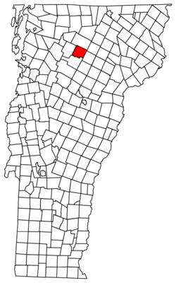
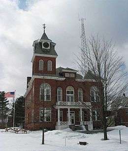
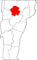
Hyde Park is a town in and the shire town[1] (county seat)[2] of Lamoille County, Vermont, United States. The town was named for Captain Jedediah Hyde, a landowner.[3][4] The population was 2,847 at the 2000 census. There is also a village within the town by the same name.
Geography
According to the United States Census Bureau, the town has a total area of 39.0 square miles (101.0 km2), of which 37.9 square miles (98.1 km2) is land and 1.1 square miles (2.9 km2) (2.87%) is water.
Demographics

| Historical population | |||
|---|---|---|---|
| Census | Pop. | %± | |
| 1790 | 43 | — | |
| 1800 | 110 | 155.8% | |
| 1810 | 261 | 137.3% | |
| 1820 | 373 | 42.9% | |
| 1830 | 823 | 120.6% | |
| 1840 | 1,080 | 31.2% | |
| 1850 | 1,107 | 2.5% | |
| 1860 | 1,409 | 27.3% | |
| 1870 | 1,624 | 15.3% | |
| 1880 | 1,715 | 5.6% | |
| 1890 | 1,633 | −4.8% | |
| 1900 | 1,472 | −9.9% | |
| 1910 | 1,453 | −1.3% | |
| 1920 | 1,323 | −8.9% | |
| 1930 | 1,165 | −11.9% | |
| 1940 | 1,178 | 1.1% | |
| 1950 | 1,291 | 9.6% | |
| 1960 | 1,219 | −5.6% | |
| 1970 | 1,347 | 10.5% | |
| 1980 | 2,021 | 50.0% | |
| 1990 | 2,344 | 16.0% | |
| 2000 | 2,847 | 21.5% | |
| 2010 | 2,954 | 3.8% | |
| Est. 2014 | 3,040 | [5] | 2.9% |
| U.S. Decennial Census[6] | |||
As of the census[7] of 2000, there were 2,847 people, 1,138 households, and 780 families residing in the town. The population density was 75.2 people per square mile (29.0/km2). There were 1,220 housing units at an average density of 32.2/sq mi (12.4/km2). The racial makeup of the town was 97.75% White, 0.53% Black or African American, 0.53% Native American, 0.39% Asian, and 0.81% from two or more races. Hispanic or Latino of any race were 0.77% of the population.
There were 1,138 households out of which 31.7% had children under the age of 18 living with them, 53.7% were couples living together and joined in either marriage or civil union, 9.3% had a female householder with no husband present, and 31.4% were non-families. 24.4% of all households were made up of individuals and 9.5% had someone living alone who was 65 years of age or older. The average household size was 2.49 and the average family size was 2.92.
In the town the population was spread out with 24.7% under the age of 18, 7.3% from 18 to 24, 28.7% from 25 to 44, 26.7% from 45 to 64, and 12.5% who were 65 years of age or older. The median age was 38 years. For every 100 females there were 98.4 males. For every 100 females age 18 and over, there were 96.2 males.
The median income for a household in the town was $38,650, and the median income for a family was $44,185. Males had a median income of $30,000 versus $25,304 for females. The per capita income for the town was $20,293. About 3.2% of families and 5.8% of the population were below the poverty line, including 4.4% of those under age 18 and 7.1% of those age 65 or over.
Notable people
- Susan Bartlett, member of the Vermont State Senate and assistant to Governor of Vermont Peter Shumlin
- Frank Ellis Boynton, American botanist
- Roger W. Hulburd, Lieutenant Governor of Vermont
- Carroll S. Page, United States Senator
- Wayne H. Page, Adjutant General of the Vermont National Guard
- Anson P. K. Safford, Governor of Arizona Territory
- Mary J. Safford, pioneering female physician
References
- ↑ Title 24, Part I, Chapter 1, §9, Vermont Statutes. Accessed 2007-11-01.
- ↑ "Find a County". National Association of Counties. Archived from the original on May 31, 2011. Retrieved 2011-06-07.
- ↑ Gannett, Henry (1905). The Origin of Certain Place Names in the United States. Govt. Print. Off. p. 164.
- ↑ "Profile for Hyde Park, Vermont". ePodunk. Retrieved 2010-05-10.
- ↑ "Annual Estimates of the Resident Population for Incorporated Places: April 1, 2010 to July 1, 2014". Retrieved June 4, 2015.
- ↑ "U.S. Decennial Census". United States Census Bureau. Archived from the original on May 11, 2015. Retrieved May 16, 2015.
- ↑ "American FactFinder". United States Census Bureau. Archived from the original on September 11, 2013. Retrieved 2008-01-31.
External links
- Lamoille Union High School
- Lamoille County Players - performing arts
Coordinates: 44°37′10″N 72°33′41″W / 44.61944°N 72.56139°W
