Indiana State Road 134
| ||||
|---|---|---|---|---|
| Girls School Road | ||||
 | ||||
| Route information | ||||
| Maintained by INDOT | ||||
| Length: | 0.379 mi[1] (0.610 km) | |||
| Major junctions | ||||
| South end: | Girls School Road in Indianapolis | |||
| North end: |
| |||
| Location | ||||
| Counties: | Marion | |||
| Highway system | ||||
| ||||
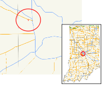
State Road 134 is a very short north–south state road in Marion County.
Route description
State Road 134 begins at the Indiana Women's Prison and directly runs north to U.S. Route 136 (Crawfordsville Road), a distance of 0.37 miles (0.60 km).
History
State Road 134 used to encompass almost all of Girls School Road on the west side of Indianapolis. Its southern terminus was at U.S. Route 40/West Washington Street, north of the Indianapolis International Airport. The state road used to be over 4 miles (6.4 km) long. However, it was truncated to only the portion east of the Indiana Women's Prison (formerly the Indiana Girls' School and the namesake of the road).
Major intersections
The entire route is in Indianapolis, Marion County.
| mi[1] | km | Destinations | Notes | ||
|---|---|---|---|---|---|
| 0.000 | 0.000 | Girls School Road | Southern terminus of SR 134 | ||
| 0.379 | 0.610 | Northern terminus of SR 134 | |||
| 1.000 mi = 1.609 km; 1.000 km = 0.621 mi | |||||
References
- 1 2 Indiana Department of Transportation (July 2015). Reference Post Book (PDF). Indianapolis: Indiana Department of Transportation. Retrieved September 17, 2016.
External links
This article is issued from Wikipedia - version of the 10/9/2016. The text is available under the Creative Commons Attribution/Share Alike but additional terms may apply for the media files.
