Innaarsuit
| Innaarsuit | |
|---|---|
|
Innaarsuit | |
 Innaarsuit Location within Greenland | |
| Coordinates: 73°12′00″N 56°00′40″W / 73.20000°N 56.01111°WCoordinates: 73°12′00″N 56°00′40″W / 73.20000°N 56.01111°W | |
| State |
|
| Constituent country |
|
| Municipality |
|
| Government[1] | |
| • Mayor | Susanne Kristensen Eliassen |
| Population (2010) | |
| • Total | 161 |
| Time zone | UTC-03 |
| Postal code | 3962 Upernavik |
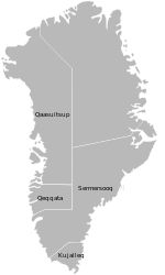
Innaarsuit (old spelling: Ivnârssuit) (IATA: IUI) is an island settlement in the Qaasuitsup municipality in northwestern Greenland. Located on an island of the same name, the settlement had 161 inhabitants in 2010.[2]
Upernavik Archipelago

Innaarsuit is located within Upernavik Archipelago, a vast archipelago of small islands on the coast of northeastern Baffin Bay. The archipelago extends from the northwestern coast of Sigguup Nunaa peninsula in the south at approximately 71°50′N 56°00′W / 71.833°N 56.000°W[3] to the southern end of Melville Bay (Greenlandic: Qimusseriarsuaq) in the north at approximately 74°50′N 57°30′W / 74.833°N 57.500°W.[4]
Population
Innaarsuit is one of the few settlements in the Qaasuitsup municipality exhibiting significant growth patterns over the course of the last two decades, increasing by nearly half relative to the 1990 levels, similarly to other settlements in the northern half of the archipelago: Kullorsuaq, and Tasiusaq.[5]

Transport
During weekdays Air Greenland serves the village as part of government contract, with flights from Innaarsuit Heliport to Tasiusaq Heliport and to Upernavik Airport.[6]
References
- ↑ "Ingen helikopter i en måned". Kalaallit Nunaata Radioa (in Danish). 22 January 2010. Retrieved 9 June 2010.
- ↑ Statistics Greenland (Danish)
- ↑ Nunavik, Saga Map, 1:250.000, Tage Schjøtt, 1992
- ↑ Upernavik Avannarleq, Saga Map, 1:250.000, Tage Schjøtt, 1992
- 1 2 Statistics Greenland
- ↑ "Booking system". Air Greenland. Retrieved 6 July 2010.

