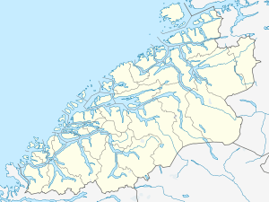
Innfjorden
| Innfjorden | |
|---|---|
| Village | |
 Innfjorden  Innfjorden Location in Møre og Romsdal | |
| Coordinates: 62°29′36″N 07°33′35″E / 62.49333°N 7.55972°ECoordinates: 62°29′36″N 07°33′35″E / 62.49333°N 7.55972°E | |
| Country | Norway |
| Region | Western Norway |
| County | Møre og Romsdal |
| District | Romsdal |
| Municipality | Rauma Municipality |
| Area[1] | |
| • Total | 0.31 km2 (0.12 sq mi) |
| Elevation[2] | 30 m (100 ft) |
| Population (2013)[1] | |
| • Total | 283 |
| • Density | 913/km2 (2,360/sq mi) |
| Time zone | CET (UTC+01:00) |
| • Summer (DST) | CEST (UTC+02:00) |
| Post Code | 6315 Innfjorden |
Innfjorden is a village in Rauma Municipality in Møre og Romsdal county, Norway. It is situated about 10 kilometres (6.2 mi) southwest of the town of Åndalsnes and 9 kilometres (5.6 mi) southeast of the village of Voll along the European Route E136 highway. The road from Åndalsnes to Innfjorden goes through the 6,594-metre (21,634 ft) long Innfjord Tunnel, which opened in 1991 after a series of deaths caused by avalanches on the former road along the shore of the Romsdalsfjorden.
The 0.31-square-kilometre (77-acre) village has a population (2013) of 283, which gives it a population density of 913 inhabitants per square kilometre (2,360/sq mi).[1] The local economy is mainly based on agriculture, while there is some industry and a few service companies relating to tourism, transportation, and road safety. In addition there is an elementary school, kindergarten, and the small Innfjorden Chapel.
Surrounding Innfjorden are 1,200-to-1,800-metre (3,900 to 5,900 ft) tall peaks on the east, south, and west sides with the Romsdalsfjorden to the north. The area is frequented by mountain hikers and lately a lot of BASE jumpers have discovered the mountains around Innfjorden.
References
- 1 2 3 Statistisk sentralbyrå (1 January 2013). "Urban settlements. Population and area, by municipality.".
- ↑ "Innfjorden" (in Norwegian). yr.no. Retrieved 2010-10-30.