Itabira


Itabira is a Brazilian municipal district and one of the main cities of the state of Minas Gerais. The city belongs to the mesoregion Metropolitana de Belo Horizonte and to the microregion of Itabira.
The first settlements date to the early eighteenth century, when the village of Itabira do Mato Dentro was founded by explorers seeking gold. The city obtained its political emancipation on 9 October 1848, through the Provincial Law no. 374.
It is currently the twenty-fourth largest city of the state in population, with 107,721 inhabitants (IBGE, 2006). It is known as the "Capital of Poetry", birthplace of Carlos Drummond de Andrade, city of the Circuit of the Gold and of the Estrada Real (King's Road or Royal Road).
The area which Itabira is located is one of the most important culturally and economically of Minas Gerais and of Brazil, possessing an important historical collection for the construction of the history of the Brazilian people.
It is located in the Southeast area, in the heart of Minas Gerais, at 104 kilometers of Belo Horizonte, 697 kilometers of the city of São Paulo, 545 kilometers of the Rio de Janeiro, 845 kilometers of the federal capital Brasília and 510 kilometers of Vitória. The highest point of the city is to 1.672 meters above sea level (see Alto da Mutuca).
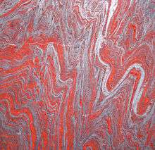
Itabira is the main city in its area and suffers with air pollution caused by the extraction of iron ore, main economical branch of it since the creation of the Companhia Vale do Rio Doce in 1942, by President Getúlio Vargas. Today, it is the second largest mining company in the world, and great part of its production comes from the mines of Itabira.
Itabira is also composed by the 2 districts of Ipoema and Senhora do Carmo, and the main access for smaller cities, such as: Jaboticatubas, Santa Maria de Itabira, Itambé do Mato Dentro and Nova Era. The closest international airport is the Tancredo Neves International Airport (Confins), that also serves Belo Horizonte and great part of the state of Minas Gerais.
See also
| Wikimedia Commons has media related to Minerals of Itabira. |
Coordinates: 19°37′08″S 43°13′37″W / 19.61889°S 43.22694°W
