Janów Lubelski
| Janów Lubelski | ||
|---|---|---|
|
Former chancellery (1818-1823) | ||
| ||
 Janów Lubelski | ||
| Coordinates: 50°43′N 22°25′E / 50.717°N 22.417°E | ||
| Country |
| |
| Voivodeship | Lublin | |
| County | Janów Lubelski County | |
| Gmina | Gmina Janów Lubelski | |
| Government | ||
| • Mayor | Krzysztof Adam Kołtyś | |
| Area | ||
| • Total | 14.84 km2 (5.73 sq mi) | |
| Population (2013[1]) | ||
| • Total | 12,092 | |
| • Density | 810/km2 (2,100/sq mi) | |
| Time zone | CET (UTC+1) | |
| • Summer (DST) | CEST (UTC+2) | |
| Postal code | 23-300 | |
| Car plates | LJA | |
| Website | http://www.janowlubelski.pl/ | |
Janów Lubelski [ˈjanuf luˈbɛlskʲi] is a town in eastern Poland. It has 11,938 inhabitants (2006). Situated in the Lublin Voivodship (since 1999), Janów Lubelski belongs to Lesser Poland, and is located in southeastern corner of this historic Polish province. It is the capital of Janów Lubelski County. Previously (1975–1998), Janów belonged to Tarnobrzeg Voivodeship. It has a large hospital (Samodzielny Publiczny Zespół Zakładów Opieki Zdrowotnej). It also has several tourist attractions, including buildings and churches from the 17th and 18th centuries.
The town lies on the edge of Roztocze, on the Białka river, and its area is 14.80 square kilometers. South of Janów there is a mighty complex of Solska Wilderness. The town is located at the intersection of two national roads: the 19th (Rzeszów – Lublin – Białystok – Grodno), and the 74th (Hrubieszów – Zamość – Kraśnik – Kielce – Piotrków Trybunalski). The distance to Lublin is 70 kilometers, and to Rzeszów, 90 kilometers.
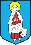
The history of Janów Lubelski dates back to the 12th century, when first human settlements appeared in Sandomierz Wilderness. Over time, the number of villages grew, and a busy merchant road was constructed from Zamość to Sandomierz. In the first half of the 17th century, local noblewoman Katarzyna Zamoyska (see: Zamoyski family) decided to found a town along the road. On July 21, 1640, King Władysław IV Vasa issued a royal privilege, agreeing to found the town of Biała with Magdeburg Rights. The coat of arms of the new town presented Saint Mary, and to build houses, the area located southwest of the Biała river was chosen. The name Janów appeared a few years later. It comes from the first name Jan (John), and commemorates Jan Zamoyski, the son of Katarzyna Zamoyska. In a similar fashion, the towns of Klemensów (now a district of Szczebrzeszyn) and Tomaszów Lubelski were named.
In 1648 Janów was captured and burned by the Cossacks of Bohdan Khmelnytsky. Four years later, the population was decimated by diseases. As a result, Jan Zamoyski, who wanted to rebuild Janów, allowed the first Jewish settlers in the town (1652). In 1653, Tatars loyal to Poland came to Janów and decided to settle here as well. In 1660, Dominicans were invited to Janów, to a church and a monastery which had been funded by the Zamoyski family. The boundaries of the town were soon extended, and in the late 17th century, Janów had ca. 1,000 residents, with several artisans. After the third partition of Poland (1795), Janów was annexed by the Austrian Empire, but in 1815 it was transferred to Russian-controlled Congress Poland. At that time it had some 2,000 residents, and in 1804, a great fire destroyed 71 houses. The number of residents declined, so the Zamoyski family decided to bring cloth makers from Silesia, who settled in a district called Sukiennia. After the November Uprising, the border between Austria and the Russian Empire was closed, which resulted in the collapse of cloth-making enterprises.
In the early 19th century, Russian authorities created Zamość County, with the capital in Zamość. Soon afterwards, however, Grand Duke Constantine Pavlovich of Russia demanded that Zamość should remain a militarized city (see Zamość Fortress), and civilian authorities (police, courts, criminal prison) moved between 1817 and 1827 to Janów. Due to this fact, the town quickly grew; the so-called New Town was founded, and in 1820, a municipal park was opened. In 1834 Janów was divided into three parts: Stare Miasto (Old Town), Nowe Miasto (New Town), and Przedmieście Zaolszynie (The Suburb of Zaolszynie). In 1841, an Eastern Orthodox church was built for Russian troops stationed in Janów, and by the mid-19th century, the population grew to 3,500. In 1860, Janów had 2 hotels, a pharmacy, 4 inns, a school, a number of cloth-making enterprises, and 12 public houses. Main streets and the market square were paved; there was a hospital (1867) and a tannery. After the January Uprising, many residents of the town and the county were sent to Siberia, and the Dominican monastery was appropriated by Russian authorities.
At the beginning of the 20th century Janów had 8,000 inhabitants. During World War I, the town was the area of heavy fighting, and in 1922, after Poland had regained independence, almost half of houses burned in a fire. Janów began to grow after 1925, when additional streets were paved, 7 bridges were built, and a middle school was completed. In 1934 it had two saw mills, a mill, a brewery, and a slaughterhouse. A local power plant provided electricity, there were 339 artisans, a hospital, a senior citizen center and several civic organizations, such as Riflemen's Association. In September 1939 Janów was three times bombed by the Luftwaffe, which killed 350 people and destroyed 85% of the town. A labor camp was opened in 1940, and town’s Jewish population was decimated. Soviet troops captured Janów on July 26, 1944, and in April 1945, units of the Home Army attacked the local prison, freeing resistance fighters from Warsaw, who were kept there. Near Janów, the Battle of Porytowe Wzgórze took place.
In 1956 Janów County was re-created, and in the 1960s the town grew, due to several new factories built there. The number of inhabitants grew, new districts were created, new hospital was opened, as well as kindergartens, post office, and a municipal stadium.
Janów is home to two local museums and Saint Mary of Rosary Sanctuary, located in former Dominican monastery (1694–1769). The town is surrounded by forests.
References
| Wikimedia Commons has media related to Janów Lubelski. |
Coordinates: 50°43′N 22°25′E / 50.717°N 22.417°E


