Kaiserwald
| Kaiserwald (Emperor's Forest, Slavkovský les) | |
|---|---|
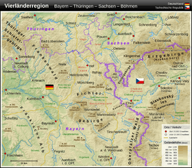
 The Kaiserwald in the west of the Czech Republic | |
| Highest point | |
| Peak | Lesný |
| Elevation | 983 m (3,225 ft) |
| Geography | |
| State | Czech Republic |
| Range coordinates | 50°03′N 12°40′E / 50.05°N 12.67°ECoordinates: 50°03′N 12°40′E / 50.05°N 12.67°E |
The Kaiserwald,[1] also called the Emperor's Forest[1] (Czech: Slavkovský les, German: Kaiserwald), is a mountain range in the Czech Republic in the triangle formed by the towns of Karlovy Vary (Carlsbad), Mariánské Lázně (Marienbad) and Františkovy Lázně (Franzensbad).
References
- 1 2 Karlovy Vary/Czech Republic at www.sachsen.de. Retrieved 14 Nov 2016.
Literature
- Jiří Majer: Těžba cinu ve Slavkovském lese v 16. stoleti (Der Zinnbergbau im Kaiserwald im 16. Jahrhundert), Prague, 1970
- Jiří Majer: Die Forstwirtschaft und Holzverwendung in den böhmischen Bergrevieren des Westerzgebirges und des Kaiserwaldes während des 16. Jahrhunderts. in: Sächsische Heimatblätter 43(1997)1, pp. 11-18
Weblinks
- Slavkovský les (Czech)
- Geoparkregionen (German)
- Landschaftsschutzgebiet Slavkovský les - Kaiserwald (German)
This article is issued from Wikipedia - version of the 11/29/2016. The text is available under the Creative Commons Attribution/Share Alike but additional terms may apply for the media files.