Tahuata
| Tahuata | |
|---|---|
|
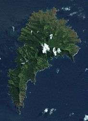
A satellite image of Tahuata | |
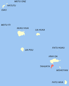
 Location of the commune (in red) within the Marquesas Islands | |
| Coordinates: 9°56′00″S 139°05′00″W / 9.9333°S 139.0833°WCoordinates: 9°56′00″S 139°05′00″W / 9.9333°S 139.0833°W | |
| Country | France |
| Overseas collectivity | French Polynesia |
| Government | |
| • Mayor | Teaiki Félix Barsinas |
| Area | 69 km2 (27 sq mi) |
| Population (August 22, 2012 census)1 | 703 |
| • Density | 10/km2 (26/sq mi) |
| INSEE/Postal code | 98746 / 98743 |
| Elevation | 0–1,050 m (0–3,445 ft) |
| 1 Population without double counting: residents of multiple communes (e.g., students and military personnel) only counted once. | |
Tahuata is the smallest of the inhabited Marquesas Islands, in French Polynesia, an overseas territory of France in the Pacific Ocean. It is located 4 km (2.5 mi.) to the south of the western end of Hiva Oa, across the Canal du Bordelais, called Ha‘ava in Marquesan.
Administration
Administratively, Tahuata forms the commune (municipality) of Tahuata, part of the administrative subdivision of the Marquesas Islands. This commune consists solely of the island of Tahuata itself.
The administrative centre of the commune is the settlement of Vaitahu, on the western side of the island.
Geography
Tahuata is approx. 69 km² (26.6 sq. mi.) The highest point on the island is Mount Amatea (French: Mont Amatea), rising to an elevation of 1,050 m (3,445 ft.).
Demographics
The 2012 census population was 703.
History
Archæological evidence indicates that Tahuata was inhabited by Polynesians as early as 200 CE.
In later pre-European times, the tribes of Tahuata were allied with the tribes from the Nuku province of Hiva Oa, and the island was considered a dependency of that province.
The first recorded sighting by Europeans was by the Spanish expedition of Álvaro de Mandaña on 22 July 1595. They charted the island as Santa Cristina. They landed at Vaitahu that they named Madre de Dios (God's Mother in Spanish). According to the Spanish accounts Tahuata had fowls, fish, sugar cane, plantains, nuts and fruits. The existent town was built on two sides of a rectangular space, the houses being of timber and intertwined canes. A building which the Spaniards supposed to be a religious one stood outside the town, in a space enclosed by palisades, and containing some ill-carved images before which were offerings and provisions. The people had large and well constructed sailing canoes. Their tools were made of shells and fish bones. They used slings, stones, and lances as weapons.[1][2]
Tahuata was visited by Captain James Cook in 1774 and Admiral Dupetit-Thouars in 1842, who signed the treaty annexing the Marquesas Islands to France.
Communications
Because there is insufficient level ground for even a small runway, the island is served by the airport on Hiva Oa. This serves to give the island a feeling of much greater isolation, despite its proximity to Hiva Oa.
References
See also
| Wikimedia Commons has media related to Tahuata. |
