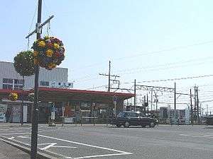
Kintetsu Kanie Station
Kintetsu Kanie Station 近鉄蟹江駅 | |
|---|---|
 Kintetsu Kanie Station | |
| Location |
Kanie-cho, Kanie, Ama, Aichi (愛知県海部郡蟹江町大字蟹江本町) Japan |
| Operated by | Kintetsu Railway |
| Line(s) | Nagoya Line |
| History | |
| Opened | 1938 |
| Previous names |
Kankyu Kanie; Sankyu Kanie Station Kankyu Kanie Station Kinki Nippon Kanie (until 1970) |
| Traffic | |
| Passengers (FY2010) | 12896 daily |
Kintetsu Kanie Station (近鉄蟹江駅 Kintetsu Kanie-eki) is a railway station on the Nagoya Line in Kanie, Ama District, Aichi Prefecture, Japan, operated by the private railway operator Kintetsu Railway. Kintetsu Kanie Station is 9.7 rail kilometers from the terminus of the line at Kintetsu Nagoya Station.[1]
Line
Station layout
Kintetsu Kanie Station has two island platforms serving four tracks. The station building is located on the north of the tracks (Kuwana side of Nagoya-bound platform).
Platforms
| 1, 2 | ■ Nagoya Line | for Yokkaichi, Osaka, Kobe and Kashikojima |
| 3, 4 | ■ Nagoya Line | for Nagoya |
Adjacent stations
| « | Service | » | ||
|---|---|---|---|---|
| Nagoya Line | ||||
| Toda | Local | Tomiyoshi | ||
| Kintetsu Nagoya | Semi-Express | Tomiyoshi | ||
| Kintetsu Nagoya | Express | Kintetsu Yatomi | ||
History
Kintetsu Kanie Station opened on June 26, 1938 as Kankyu Kanie Station (関急蟹江駅 Kankyu Kanie eki) on the Sangu Express Electric Railway. On January 1, 1940, the Sangu Express Railway and the Kansai Express Electric Railway merged and the station was renamed Sankyu Kanie Station (参急蟹江駅 Sankyu Kanie eki). After merging with Osaka Electric Kido on March 15, 1941, the line became the Kansai Express Railway's Nagoya Line and the station reverted to its original name. [2] This line was merged with the Nankai Electric Railway on June 1, 1944 to form Kintetsu,[2] and the station name became Kinki Nippon Kanie Station (近畿日本蟹江駅 Kinki Nippon Kanie eki). The name was shortened to its present form on March 1, 1970
External links
| Wikimedia Commons has media related to Kintetsu-Kanie Station. |
- (Japanese) Kintetsu: Kintetsu Kanie Station
References
Coordinates: 35°7′47.07″N 136°47′38.98″E / 35.1297417°N 136.7941611°E