Kippa-Ring, Queensland
| Kippa-Ring Queensland | |||||||||||||
|---|---|---|---|---|---|---|---|---|---|---|---|---|---|
 | |||||||||||||
| Population | 9,929 (2011 census)[1] | ||||||||||||
| Established | 1971 | ||||||||||||
| Postcode(s) | 4021 | ||||||||||||
| Elevation | 6 m (20 ft) | ||||||||||||
| Location |
| ||||||||||||
| LGA(s) | Moreton Bay Region | ||||||||||||
| Region | South East Queensland | ||||||||||||
| State electorate(s) | Murrumba, Redcliffe | ||||||||||||
| Federal Division(s) | Petrie | ||||||||||||
| |||||||||||||
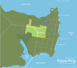
Kippa-Ring is a suburb of the Moreton Bay Region, Queensland, Australia.[2] It is at the center of the Redcliffe Peninsula, approximately 27 kilometres (17 mi) north-northeast of Brisbane, the state capital. Designated as the commercial, retail & financial centre for the Redcliffe region, Kippa-Ring houses the bulk of the commercial and retail sectors on the peninsula including the largest shopping centres.
History
The suburb's name is a combination of the Kabi indigenous word "kippa", meaning young uninitiated man, and ring, a reference to a bora ring.[3]
Attractions and features
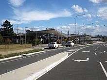
Kippa-Ring is home to two of the Redcliffe Peninsula's largest shopping centres - Peninsula Fair & Kippa-Ring Village, both of which are side by side. Peninsula Fair houses one of the first Kmart stores in Queensland and the only multiplex cinemas on the Redcliffe peninsula. Kippa-Ring station is the location of the terminus of the Redcliffe Peninsula railway line. The suburb is home to the Redcliffe Botanic Gardens[4] which hosts a multitude of native flora and fauna and is home during the day to the regions fruit bat population.
Sport
Kippa-Ring is home to Talobilla Park which hosts baseball club, Redcliffe Padres, rugby league club the Redcliffe Dolphins, Redcliffe PCYC softball as well as a canoe, dragon boat and rowing club. Peninsula Power football club also play at AJ Kelly Field, competing in the Brisbane Premier League.
Education
Educational institutions within Kippa-Ring are Hercules Road State School with just over 820 enrollments,[5] Kippa-Ring State School with more than 500 enrollments,[6] and Southern Cross Catholic College's Holy Cross primary campus.
References
- ↑ Australian Bureau of Statistics (31 October 2012). "Kippa-Ring (State Suburb)". 2011 Census QuickStats. Retrieved 24 October 2013.
- ↑ "Kippa-Ring (entry 45443)". Queensland Place Names. Queensland Government. Retrieved 30 May 2014.
- ↑ "Kippa-Ring". Place Names Online Search. Queensland Department of Natural Resources and Water. Retrieved 2008-08-24.
- ↑ "Redcliffe Botanic Gardens". Moreton Bay Regional Council. Retrieved 9 September 2016.
- ↑ "Hercules Road State School (SS) : Primary Enrolments". Queensland Government Department of Education, Training and the Arts. Retrieved 2007-07-27.
- ↑ "Kippa-Ring State School (SS) : Primary Enrolments". Queensland Government Department of Education, Training and the Arts. Retrieved 2007-07-27.
External links
| Wikimedia Commons has media related to Kippa-Ring. |
Coordinates: 27°13′32″S 153°05′04″E / 27.2255°S 153.0844°E
