Pickering Brook, Western Australia
| Pickering Brook Perth, Western Australia | |||||||||||||
|---|---|---|---|---|---|---|---|---|---|---|---|---|---|
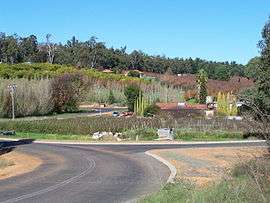
 Autumn colours of orchards in Pickering Brook | |||||||||||||
 Pickering Brook | |||||||||||||
| Coordinates | 32°02′13″S 116°07′19″E / 32.037°S 116.122°ECoordinates: 32°02′13″S 116°07′19″E / 32.037°S 116.122°E | ||||||||||||
| Population | 737 (2006 census)[1] | ||||||||||||
| Postcode(s) | 6076 | ||||||||||||
| LGA(s) | Shire of Kalamunda | ||||||||||||
| State electorate(s) | Darling Range | ||||||||||||
| Federal Division(s) | Canning | ||||||||||||
| |||||||||||||
Pickering Brook is a suburb of Perth, Western Australia, located within the Shire of Kalamunda.
Prior to 1949 it was a stopping place on the Upper Darling Range Railway.
It was named after nearby Pickering Brook. The brook is named after an early settler, Captain Edward Picking whose name was sometimes recorded as Pickering. The suburb of Pickering Brook was officially created on 12 January 1973. Part of it was formerly known as Carilla.
Like nearby areas such as Karragullen, Pickering Brook is primarily made up of various family run orchards.
The suburb was seriously under threat in December 2001 from a bushfire.[2]
In June 2008 - the previously named Pickering Brook National Park - associated with the locality - was named Korung National Park.[3]
See also
Notes
- ↑ Australian Bureau of Statistics (25 October 2007). "Pickering Brook (State Suburb)". 2006 Census QuickStats. Retrieved 2008-10-05.
- ↑ Heroic efforts of fire crews in Perth hills. A fire lit by an arsonist burnt more than 26,000 ha or 260 km² in the Pickering Brook, Karragullen, Mundaring and Barton's Mill area in Conservation news, Jan. 2005, p.1
- ↑ Pamphlet Parks of the Perth Hills - Whats in a name?issues by the Perth Hills District of DEC in June 2008 - the name being after a Nyoongar elder at the time of european settlement - see also http://www.roleybushcare.com/bush-topics/109-new-aboriginal-names-for-regional-parks.html