Krn
| Krn | |
|---|---|
|
Northern side in winter | |
| Highest point | |
| Elevation | 2,244 m (7,362 ft) |
| Prominence | 605 m (1,985 ft) [1] |
| Coordinates | 46°15′58.752″N 13°39′31″E / 46.26632000°N 13.65861°ECoordinates: 46°15′58.752″N 13°39′31″E / 46.26632000°N 13.65861°E |
| Geography | |
 Krn | |
| Parent range | Julian Alps |


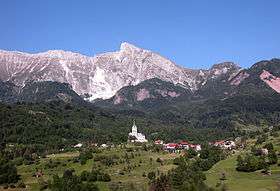
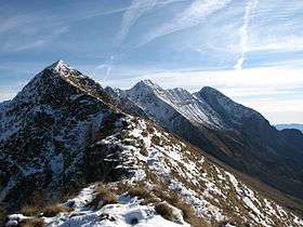
Krn (pronounced [ˈkəɾn]; Italian: Monte Nero; 2,244 metres or 7,362 feet) is a mountain of the southwestern Julian Alps in northwestern Slovenia. The mountain is located about 50 kilometres (31 mi) from the Adriatic Sea. The Soča River flows west of the peak, and the smaller Lepenjica River northeast and the Tolminka River southwest of it. Krn has a mighty western wall, which can be best seen from Kobarid or Drežnica.
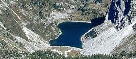
On the southern slope of the mountain lie the small villages of Vrsno, Krn, Drežnica, Drežniške Ravne, and Magozd. On the northern side lies Lake Krn, the largest glacial lake in Slovenia.
During the First World War, the Battles of the Isonzo took place in the area. The top of the neighbouring mountain Batognica (2,164 m or 7,100 ft) has been blown off by an accidental weapon depot explosion. A lot of remnants from the war remain scattered around the peak.
Lodges
- On the southern side near the top is the Gomišček Krn Lodge (Gomiščkovo zavetišče na Krnu; 2,182 m or 7,159 ft);
- On the northern side near the lake stands the Krn Lakes Lodge (Planinski dom pri Krnskih jezerih; 1,385 m or 4,544 ft);
- On the Kuhinja Pasture stands the Kuhinja Pasture Lodge (Dom na planini Kuhinja; 991 metres (3,251 ft));
- Below its northern slope, in Lepena, stands the Dr. Klement Jug Lepena Lodge (Dom dr. Klementa Juga v Lepeni; 700 m or 2,300 ft).
Access to the summit
- 3 hours from Kuhinja Pasture,
- 5 hours from Dr Klement Jug Lepena Lodge,
- 5 hours from Drežnica, via the Silvo Koren Route,
- 7¾ hours from the Savica Lodge over the Prehodavci Pass.
References
- ↑ "Krn - peakbagger". peakbagger.com. Retrieved 6 January 2015.
Literature
- Planinski vodnik Julijske Alpe, PZS, 2003, ISBN 961-6156-47-0
- Andrej Stritar, Vodnik Julijske Alpe - Gore nad Sočo, 1997, ISBN 961-6027-13-1
External links
![]() Media related to Krn at Wikimedia Commons
Media related to Krn at Wikimedia Commons
- Krn on Geopedia.si
- Krn on Hribi.net Routes and photos
- Virtual panoramas. Burger.si
- Krn on Facebook
- SummitPost: Krn