Greater Kyoto
| Kyoto Metropolitan Area Kyoto MEA | |
|---|---|
| Urban Employment Area | |
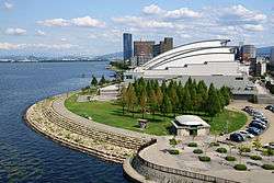
 Kyoto Tower and Downtown Kyoto  Biwako Hall in Ōtsu | |
 Kyoto Metropolitan Area | |
| Coordinates: 35°0′N 135°46′E / 35.000°N 135.767°ECoordinates: 35°0′N 135°46′E / 35.000°N 135.767°E | |
| Country |
|
| Prefectures | |
| Core city |
|
| Area(2011)[1] | |
| • Metro | 2,835.93 km2 (1,094.96 sq mi) |
| Population (2010) | |
| • Metro[2] | 2,679,094 |
| • Metro density | 940/km2 (2,400/sq mi) |
| GDP | (2010)[1] |
| Nominal | $115.3 billion[3] |
| Website |
www |
Greater Kyoto is a metropolitan area in Japan encompassing Kyoto, the capital of Kyoto Prefecture, as well as its surrounding areas including Ōtsu, the capital of Shiga Prefecture.[4][5]
The metropolitan area is also referred to as Keiji (京滋) or Keishin (京津). The name Keiji is constructed by extracting a representative kanji from Kyoto (京都) and Shiga (滋賀). The name Keishin is constructed by extracting a representative kanji from Kyoto (京都) and Ōtsu (大津).
| Historical population | ||
|---|---|---|
| Year | Pop. | ±% |
| 1980 | 2,361,205 | — |
| 1990 | 2,485,352 | +5.3% |
| 1995 | 2,539,639 | +2.2% |
| 2000 | 2,583,304 | +1.7% |
| 2005 | 2,560,850 | −0.9% |
| 2010 | 2,679,049 | +4.6% |
| Source: UEA Code Table | ||
See also
References
- 1 2 Kanemoto, Yoshitsugu. "Metropolitan Employment Area (MEA) Data". Center for Spatial Information Science, the University of Tokyo. Retrieved November 23, 2016.
- ↑ "平成26年度総合調査研究(地域経済の将来動向分析に関する調査研究)" (in Japanese). Ministry of Economy, Trade and Industry. Retrieved November 23, 2016.
- ↑ 10.12 trillion Japanese yen
- ↑ "京都市の観光行政を戦略部長に聞いてきた、「量より質」への転換で解決すべき5つの課題" (in Japanese). Retrieved 2016-11-23.
- ↑ "Kitayama Area & Greater Kyoto". Retrieved 2016-11-23.
External links
- 京都都市圏自治体ネットワーク(Japanese)
This article is issued from Wikipedia - version of the 12/4/2016. The text is available under the Creative Commons Attribution/Share Alike but additional terms may apply for the media files.