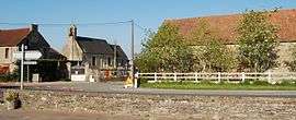
La Caine
| La Caine | |
|---|---|
 | |
 La Caine | |
|
Location within Normandy region  La Caine | |
| Coordinates: 49°02′07″N 0°31′08″W / 49.0353°N 0.5189°WCoordinates: 49°02′07″N 0°31′08″W / 49.0353°N 0.5189°W | |
| Country | France |
| Region | Normandy |
| Department | Calvados |
| Arrondissement | Caen |
| Canton | Évrecy |
| Intercommunality | Évrecy-Orne-Odon |
| Government | |
| • Mayor (2008–2014) | Jacques Leroux |
| Area1 | 2.41 km2 (0.93 sq mi) |
| Population (2008)2 | 101 |
| • Density | 42/km2 (110/sq mi) |
| Time zone | CET (UTC+1) |
| • Summer (DST) | CEST (UTC+2) |
| INSEE/Postal code | 14122 / 14210 |
| Elevation |
114–193 m (374–633 ft) (avg. 176 m or 577 ft) |
|
1 French Land Register data, which excludes lakes, ponds, glaciers > 1 km² (0.386 sq mi or 247 acres) and river estuaries. 2 Population without double counting: residents of multiple communes (e.g., students and military personnel) only counted once. | |
La Caine is a commune in the Calvados department in the Normandy region in north-western France.
History
World War II
Main article: RAF raid on La Caine HQ
Following the Allied Normandy Landings, the headquarters of Panzer Group West was established in the Chateau at La Caine. The headquarters' new location was revealed to the British intelligence by Ultra's deciphering of German signals traffic. On 10 June 1944, aircraft of the RAF's Second Tactical Air Force bombed the village killing the German chief of staff and many other personnel. German communications equipment and vehicles were also destroyed.
Population
| Historical population | ||
|---|---|---|
| Year | Pop. | ±% |
| 1962 | 68 | — |
| 1968 | 65 | −4.4% |
| 1975 | 81 | +24.6% |
| 1982 | 60 | −25.9% |
| 1990 | 97 | +61.7% |
| 1999 | 93 | −4.1% |
| 2008 | 101 | +8.6% |
See also
References
| Wikimedia Commons has media related to La Caine. |
This article is issued from Wikipedia - version of the 11/3/2016. The text is available under the Creative Commons Attribution/Share Alike but additional terms may apply for the media files.