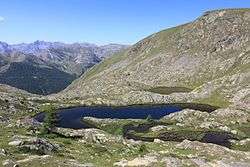
Lacs Les Laussets
| Lacs Les Laussets | |
|---|---|
 A view on the Lakes Les Laussets (Tinée, French Alps). | |
| Location | Alpes-Maritimes, Alps |
| Coordinates | 44°20′00″N 6°54′15″E / 44.33333°N 6.90417°ECoordinates: 44°20′00″N 6°54′15″E / 44.33333°N 6.90417°E |
| Basin countries | France |
| Surface elevation | 2,400 m (7,900 ft) |
The lacs Les Laussets are a group of three lakes in the Tinée valley, Alpes-Maritimes, Alps, France. They are located at an elevation of 2400 m, south-east to the Crête des Terres Rouges, and close to the Tête des Mourres.
Of note, a group of lakes can be found in the vicinity of the lakes Les Laussets: the lakes of Morgon.
Itinerary
On the way of the Col de la Bonette from the Saint-Étienne-de-Tinée side, two main itineraries are possible.
From the Hameau du Pra
From the hamlet of Pra, follow the trail that goes up in the south-facing slope, and reach the small plateau of Morgon. Quit the marked route leading to the forest house of Tortisse, and climb in the valley of Morgon, find a pastoral hut and then walk through a scree slope. On the left, climb the rocky spine to find a secondary valley. Follow the small torrent and then reach the lakes Laussets. [1]
From the Camp des Fourches
From the Camp des Fourches, go to the Col des Fourches. Follow the GR 5 to go down in the Cougnas ravine. Leave the GR at tag 37 (2100 m), cross a ravine, and follow on the right the small footpath in the Cabane valley, along the Salso Moreno torrent. Enter a small rocky gorge on the right, and find the Big Lake of Morgon. From there, walk west to reach the three lakes Les Laussets.[2]
References
- ↑ Wacongne, Richard (May 1994). Les lacs d'azur. De la Vallée des Merveilles au Queyras (in French). Grenoble (France): Éditions Glénat / Collection Montagne-Randonnée. pp. 88–90. ISBN 978-2-7234-1572-9.
- ↑ Mérienne, Patrick (June 2013). Le guide rando: Mercantour — Alpes du Sud (in French). Grenoble (France): Éditions Glénat / Rando Editions. pp. 82–83. ISBN 978-2-8418-2291-1.