Lances de Malissard
| Lances de Malissard | |
|---|---|
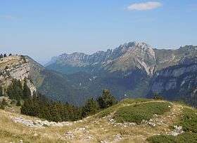
 Les Lances de Malissard from Pravouta | |
| Highest point | |
| Elevation | 2,045 m (6,709 ft) |
| Coordinates | 45°20′48″N 5°52′24″E / 45.34667°N 5.87333°ECoordinates: 45°20′48″N 5°52′24″E / 45.34667°N 5.87333°E |
| Geography | |
 Lances de Malissard Location in the Alps | |
| Location | Isère, France |
| Parent range | Chartreuse Mountains |
| Climbing | |
| Easiest route | Through the Cirque de Saint-Même |
The Lances de Malissard are two summits, located in the Chartreuse Mountains in the Department of Isère, in the French Prealps. More than the peaks themselves, it is the long ridge that is north/south facing, that separate the col de Bellefond and a long alpine valley of another ridge, the Aulp du Seuil, that dominates the Gresivaudan valley. There are two "Lances" (summits) in the Lances de Malissard. The South "Lance" of Malissard culminates at 2,045 metres (6,709 ft)[1] and north "Lance" of Malissard at 2,036 metres (6,680 ft). The Guiers Vif rises at the north end of the ridge of the Lances de Malissard.
References
- ↑ "Lances de Malissard". camptocamp.org. Retrieved February 26, 2016.
| Wikimedia Commons has media related to Lances de Malissard. |
This article is issued from Wikipedia - version of the 2/26/2016. The text is available under the Creative Commons Attribution/Share Alike but additional terms may apply for the media files.