List of National Historic Landmarks in Vermont
This is a list of National Historic Landmarks in Vermont. There are 18 National Historic Landmarks in Vermont.
This is intended to be a complete list of properties and districts that are National Historic Landmarks in Vermont. The locations of National Register properties and districts (at least for all showing latitude and longitude coordinates below) may be seen in an online map by clicking on "Map of all coordinates".[1]
| [2] | Landmark name | Image | Date designated[3] | Location | County | Description |
|---|---|---|---|---|---|---|
| 1 | Brown Bridge | 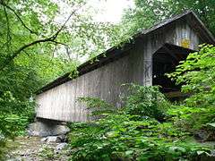 |
(#74000250) |
Shrewsbury 43°33′58″N 72°55′10″W / 43.56618°N 72.91949°W |
Rutland | 1880 covered bridge is outstanding example of Town lattice truss; may have been last bridge built by longtime bridgewright Nicholas Powers. |
| 2 | Calvin Coolidge Homestead District | 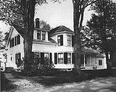 |
(#66000794) |
Plymouth Notch 43°32′08″N 72°43′18″W / 43.5356°N 72.721639°W |
Windsor | Birthplace and family home of President Calvin Coolidge. |
| 3 | Robert Frost Farm | .jpg) |
(#68000046) |
Ripton 43°57′59″N 73°00′17″W / 43.96639°N 73.00472°W |
Addison | Homestead of author Robert Frost, now owned by Middlebury College. |
| 4 | George Perkins Marsh Boyhood Home | 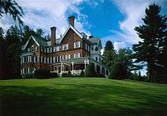 |
(#67000023) |
Woodstock 43°37′39″N 72°31′06″W / 43.6275°N 72.5183°W |
Windsor | Boyhood home of George Perkins Marsh, an American diplomat and philologist, an early environmentalist. Now in the Marsh-Billings-Rockefeller National Historical Park. |
| 5 | Justin S. Morrill Homestead | 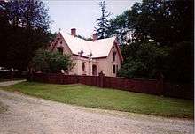 |
(#66000795) |
Strafford 43°51′40″N 72°22′33″W / 43.8610°N 72.3759°W |
Orange | Gothic Revival home of Justin Smith Morrill, Vermont representative and senator known for the 1862 and 1890 Morrill Land-Grant Colleges Acts. |
| 6 | Mount Independence | 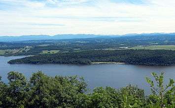 |
(#71000079) |
Orwell 43°49′35″N 73°22′49″W / 43.82639°N 73.38028°W |
Addison | Site of Fort Independence, an American Revolutionary War fortification built opposite Fort Ticonderoga. |
| 7 | Naulakha (Rudyard Kipling House) | |
(#79000231) |
Dummerston 42°53′55″N 72°33′51″W / 42.8986°N 72.56417°W |
Windham | Home where Rudyard Kipling wrote The Jungle Book. |
| 8 | Robbins and Lawrence Armory and Machine Shop |  |
(#66000796) |
Windsor 43°28′22″N 72°23′23″W / 43.4727°N 72.3897°W |
Windsor | Erected in 1846, this site is an excellent example of 19th-century American industrial architecture. |
| 9 | Rockingham Meeting House | 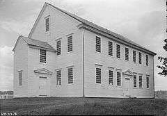 |
(#79000232) |
Rockingham 43°11′16″N 72°29′13″W / 43.1877°N 72.48694°W |
Windham | A rare 18th century New England meetinghouse of the "second period" type. |
| 10 | Rokeby | |
(#74000201) |
Ferrisburg 44°13′14″N 73°14′17″W / 44.2205°N 73.2380°W |
Addison | This Robinson family farmstead is significant for its role in the Underground Railroad. |
| 11 | Round Church | 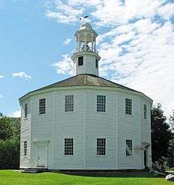 |
(#74000355) |
Richmond 44°23′56″N 72°59′58″W / 44.3989°N 72.9994°W |
Chittenden | The Round Church, built in 1812–1813, is a rare, well-preserved example of a sixteen-sided meetinghouse. |
| 12 | Shelburne Farms | 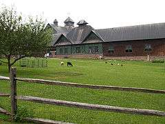 |
(#80000330) |
Shelburne 44°23′32″N 73°15′26″W / 44.3922°N 73.2572°W |
Chittenden | Created in 1886 by Dr. William Seward Webb and Eliza Vanderbilt Webb as a model agricultural estate. |
| 13 | St. Johnsbury Athenaeum |  |
(#96000970) |
St. Johnsbury 44°24′39″N 72°01′08″W / 44.4107°N 72.0189°W |
Caledonia | Significant due to its architecture, its American paintings and books from its original role as a public library and free art gallery, and its funding by Horace Fairbanks, manufacturer of the world's first platform scale. |
| 14 | Socialist Labor Party Hall | 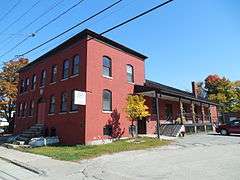 |
(#98001267) |
Barre 44°11′54″N 72°30′27″W / 44.1983°N 72.5075°W |
Washington | A place where socialist, anarchist, and labor anarchist politics were debated. |
| 15 | Stellafane Observatory | |
(#77000107) |
North Springfield 43°16′34″N 72°31′09″W / 43.2761°N 72.5193°W |
Windsor | Contains original clubhouse of the Springfield Telescope Makers, Inc. (1924), and the first large optical telescope (1930) built and owned by that kind of amateur society. |
| 16 | Ticonderoga (Side-paddle-wheel Lakeboat) | |
(#66000797) |
Shelburne 44°22′30″N 73°13′53″W / 44.3749°N 73.2315°W |
Chittenden | 220-foot (67 m) steamboat built in Shelburne in 1906. |
| 17 | Vermont Statehouse |  |
(#70000739) |
Montpelier 44°15′37″N 72°34′51″W / 44.2604°N 72.5808°W |
Washington | The capitol and seat of the state's legislative branch of government. |
| 18 | Emma Willard House |  |
(#66000798) |
Middlebury 44°00′20″N 73°10′29″W / 44.0056°N 73.1747°W |
Addison | Home of Emma Willard, an influential pioneer in the development of women's education in the United States. |
Former landmark
| Landmark name |
Image |
Year listed |
Locality |
County |
Description |
|---|---|---|---|---|---|
| Robert Frost Farm, "The Gully" | 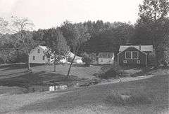 |
Designated 1968, withdrawn 1986 | South Shaftsbury | Bennington | This property was the residence of poet Robert Frost between 1929 and 1938. Many of the poems from his Pulitzer Prize-winning Collected Poems (1930) and A Further Range (1937) were written here. The property remained in the Frost family until 1963. Extensive renovations to the buildings after 1979 led the Park Service to withdraw the landmark designation.[4] |
See also
| Wikimedia Commons has media related to National Historic Landmarks in Vermont. |
- National Register of Historic Places listings in Vermont
- List of National Historic Landmarks by state
References
- ↑ The latitude and longitude information provided in this table was derived originally from the National Register Information System, which has been found to be fairly accurate for about 99% of listings. For about 1% of NRIS original coordinates, experience has shown that one or both coordinates are typos or otherwise extremely far off; some corrections may have been made. A more subtle problem causes many locations to be off by up to 150 yards, depending on location in the country: most NRIS coordinates were derived from tracing out latitude and longitudes off of USGS topographical quadrant maps created under the North American Datum of 1927, which differs from the current, highly accurate WGS84 GPS system used by most on-line maps. Chicago is about right, but NRIS longitudes in Washington are higher by about 4.5 seconds, and are lower by about 2.0 seconds in Maine. Latitudes differ by about 1.0 second in Florida. Some locations in this table may have been corrected to current GPS standards.
- ↑ Numbers represent an ordering by significant words. Various colorings, defined here, differentiate National Historic Landmarks and historic districts from other NRHP buildings, structures, sites or objects.
- ↑ The eight-digit number below each date is the number assigned to each location in the National Register Information System database, which can be viewed by clicking the number.
- ↑ "Withdrawal of National Historic Landmark Designation: Robert Frost Farm". National Park Service. Retrieved 2012-03-12.
This article is issued from Wikipedia - version of the 8/18/2016. The text is available under the Creative Commons Attribution/Share Alike but additional terms may apply for the media files.