List of Pennsylvania state historical markers in Westmoreland County

Location of Westmoreland County in Pennsylvania
This is a list of the Pennsylvania state historical markers in Westmoreland County.
This is intended to be a complete list of the official state historical markers placed in Westmoreland County, Pennsylvania by the Pennsylvania Historical and Museum Commission (PHMC). The locations of the historical markers, as well as the latitude and longitude coordinates as provided by the PHMC's database, are included below when available. There are 42 historical markers located in Westmoreland County.[1]
Historical markers
| Marker title | Image | Date dedicated | Location | Marker type | Topics |
|---|---|---|---|---|---|
| Arthur St. Clair | 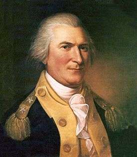 |
December 10, 1946 | U.S. 30, 6.5 miles NW of Ligonier 40°17′07″N 79°19′15″W / 40.2854°N 79.3209°W |
Roadside | American Revolution, Government & Politics, Government & Politics 18th Century, Military |
| Arthur St. Clair (1737-1818) | |
October 28, 1995 | St. Clair Park, N. Main St. near E Otterman St., Greensburg |
Roadside | American Revolution, Ethnic & Immigration, Government & Politics, Government & Politics 18th Century, Military |
| Brush Creek Salems Church | May 26, 1952 | U.S. 30 near Adamsburg, near Bush Run Markers (Missing) |
Roadside | Religion | |
| Bullet's Defeat | June 10, 2003 | Old Forbes Road, SR1010 50, Ligonier |
Roadside | Forts, French & Indian War, Military | |
| Bushy Run | December 10, 1946 | U.S. 30 at Lowry Ave., S end of Jeanette 40°18′39″N 79°37′08″W / 40.31087°N 79.61892°W |
Roadside | Early Settlement, Forts, French & Indian War, Military, Native American, Transportation | |
| Bushy Run | 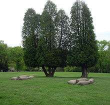 |
December 10, 1946 | Pa. 66 at Pittsburgh St. (old U.S. 22), Delmont 40°24′51″N 79°34′21″W / 40.41412°N 79.57252°W |
Roadside | Early Settlement, Forts, French & Indian War, Military, Native American |
| Bushy Run Battlefield |  |
September 14, 1964 | At site, Pa. 993, 1 mile E of Harrison City 40°21′21″N 79°37′32″W / 40.35577°N 79.6256°W |
Roadside | Forts, French & Indian War, Military, Native American |
| Christian B. Anfinen |  |
October 1, 1999 | 3rd & Donner Avenues, Monessen |
City | Education, Invention, Medicine & Science, Professions & Vocations |
| Colonel Edward Cook | 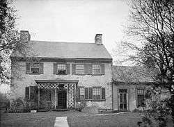 |
October 29, 1994 | Intersection near Rehoboth Church |
Roadside | Early Settlement, Government & Politics, Government & Politics 18th Century, Military, Professions & Vocations, Whiskey Rebellion |
| Dagworthy's Camp | July 17, 1946 | U.S. 30, 8.3 miles E of Greensburg (Missing) |
Roadside | Forts, French & Indian War, Medicine & Science, Military | |
| Darr Mine Disaster | September 14, 1994 | Olive Branch Cemetery, Pa. 981 between Pa. 51 and Smithton 40°09′16″N 79°45′20″W / 40.15452°N 79.75562°W |
Roadside | Business & Industry, Coal, Ethnic & Immigration, Labor | |
| Fanny Sellins | September 3, 1989 | Front of Union Cemetery, Pa. 366, Arnold 40°34′56″N 79°45′28″W / 40.5821°N 79.75783°W |
Roadside | Labor, Women | |
| Forbes Road | July 13, 1960 | U.S. 22, 1.2 miles E of Murrysville (Missing) |
Roadside | French & Indian War, George Washington, Military, Roads | |
| Forbes Road | November 11, 1967 | Murrysville |
Roadside | French & Indian War, George Washington, Military, Roads | |
| Forbes Road | n/a | U.S. 22, 1.2 miles E of Murrysville 40°25′23″N 79°39′49″W / 40.42308°N 79.66362°W |
Roadside | French & Indian War, George Washington, Military, Roads | |
| Forbes Road, 1758, Fort Bedford to Fort Duquesne - 12 Mile Run Encampment (PLAQUE) | 1930 | Rt. 30 next to Latrobe Airport runway (?) |
Plaque | French & Indian War, Military, Roads | |
| Forbes Road, 1758, Fort Bedford to Fort Duquesne - Fort Ligonier (PLAQUE) | 1930 | 301 E Main St., half block from public sq., Ligonier |
Plaque | Forts, French & Indian War, Military, Roads | |
| Forbes Road, 1758, Fort Bedford to Fort Duquesne - Turtle Creek Defile (PLAQUE) | 1930 | Rt. 22 at Priority Ln., at Post Office, Murrysville |
Plaque | French & Indian War, George Washington, Military, Roads | |
| Fort Allen | December 10, 1946 | Pa. 136 at SR 3097, Hempfield Twp, SW of Greensburg 40°17′01″N 79°35′33″W / 40.28348°N 79.5924°W |
Roadside | American Revolution, Early Settlement, Ethnic & Immigration, Forts, Military, Native American | |
| Fort Allen - PLAQUE | May 1, 1929 | At church, SR 3097 & St. Johns Church Rd., .5 mile S of PA 136 SW of Greensburg 40°16′45″N 79°35′30″W / 40.27905°N 79.59163°W |
Plaque | American Revolution, Forts, French & Indian War, Military | |
| Fort Ligonier |  |
December 10, 1946 | Main & Market Sts., Ligonier 40°14′28″N 79°14′06″W / 40.24123°N 79.23505°W |
Roadside | Forts, French & Indian War, Military, Native American |
| Hannastown | December 6, 1946 | U.S. 119 at SR 1032 (Forbes Rd.) N of Greensburg (Missing) |
Roadside | American Revolution, Government & Politics, Government & Politics 18th Century, Native American | |
| Henry Clay Frick |  |
December 10, 1946 | Pa. 819 at SR 3089 (old U.S. 119) N end of Scottdale |
Roadside | Business & Industry, Coal, Professions & Vocations, Steel |
| John W. Geary | 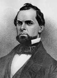 |
August 23, 1951 | S. Diamond St. & Union Alley, Mount Pleasant Veterans Park |
Roadside | Civil War, Government & Politics, Government & Politics 19th Century, Governors, Military |
| Johnston House | 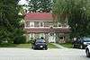 |
December 10, 1946 | U.S. 30, 7 miles NW of Ligonier |
Roadside | Buildings, Government & Politics, Government & Politics 19th Century, Governors, Houses & Homesteads |
| Loyalhanning | December 10, 1946 | U.S. 30 just SE of Ligonier 40°14′13″N 79°13′50″W / 40.23707°N 79.23042°W |
Roadside | Early Settlement, Native American | |
| Mammoth Mine Explosion | September 29, 2000 | St. John's Cemetery, along Rt. 819, Scottdale 40°05′35″N 79°36′09″W / 40.09303°N 79.6024°W |
Roadside | Business & Industry, Labor | |
| Morewood Massacre | September 29, 2000 | Rt. 119 overpass on Rt. 981 (Moorewood Rd.), E Huntington Twp. |
Roadside | Business & Industry, Labor | |
| Murrysville Gas Well | July 13, 1960 | US 22, between Trafford Rd. and Reed Blvd., Murrysville 40°25′37″N 79°41′51″W / 40.42702°N 79.69762°W |
Roadside | Business & Industry, Oil & Gas | |
| Norvelt | September 8, 2002 | Mt. Pleasant Road (LR 6406), on V.F.D. property, Norvelt 40°12′34″N 79°29′51″W / 40.20942°N 79.4974°W |
Roadside | Business & Industry, Government & Politics, Government & Politics 20th Century, Labor | |
| Rural Free Delivery | June 26, 2001 | 135 West Pennsylvania Ave., New Stanton 40°12′58″N 79°36′36″W / 40.216°N 79.6099°W |
Roadside | Government & Politics 19th Century, Government & Politics 20th Century, Transportation | |
| St. Vincent | 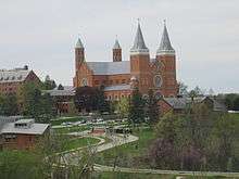 |
December 10, 1946 | U.S. 30, 6.6 miles E of Greensburg at College (Missing) |
Roadside | Education, Religion |
| St. Xavier's | December 10, 1946 | US 30 at St. Xavier's Rd., 6 miles E of Greensburg at Academy 40°16′57″N 79°24′59″W / 40.28263°N 79.41637°W |
Roadside | Education, Ethnic & Immigration, Religion, Women | |
| Standard Shaft Mine & Coke Works | April 14, 2007 | Along State St. (SR 2007), Mt. Pleasant Twp. |
Roadside | Business & Industry, Coal, Ethnic & Immigration | |
| Toll House | May 28, 1955 | E. Pittsburgh St., east of Stark St., Greensburg 40°18′10″N 78°28′11″W / 40.3028°N 78.4696°W |
City | Roads, Transportation | |
| Toll House | May 28, 1955 | Mount Odin Park, Tollgate Hill Rd. (Bus. Rt. 30), Greensburg 40°18′22″N 78°25′50″W / 40.3062°N 78.4306°W |
City | Roads, Transportation | |
| Twelve Mile Camp | December 10, 1946 | Junction U.S. 30 & Pa. 981, 7.1 miles E of Greensburg |
Roadside | French & Indian War, George Washington, Military | |
| Vandergrift |  |
May 17, 1990 | Municipal Bldg. E lawn, Washington Ave. Near Custer Ave. (Rt. 56), Vandergrift 40°36′15″N 79°33′53″W / 40.60407°N 79.56483°W |
City | Business & Industry, Cities & Towns |
| West Newton | 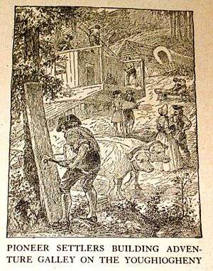 |
December 10, 1946 | W Main St. (PA 136) at Youghiogheny River bridge, West Newton 40°12′41″N 79°46′13″W / 40.21138°N 79.77033°W |
Roadside | Government & Politics, Government & Politics 18th Century |
| Westmoreland County |  |
November 25, 1981 | NE corner, Courthouse Square, Main & Otterman Sts., Greensburg 40°18′11″N 78°27′20″W / 40.303°N 78.4555°W |
City | Government & Politics, Government & Politics 18th Century |
| William Findley | 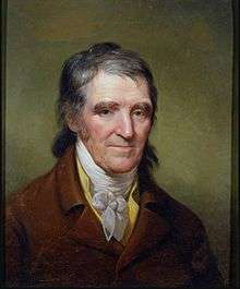 |
October 28, 1994 | Route 981 near Route 30, Latrobe |
Roadside | Government & Politics, Government & Politics 18th Century, Whiskey Rebellion |
| Willie Thrower (1930-2002) | October 24, 2003 | Valley High School, 703 Stevenson Blvd., New Kensington 40°33′56″N 79°45′18″W / 40.5656°N 79.75495°W |
Roadside | African American, Football, Sports |
See also
- List of Pennsylvania state historical markers
- National Register of Historic Places listings in Westmoreland County, Pennsylvania
References
- ↑ "PHMC Historical Markers Search" (Searchable database). Pennsylvania Historical and Museum Commission. Commonwealth of Pennsylvania. Retrieved 2010-07-19.
External links
| Counties |  Map of the Pittsburgh Tri-State with green counties in the metropolitan area and yellow counties in the combined area. | |
|---|---|---|
| Major cities | ||
| Cities and towns 15k-50k (in 2010) | ||
| Airports | ||
| Topics | ||
| ||
This article is issued from Wikipedia - version of the 4/23/2016. The text is available under the Creative Commons Attribution/Share Alike but additional terms may apply for the media files.