List of earthquakes in 1918
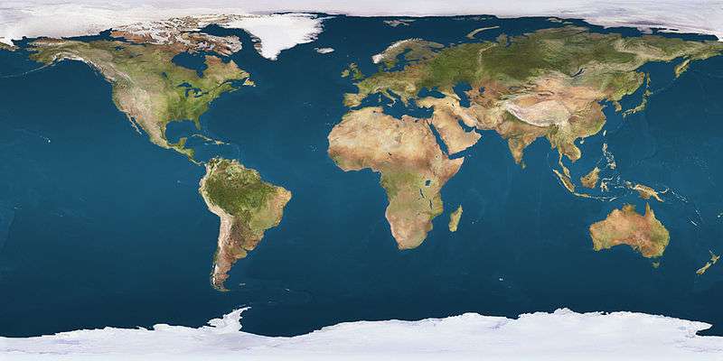 Approximate epicenters of the earthquakes in 1918
| |||
Strongest magnitude |
| ||
|---|---|---|---|
| Deadliest |
| ||
| Total fatalities | 2,317 | ||
| Number by magnitude | |||
| 9.0+ | 0 | ||
| 8.0−8.9 | 2 | ||
| 7.0−7.9 | 14 | ||
| 6.0−6.9 | 30 | ||
| 5.0−5.9 | 1 | ||
This is a list of earthquakes in 1918. Only magnitude 6.0 or greater earthquakes appear on the list. Lower magnitude events are included if they have caused death, injury or damage. Events which occurred in remote areas will be excluded from the list as they wouldn't have generated significant media interest. All dates are listed according to UTC time.
Overall
By death toll
| Rank | Death toll | Magnitude | Location | Depth (km) | Date |
|---|---|---|---|---|---|
| 1 | 2,000 | 7.3 | |
15.0 | February 13 |
| 2 | 240 | 7.1 | |
15.0 | October 11 |
| 3 | 52 | 8.3 | |
20.0 | August 15 |
| 4 | 23 | 8.1 | |
15.0 | September 7 |
- Note: At least 10 casualties
By magnitude
| Rank | Magnitude | Death toll | Location | Depth (km) | Date |
|---|---|---|---|---|---|
| 1 | 8.3 | 52 | |
20.0 | August 15 |
| 2 | 8.1 | 23 | |
15.0 | September 7 |
| 3 | 7.8 | 0 | |
15.0 | November 8 |
| 3 | 7.8 | 1 | |
25.0 | December 4 |
| 4 | 7.5 | 0 | |
15.0 | July 3 |
| 4 | 7.5 | 0 | |
35.0 | November 18 |
| 5 | 7.4 | 0 | |
330.4 | January 30 |
| 6 | 7.3 | 2,000 | |
15.0 | February 13 |
| 6 | 7.3 | 0 | |
15.0 | May 20 |
| 7 | 7.2 | 0 | |
15.0 | July 8 |
| 7 | 7.2 | 0 | |
15.0 | October 27 |
| 8 | 7.1 | 0 | |
35.0 | May 22 |
| 8 | 7.1 | 240 | |
15.0 | October 11 |
| 8 | 7.1 | 0 | |
15.0 | December 2 |
| 9 | 7.0 | 0 | |
564.9 | April 10 |
| 9 | 7.0 | 0 | |
15.0 | May 20 |
- Note: At least 7.0 magnitude
Notable events
January–March
 A magnitude 6.3 earthquake struck off the north coast of West Papua (province), Indonesia on January 21 at a depth of 25.0 km.[1]
 A magnitude 7.4 earthquake struck Primorsky Krai, Russia on January 30 at a depth of 330.4 km.[2]
 A magnitude 6.9 earthquake struck southeast Mindanao, Philippines on February 7 at a depth of 35.0 km.[3]
 A magnitude 6.5 earthquake struck Jilin Province, China on February 9 at a depth of 450.0 km.[4]
 A magnitude 7.3 earthquake struck Fujian Province, China on February 13 at a depth of 15.0 km.[5] This part of China is not known for earthquakes of this magnitude as they tend to happen in the western, southern and central provinces. Two-thousand people were killed, more than 1,000 further people were injured. Major damage was caused with scores of homes being destroyed. Shantou was particularly hard hit.[6]
 A magnitude 6.2 earthquake struck to the southwest of Grenada on February 24 at a depth of 35.0 km.[7]
April–June
 A magnitude 7.0 earthquake struck Heilongjiang Province, China on April 10 at a depth of 564.9 km.[8]
 A magnitude 6.7 earthquake struck southern California on April 21 at a depth of 10.0 km.[9] One person died and some people were injured. San Jacinto, California experienced major damage.[10]
- A magnitude 7.3 earthquake struck the central Mid-Atlantic Ridge on May 20 at a depth of 15.0 km.[11]
 A magnitude 6.8 earthquake struck off the coast of Coquimbo Region, Chile on May 20 at a depth of 20.0 km.[12]
 A magnitude 7.0 earthquake struck north of New Ireland (island), Papua New Guinea on May 20 at a depth of 15.0 km.[13] This came just eight minutes after the Chile quake.
 A magnitude 7.1 earthquake struck Fiji on May 22 at a depth of 35.0 km.[14]
 A magnitude 6.8 earthquake struck Sonora, Mexico on May 23 at a depth of 10.0 km.[15]
 A magnitude 6.2 earthquake struck Morobe Province, Papua New Guinea on June 4 at a depth of 15.0 km.[16]
July–September
 A magnitude 6.5 earthquake struck east of Mindanao, Philippines on July 1 at a depth of 35.0 km.[17]
 A magnitude 7.5 earthquake struck off the north coast of Papua New Guinea on July 3 at a depth of 15.0 km.[18]
 A magnitude 7.2 earthquake struck Netrokona District, Bangladesh on July 8 at a depth of 15.0 km.[19] Some damage was caused in the area.[20] An event of this magnitude is unusual for Bangladesh.
 A magnitude 6.4 earthquake struck off the coast of northern California on July 15 at a depth of 15.0 km.[21]
 A magnitude 6.5 earthquake struck north of Crete, Greece on July 16 at a depth of 150.0 km.[22]
 A magnitude 6.7 earthquake struck the Solomon Islands on July 21 at a depth of 20.0 km.[23]
 A magnitude 6.7 earthquake struck off the east coast of Honshu, Japan on July 25 at a depth of 35.0 km.[24]
 A magnitude 6.6 earthquake struck off the northern coast of Papua New Guinea on July 29 at a depth of 15.0 km.[25]
 A magnitude 6.5 earthquake struck east of New Britain, Papua New Guinea on August 8 at a depth of 35.0 km.[26]
 A magnitude 5.5 earthquake struck Yunnan Province, China on August 14 at an unknown depth. Some damage was caused in the area.[27]
 A magnitude 8.3 earthquake struck south of Mindanao, Philippines on August 15 at a depth of 20.0 km.[28] Fifty-two people were killed and major damage was caused. A major tsunami struck Mindanao with some waves reaching 24 feet high. Many aftershocks followed.[29][30]
 A magnitude 6.4 aftershock struck south of Mindanao, Philippines on August 15 at a depth of 35.0 km.[31]
 A magnitude 6.9 aftershock struck south of Mindanao, Philippines on August 15 at a depth of 15.0 km.[32]
 A magnitude 6.1 aftershock struck south of Mindanao, Philippines on August 16 at a depth of 35.0 km.[33]
 A magnitude 6.5 earthquake struck the Santa Cruz Islands on August 23 at a depth of 15.0 km.[34]
 A magnitude 8.1 earthquake struck the Kuril Islands, Russia on September 7 at a depth of 15.0 km.[35] A tsunami was generated which led to 23 deaths and seven people to be injured. Damage was reported to 19 homes and some more were destroyed.[36]
 An earthquake struck Batan Island, Philippines on September 13. The magnitude and depth were unknown. Some homes were destroyed.[37]
 A magnitude 6.5 earthquake struck off the west coast of Sumatra, Indonesia on September 22 at a depth of 35.0 km.[38]
 A magnitude 6.7 earthquake struck the Kuril Islands, Russia on September 22 at a depth of 35.0 km.[39]
 A magnitude 6.6 earthquake struck off the coast of Syria on September 29 at a depth of 15.0 km.[40]
 A magnitude 6.5 earthquake struck southeast of the Loyalty Islands on September 30 at a depth of 35.0 km.[41]
October–December
 A magnitude 7.1 earthquake struck the Mona Passage on October 11 at a depth of 15.0 km.[42] The quake struck the side closer to Puerto Rico. A tsunami was generated which contributed to 140 deaths. A further 100 people were declared missing. Property damage amounted to approximately $29 million (1918 rate).[43]
 A magnitude 6.6 earthquake struck Ahuachapan Department, El Salvador on October 19 at a depth of 35.0 km.[44]
 A magnitude 7.2 earthquake struck Mussau Island, Papua New Guinea on October 27 at a depth of 15.0 km.[45]
 A magnitude 7.8 earthquake struck east of the Kuril Islands, Russia on November 8 at a depth of 15.0 km.[46]
 A magnitude 6.5 earthquake struck Nagano Prefecture, Honshu, Japan on November 11 at a depth of 5.0 km.[47]
 A magnitude 7.5 earthquake struck the Babar Islands, Indonesia on November 18 at a depth of 35.0 km.[48]
 A magnitude 6.9 earthquake struck the Banda Sea, Indonesia on November 23 at a depth of 15.0 km.[49]
 A magnitude 6.4 earthquake struck Sakha Republic, Russia on November 30 at a depth of 15.0 km.[50]
 A magnitude 6.5 earthquake struck Gorno-Badakhshan Autonomous Region, Tajikistan on December 1 at a depth of 20.0 km.[51]
- A magnitude 7.1 earthquake struck the northern Mid-Atlantic Ridge on December 2 at a depth of 10.0 km.[52]
 A magnitude 7.8 earthquake struck Atacama Region, Chile on December 4 at a depth of 40.0 km.[53] At least one death was reported and the city of Copiapo was severely damaged.[54]
 A magnitude 6.8 earthquake struck Vancouver Island, Canada on December 6 at a depth of 15.0 km.[55]
 A magnitude 6.6 earthquake struck southeast of New Britain, Papua New Guinea on December 25 at a depth of 458.9 km.[56]
References
- ↑ "M6.3 - near the north coast of Papua, Indonesia". United States Geological Survey. January 21, 1918. Retrieved December 6, 2015.
- ↑ "Centennial Earthquake Catalog". United States Geological Survey. January 30, 1918. Retrieved December 6, 2015.
- ↑ "M6.9 - Mindanao, Philippines". United States Geological Survey. February 7, 1918. Retrieved December 6, 2015.
- ↑ "On-Line Bulletin". International Seismological Centre. February 9, 1918. Retrieved December 6, 2015.
- ↑ "M7.3 - near the coast of Fujian, China". United States Geological Survey. February 13, 1918. Retrieved December 6, 2015.
- ↑ "Significant Earthquake CHINA: GUANGDONG PROVINCE". National Geophysical Data Center. February 13, 1918. Retrieved December 6, 2015.
- ↑ "On-Line Bulletin". International Seismological Centre. February 24, 1918. Retrieved December 6, 2015.
- ↑ "Centennial Earthquake Catalog". United States Geological Survey. April 10, 1918. Retrieved December 6, 2015.
- ↑ "M6.7 - Southern California". United States Geological Survey. April 21, 1918. Retrieved December 6, 2015.
- ↑ "Historic Earthquakes". United States Geological Survey. April 21, 1918. Retrieved December 6, 2015.
- ↑ "M7.3 - central Mid-Atlantic Ridge". United States Geological Survey. May 20, 1918. Retrieved December 6, 2015.
- ↑ "M6.8 - offshore Coquimbo, Chile". United States Geological Survey. May 20, 1918. Retrieved December 6, 2015.
- ↑ "M7.0 - New Ireland region, Papua New Guinea". United States Geological Survey. May 20, 1918. Retrieved December 6, 2015.
- ↑ "Centennial Earthquake Catalog". United States Geological Survey. April 10, 1918. Retrieved December 6, 2015.
- ↑ "M6.8 - Sonora, Mexico". United States Geological Survey. May 23, 1918. Retrieved December 6, 2015.
- ↑ "M6.2 - eastern New Guinea region, Papua New Guinea". United States Geological Survey. June 4, 1918. Retrieved December 6, 2015.
- ↑ "M6.5 - Mindanao, Philippines". United States Geological Survey. July 1, 1918. Retrieved December 6, 2015.
- ↑ "M7.5 - near the north coast of New Guinea, Papua New Guinea". United States Geological Survey. July 3, 1918. Retrieved December 6, 2015.
- ↑ "M7.2 - Bangladesh". United States Geological Survey. July 8, 1918. Retrieved December 6, 2015.
- ↑ "Significant Earthquake BANGLADESH: SRIMANGAL". National Geophysical Data Center. July 8, 1918. Retrieved December 6, 2015.
- ↑ "M6.4 - offshore Northern California". United States Geological Survey. July 15, 1918. Retrieved December 6, 2015.
- ↑ "On-Line Bulletin". International Seismological Centre. July 16, 1918. Retrieved December 6, 2015.
- ↑ "M6.7 - Solomon Islands". United States Geological Survey. July 21, 1918. Retrieved December 6, 2015.
- ↑ "Centennial Earthquake Catalog". United States Geological Survey. July 25, 1918. Retrieved December 6, 2015.
- ↑ "M6.6 - near the north coast of New Guinea, Papua New Guinea". United States Geological Survey. July 29, 1918. Retrieved December 6, 2015.
- ↑ "M6.5 - New Britain region, Papua New Guinea". United States Geological Survey. August 8, 1918. Retrieved December 6, 2015.
- ↑ "Significant Earthquake CHINA: YUNNAN PROVINCE". National Geophysical Data Center. August 14, 1918. Retrieved December 6, 2015.
- ↑ "M8.3 - Mindanao, Philippines". United States Geological Survey. August 15, 1918. Retrieved December 6, 2015.
- ↑ "Significant Earthquake PHILIPPINES: MINDANAO: COTABATO". National Geophysical Data Center. August 15, 1918. Retrieved December 6, 2015.
- ↑ "Tsunami Event CELEBES SEA". National Geophysical Data Center. August 15, 1918. Retrieved December 6, 2015.
- ↑ "M6.4 - Mindanao, Philippines". United States Geological Survey. August 15, 1918. Retrieved December 6, 2015.
- ↑ "M6.9 - Mindanao, Philippines". United States Geological Survey. August 15, 1918. Retrieved December 8, 2015.
- ↑ "M6.1 - Mindanao, Philippines". United States Geological Survey. August 16, 1918. Retrieved December 8, 2015.
- ↑ "M6.5 - Santa Cruz Islands region". United States Geological Survey. August 23, 1918. Retrieved December 8, 2015.
- ↑ "M8.1 - Kuril Islands". United States Geological Survey. September 7, 1918. Retrieved December 8, 2015.
- ↑ "Tsunami Event S. KURIL ISLANDS". National Geophysical Data Center. September 7, 1918. Retrieved December 8, 2015.
- ↑ "Significant Earthquake PHILIPPINES: BATANES: IVANA,SABTAN,SAN VICENTE". National Geophysical Data Center. September 13, 1918. Retrieved December 8, 2015.
- ↑ "M6.5 - southern Sumatra, Indonesia". United States Geological Survey. September 22, 1918. Retrieved December 8, 2015.
- ↑ "Centennial Earthquake Catalog". United States Geological Survey. September 22, 1918. Retrieved December 8, 2015.
- ↑ "M6.6 - near the coast of Syria". United States Geological Survey. September 29, 1918. Retrieved December 8, 2015.
- ↑ "M6.5 - southeast of the Loyalty Islands". United States Geological Survey. September 30, 1918. Retrieved December 8, 2015.
- ↑ "M7.1 - Puerto Rico region". United States Geological Survey. October 11, 1918. Retrieved December 8, 2015.
- ↑ "Significant Earthquake PUERTO RICO: MONA PASSAGE". National Geophysical Data Center. October 11, 1918. Retrieved December 8, 2015.
- ↑ "M6.6 - El Salvador". United States Geological Survey. October 19, 1918. Retrieved December 8, 2015.
- ↑ "M7.2 - New Ireland region, Papua New Guinea". United States Geological Survey. October 27, 1918. Retrieved December 8, 2015.
- ↑ "M7.8 - east of the Kuril Islands". United States Geological Survey. November 8, 1918. Retrieved December 8, 2015.
- ↑ "Centennial Earthquake Catalog". United States Geological Survey. November 11, 1918. Retrieved December 8, 2015.
- ↑ "Centennial Earthquake Catalog". United States Geological Survey. September 22, 1918. Retrieved December 8, 2015.
- ↑ "M6.9 - Banda Sea". United States Geological Survey. November 23, 1918. Retrieved December 8, 2015.
- ↑ "M6.4 - northwestern Sakha, Russia". United States Geological Survey. November 30, 1918. Retrieved December 8, 2015.
- ↑ "M6.5 - Tajikistan". United States Geological Survey. December 1, 1918. Retrieved December 8, 2015.
- ↑ "M7.1 - northern Mid-Atlantic Ridge". United States Geological Survey. December 2, 1918. Retrieved December 8, 2015.
- ↑ "M7.8 - Atacama, Chile". United States Geological Survey. December 4, 1918. Retrieved December 8, 2015.
- ↑ "Significant Earthquake CHILE: COPIAPO". National Geophysical Data Center. December 4, 1918. Retrieved December 8, 2015.
- ↑ "M6.8 - Vancouver Island, Canada region". United States Geological Survey. December 6, 1918. Retrieved December 8, 2015.
- ↑ "Centennial Earthquake Catalog". United States Geological Survey. December 25, 1918. Retrieved December 8, 2015.
This article is issued from Wikipedia - version of the 1/22/2016. The text is available under the Creative Commons Attribution/Share Alike but additional terms may apply for the media files.