List of historic places in Central Ontario

This is a list of historic places in Central Ontario, containing heritage sites listed on the Canadian Register of Historic Places (CRHP), all of which are designated as historic places either locally, provincially, territorially, nationally, or by more than one level of government.

List of historic places

Dufferin County

Name Address Municipality PC Coordinates IDF IDP IDM Image
Dufferin County Court House 51 Zina Street Orangeville N0G 43°55′21″N 80°39′48″W / 43.9224°N 80.6633°W / 43.9224; -80.6633 (Dufferin County Court House) 10426
More images

Haliburton County

Name Address Municipality PC Coordinates IDF IDP IDM Image
Wilberforce Red Cross Outpost National Historic Site of Canada Highway 648 Highlands East K0L 45°02′17″N 78°13′24″W / 45.038°N 78.2232°W / 45.038; -78.2232 (Wilberforce Red Cross Outpost National Historic Site of Canada) 7740

Hastings County

Name Address Municipality PC Coordinates IDF IDP IDM Image
Belleville Railway Station (Grand Trunk) National Historic Site of Canada 240 Station Street Belleville K8N 44°10′44″N 77°22′27″W / 44.1789°N 77.3741°W / 44.1789; -77.3741 (Belleville Railway Station (Grand Trunk) National Historic Site of Canada) 7368
More images
Bellevue Terrace 10 Patterson Street Belleville K8N 44°09′59″N 77°23′00″W / 44.1663°N 77.3832°W / 44.1663; -77.3832 (Bellevue Terrace) 6302
Glanmore / Phillips-Faulkner House National Historic Site of Canada 257 Bridge Street East Belleville K0K 44°06′00″N 77°13′13″W / 44.1001°N 77.2203°W / 44.1001; -77.2203 (Glanmore / Phillips-Faulkner House National Historic Site of Canada) 12079
9 Hangar 84 North Star Drive, CFB Trenton Quinte West 44°06′54″N 77°32′21″W / 44.1151°N 77.5392°W / 44.1151; -77.5392 (9 Hangar) 11619
10 Hangar 52 North Star Drive, CFB Trenton Quinte West 44°06′54″N 77°32′21″W / 44.1151°N 77.5392°W / 44.1151; -77.5392 (10 Hangar) 11508
Building 23 CFB Trenton Quinte West 44°06′54″N 77°32′20″W / 44.115°N 77.539°W / 44.115; -77.539 (Building 23) 11509
Hangar 77 CFB Trenton Quinte West 44°04′12″N 77°19′59″W / 44.07°N 77.333°W / 44.07; -77.333 (Hangar 77) 10151
Hangar 78 CFB Trenton Quinte West 44°04′14″N 77°19′56″W / 44.0705°N 77.3322°W / 44.0705; -77.3322 (Hangar 78) 10155
Hangar 80 CFB Trenton Quinte West 44°04′18″N 77°19′49″W / 44.0718°N 77.3302°W / 44.0718; -77.3302 (Hangar 80) 10156
Hangar 81 CFB Trenton Quinte West 44°04′18″N 77°19′49″W / 44.0718°N 77.3302°W / 44.0718; -77.3302 (Hangar 81) 10157
Hangar 82 CFB Trenton Quinte West 44°04′10″N 77°19′54″W / 44.0695°N 77.3316°W / 44.0695; -77.3316 (Hangar 82) 10159
Lockmaster's House Sidney 44°07′46″N 77°35′17″W / 44.1294°N 77.5881°W / 44.1294; -77.5881 (Lockmaster's House (Sidney Locks)) 10517
More images
Officers' Mess CFB Trenton Quinte West 44°06′55″N 77°32′21″W / 44.1152°N 77.5392°W / 44.1152; -77.5392 (Officers' Mess) 11511
Officer's Quarters CFB Trenton Quinte West 44°06′55″N 77°32′21″W / 44.1152°N 77.5392°W / 44.1152; -77.5392 (Officer's Quarters) 11102
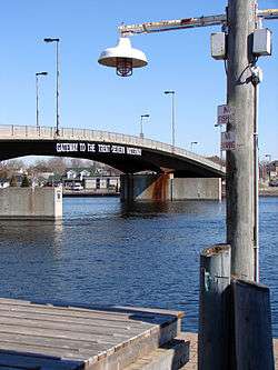
Trent–Severn Waterway National Historic Site of Canada Trenton to Severn Quinte West (Trenton) 44°23′09″N 78°27′21″W / 44.3857°N 78.4558°W / 44.3857; -78.4558 (Trent–Severn Waterway National Historic Site of Canada (Quinte West)) 4507
More images

Kawartha Lakes

Name Address Municipality PC Coordinates IDF IDP IDM Image
Canal Lake Concrete Arch Bridge National Historic Site of Canada Centennial Park Road over the Trent-Severn Waterway Kawartha Lakes K0M 44°33′29″N 79°02′45″W / 44.558°N 79.0459°W / 44.558; -79.0459 (Canal Lake Concrete Arch Bridge National Historic Site of Canada) 13085

District Municipality of Muskoka

Name Address Municipality PC Coordinates IDF IDP IDM Image
Woodchester Villa 15 King Street Bracebridge P1L 45°02′22″N 79°18′19″W / 45.0394°N 79.3052°W / 45.0394; -79.3052 (Woodchester Villa) 8206 8568
More images
Bethune House 235 John Street Gravenhurst P1P 44°55′14″N 79°22′34″W / 44.9205°N 79.376°W / 44.9205; -79.376 (Bethune House) 9727
More images
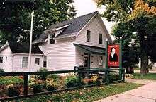
Bethune Memorial House National Historic Site of Canada 235 John Street North Gravenhurst P1P 44°55′14″N 79°22′34″W / 44.9205°N 79.3761°W / 44.9205; -79.3761 (Bethune Memorial House National Historic Site of Canada) 7765
Huntsville CNR Station 1 Station Road Huntsville P1H 45°19′25″N 79°13′34″W / 45.3237°N 79.2262°W / 45.3237; -79.2262 (Huntsville CNR Station) 6811 10507
More images

Northumberland County

Name Address Municipality PC Coordinates IDF IDP IDM Image
Barnum House National Historic Site of Canada County Road 2 Alnwick/Haldimand K0K 43°59′41″N 78°00′56″W / 43.9948°N 78.0156°W / 43.9948; -78.0156 (Barnum House National Historic Site of Canada) 4027
More images
Old Market Building 201 Third Street Cobourg K9A 43°57′34″N 78°10′04″W / 43.9595°N 78.1679°W / 43.9595; -78.1679 (Old Market Building) 8184
More images
Poplars 18 Spencer Street East Cobourg K9A 43°57′54″N 78°10′09″W / 43.9651°N 78.1691°W / 43.9651; -78.1691 (Poplars) 8897
Second Street Fire Hall 213 Second Street Cobourg K9A 43°57′34″N 78°10′04″W / 43.9595°N 78.1679°W / 43.9595; -78.1679 (Second Street Fire Hall) 10570
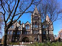
Victoria College 100 University Street East Cobourg K9A 43°57′55″N 78°09′53″W / 43.9654°N 78.1646°W / 43.9654; -78.1646 (Victoria College) 8208
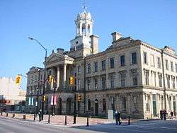
Victoria Hall / Cobourg Town Hall National Historic Site of Canada 55 King Street Cobourg K9A 43°57′34″N 78°10′04″W / 43.9595°N 78.1679°W / 43.9595; -78.1679 (Victoria Hall / Cobourg Town Hall National Historic Site of Canada) 7550 8201
More images
26 Barrett Street 26 Barrett Street Port Hope L1A 43°57′15″N 78°17′43″W / 43.9541°N 78.2954°W / 43.9541; -78.2954 (26 Barrett Street) 9329
34-46 Walton Street, Port Hope 34 Walton Street Port Hope L1A 43°57′05″N 78°17′35″W / 43.9513°N 78.2931°W / 43.9513; -78.2931 (34-46 Walton Street, Port Hope) 8836
More images
Armstrong Cottage 239 Ridout Street Port Hope L1A 43°57′05″N 78°18′13″W / 43.9515°N 78.3035°W / 43.9515; -78.3035 (Armstrong Cottage) 9327
Bank of Upper Canada 86 John Street Port Hope L1A 43°56′59″N 78°17′43″W / 43.9496°N 78.2952°W / 43.9496; -78.2952 (Bank of Upper Canada) 9428
Blackham's Hotel 4345 Dorset Street West Port Hope L1A 43°56′54″N 78°17′45″W / 43.9483°N 78.2957°W / 43.9483; -78.2957 (Blackham's Hotel) 8945
Cassie Cottage 15 Julia Street Port Hope L1A 43°57′09″N 78°18′15″W / 43.9525°N 78.3043°W / 43.9525; -78.3043 (Cassie Cottage) 8946
Chalk Carriage Works 46 Cavan Street Port Hope L1A 43°57′13″N 78°17′44″W / 43.9537°N 78.2956°W / 43.9537; -78.2956 (Chalk Carriage Works) 9331
More images
Charles Clemes Duplex 57 King Street Port Hope L1A 43°57′03″N 78°17′25″W / 43.9507°N 78.2902°W / 43.9507; -78.2902 (Charles Clemes Duplex) 9332
More images
Charles Wickett House 55 King Street Port Hope L1A 43°57′03″N 78°17′25″W / 43.9508°N 78.2902°W / 43.9508; -78.2902 (Charles Wickett House) 9993
More images
Crawley House 28 Bedford Street Port Hope L1A 43°57′22″N 78°17′54″W / 43.9562°N 78.2984°W / 43.9562; -78.2984 (Crawley House) 9994
David Smart House 175 Dorset Street West Port Hope L8P 43°56′47″N 78°18′08″W / 43.9463°N 78.3021°W / 43.9463; -78.3021 (David Smart House) 7789
Fairmont: The David Smith House 162 Dorset Street Port Hope L1A 43°57′09″N 78°16′48″W / 43.9524°N 78.28°W / 43.9524; -78.28 (Fairmont: The David Smith House) 9997
George Manning Furby House 61 Bramley Street North Port Hope L1A 43°57′14″N 78°18′26″W / 43.9539°N 78.3073°W / 43.9539; -78.3073 (George Manning Furby House) 9998
More images
Henry Howard Meredith House 47 Pine Street South Port Hope L1A 43°57′01″N 78°17′46″W / 43.9502°N 78.2961°W / 43.9502; -78.2961 (Henry Howard Meredith House) 10002
Hooey Cottage 20 Ward Street Port Hope L1A 43°57′14″N 78°17′28″W / 43.9539°N 78.2911°W / 43.9539; -78.2911 (Hooey Cottage) 10003
James Leslie Cottage 118 Bruton Street Port Hope L1A 43°57′13″N 78°18′21″W / 43.9535°N 78.3057°W / 43.9535; -78.3057 (James Leslie Cottage) 10004
James Sculthorp Townhouse 200 Walton Street Port Hope L1A 43°57′08″N 78°18′03″W / 43.9523°N 78.3007°W / 43.9523; -78.3007 (James Sculthorp Townhouse) 10006
John David Smith House 21 Dorset Street East Port Hope L1A 43°56′59″N 78°17′24″W / 43.9498°N 78.2899°W / 43.9498; -78.2899 (John David Smith House) 8343
John, Ontario and Queen Street Heritage Conservation District John, Ontario and Queen Street Heritage Conservation District Port Hope L1A 43°57′04″N 78°17′35″W / 43.9512°N 78.2931°W / 43.9512; -78.2931 (John, Ontario and Queen Street Heritage Conservation District) 10001
John Tucker Williams House: Penryn Homestead 82 Victoria Street South Port Hope L1A 43°56′46″N 78°18′21″W / 43.9461°N 78.3058°W / 43.9461; -78.3058 (John Tucker Williams House: Penryn Homestead) 9999
Joseph Clarke House 13 King Street Port Hope L1A 43°57′12″N 78°17′25″W / 43.9534°N 78.2904°W / 43.9534; -78.2904 (Joseph Clarke House) 10007
Judson A. Brown House 82 Augusta Street Port Hope L1A 43°56′58″N 78°17′52″W / 43.9494°N 78.2979°W / 43.9494; -78.2979 (Judson A. Brown House) 10008
Little Bluestone 117 King Street Port Hope L1A 43°56′50″N 78°17′24″W / 43.9473°N 78.29°W / 43.9473; -78.29 (Little Bluestone) 8318
More images
Little Station 10 Hayward Street Port Hope L1A 43°56′45″N 78°17′42″W / 43.9459°N 78.2949°W / 43.9459; -78.2949 (Little Station) 10009
Margaret and Charles Stuart House 180 Dorset Street East Port Hope 43°57′13″N 78°16′32″W / 43.9535°N 78.2755°W / 43.9535; -78.2755 (Margaret and Charles Stuart House) 15583
Penstowe 98 Ontario Street Port Hope L1A 43°57′22″N 78°17′34″W / 43.9561°N 78.2928°W / 43.9561; -78.2928 (Penstowe) 8342
More images
Port Hope Capitol Theatre 14 Queen Street Port Hope L1A 43°57′02″N 78°17′35″W / 43.9506°N 78.2931°W / 43.9506; -78.2931 (Port Hope Capitol Theatre) 7788
More images
Port Hope CNR Station 20 Hayward Street Port Hope L1A 43°56′39″N 78°17′52″W / 43.9442°N 78.2979°W / 43.9442; -78.2979 (Port Hope CNR Station) 8898
More images
Port Hope Registry Office 17 Mill Street North Port Hope L1A 43°57′04″N 78°17′31″W / 43.9512°N 78.2919°W / 43.9512; -78.2919 (Port Hope Registry Office) 10011
More images
Port Hope Town Hall 56 Queen Street Port Hope L1A 43°56′57″N 78°17′35″W / 43.9491°N 78.293°W / 43.9491; -78.293 (Port Hope Town Hall) 10012
More images
Richard Trick Cottage 254 Ridout Street Port Hope L1A 43°57′05″N 78°18′15″W / 43.9515°N 78.3043°W / 43.9515; -78.3043 (Richard Trick Cottage) 10013
Robert Mitchell House 8 King Street Port Hope L1A 43°57′13″N 78°17′27″W / 43.9537°N 78.2907°W / 43.9537; -78.2907 (Robert Mitchell House) 10014
More images
Robert Youdan Terrace 46 Baldwin Street Port Hope L1A 43°57′12″N 78°18′05″W / 43.9532°N 78.3014°W / 43.9532; -78.3014 (Robert Youdan Terrace) 10015
St. Lawrence Hall Block 87 Walton Street Port Hope L1A 43°57′06″N 78°17′41″W / 43.9516°N 78.2948°W / 43.9516; -78.2948 (St. Lawrence Hall Block) 8274
More images
St. Mark's Anglican Church 51 King Street Port Hope L1A 43°57′05″N 78°17′25″W / 43.9515°N 78.2904°W / 43.9515; -78.2904 (St. Mark's Anglican Church) 9964
More images
Smith Cottage 72 Augusta Street Port Hope L1A 43°56′58″N 78°17′50″W / 43.9495°N 78.2973°W / 43.9495; -78.2973 (Smith Cottage) 9961
More images
Thomas B. Chalk House 48 Bloomsgrove Avenue Port Hope L1A 43°57′26″N 78°17′29″W / 43.9572°N 78.2915°W / 43.9572; -78.2915 (Thomas B. Chalk House) 9966
Thomas Clarke House: The Cone 115 Dorset Street West Port Hope L1A 43°56′50″N 78°17′58″W / 43.9473°N 78.2995°W / 43.9473; -78.2995 (Thomas Clarke House: The Cone) 9967
More images
Thomas McCreery House 78 Augusta Street Port Hope L1A 43°56′58″N 78°17′52″W / 43.9494°N 78.2977°W / 43.9494; -78.2977 (Thomas McCreery House) 9968
More images
Thomas White House 22 Shortt Street Port Hope L1A 43°56′59″N 78°18′42″W / 43.9497°N 78.3116°W / 43.9497; -78.3116 (Thomas White House) 9969
Union Cemetery Chapel 114 Toronto Road Port Hope L1A 43°57′21″N 78°19′01″W / 43.9559°N 78.317°W / 43.9559; -78.317 (Union Cemetery Chapel) 8317
Waddell Block 1 Waddell Street Port Hope L1A 43°57′02″N 78°17′31″W / 43.9505°N 78.2919°W / 43.9505; -78.2919 (Waddell Block) 9973
Walton Street Heritage Conservation District, Downtown Port Hope Walton Street, between Pine Street and Mill Street Port Hope L1A 43°57′02″N 78°17′31″W / 43.9505°N 78.2919°W / 43.9505; -78.2919 (Walton Street Heritage Conservation District, Downtown Port Hope) 7792
William B. Cawthorne House 64 Augusta Street Port Hope L1A 43°56′59″N 78°17′48″W / 43.9496°N 78.2968°W / 43.9496; -78.2968 (William B. Cawthorne House) 9974
More images
William Bellamy Cottage 64 Charles Street Port Hope L1A 43°57′09″N 78°18′18″W / 43.9525°N 78.3051°W / 43.9525; -78.3051 (William Bellamy Cottage) 9975
William Craig House 42 Bedford Street Port Hope L1A 43°57′22″N 78°17′58″W / 43.956°N 78.2995°W / 43.956; -78.2995 (William Craig House) 9976
William Sisson House: Wimbourne 89 Dorset Street West Port Hope L1A 43°56′52″N 78°17′52″W / 43.9477°N 78.2979°W / 43.9477; -78.2979 (William Sisson House: Wimbourne) 9972
More images
William Skitch Cottage 159 Bruton Street Port Hope L1A 43°57′10″N 78°18′31″W / 43.9528°N 78.3086°W / 43.9528; -78.3086 (William Skitch Cottage) 9977
William Trick Cottage 9 Church Street Port Hope L1A 43°57′08″N 78°18′07″W / 43.9523°N 78.302°W / 43.9523; -78.302 (William Trick Cottage) 9978

Parry Sound District

Name Address Municipality PC Coordinates IDF IDP IDM Image
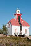
Pointe-au-Baril Lighthouse The Archipelago (Pointe au Baril) P0G 9821
More images
Snug Harbour Rear Range Light Tower southern tip of Snug Island Carling P0B 45°22′26″N 80°18′40″W / 45.374°N 80.311°W / 45.374; -80.311 (Snug Harbour Rear Range Light Tower) 15955
Commanda General Store 4077 Highway 522 Nipissing (Commanda) P0H 45°57′06″N 79°36′19″W / 45.9516°N 79.6053°W / 45.9516; -79.6053 (Commanda General Store) 10425
Belvedere Heights Lookout Belvedere Parry Sound 45°20′33″N 80°02′23″W / 45.3426°N 80.0397°W / 45.3426; -80.0397 (Belvedere Heights Lookout) 18530
Canadian Pacific Railway Station 1 Avenue Road Parry Sound P2A 7094
Rear Range Light Tower Badgeley Island Parry Sound 45°33′21″N 80°29′08″W / 45.5558°N 80.4856°W / 45.5558; -80.4856 (Rear Range Light Tower) 13216
Lighthouse and Dwelling Gereaux Island Unorganized Centre Parry Sound District 45°44′40″N 80°39′33″W / 45.7444°N 80.6591°W / 45.7444; -80.6591 (Lighthouse and Dwelling) 9678
More images
Red Rock Light Tower Red Rock Island Unorganized Centre Parry Sound District 45°21′39″N 80°23′50″W / 45.3608°N 80.3971°W / 45.3608; -80.3971 (Red Rock Light Tower) 13214

Peterborough County

Name Address Municipality PC Coordinates IDF IDP IDM Image
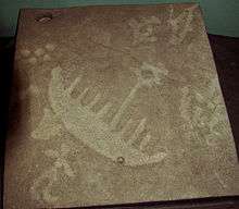
Peterborough Petroglyphs National Historic Site of Canada Petroglyphs Provincial Park Otonabee–South Monaghan K0L 44°36′46″N 78°02′34″W / 44.6128°N 78.0427°W / 44.6128; -78.0427 (Peterborough Petroglyphs National Historic Site of Canada) 11705
More images
Serpent Mounds National Historic Site of Canada Roach’s Point and East Sugar Island in Rice Lake Otonabee–South Monaghan K0L 44°12′57″N 78°08′34″W / 44.2157°N 78.1428°W / 44.2157; -78.1428 (Serpent Mounds National Historic Site of Canada) 14407
Absalom Ingram House 309 Engleburn Avenue Peterborough K9H 44°18′12″N 78°18′45″W / 44.3032°N 78.3126°W / 44.3032; -78.3126 (Absalom Ingram House) 2155
More images
Auburn Mills Cottage 205 Lisburn Street Peterborough K9H 44°19′27″N 78°18′41″W / 44.3242°N 78.3114°W / 44.3242; -78.3114 (Auburn Mills Cottage) 6378
More images
Bonner Worth Mill Administration Building 544 McDonnel Street Peterborough K9H 44°18′30″N 78°20′11″W / 44.3083°N 78.3365°W / 44.3083; -78.3365 (Bonner Worth Mill Administration Building) 4054
More images
Burnham Mansion 760 Lansdowne Street East Peterborough K9J 44°17′46″N 78°16′39″W / 44.296°N 78.2774°W / 44.296; -78.2774 (Burnham Mansion) 1386
Cathedral of St. Peters in Chains 316 Hunter Street West Peterborough K9H 44°18′20″N 78°19′39″W / 44.3056°N 78.3276°W / 44.3056; -78.3276 (Cathedral of St. Peters in Chains) 1566
More images
Confederation Park 501 George Street North Peterborough K9H 44°18′31″N 78°19′15″W / 44.3086°N 78.3208°W / 44.3086; -78.3208 (Confederation Park) 1664
More images
Cox Terrace National Historic Site of Canada 332-344 Rubidge Street Peterborough K9H 44°18′13″N 78°19′35″W / 44.3036°N 78.3265°W / 44.3036; -78.3265 (Cox Terrace National Historic Site of Canada) 1188
More images
The Dixon-Stevenson-Bradburn Building 379 George Street North Peterborough K9H 44°18′19″N 78°19′13″W / 44.3052°N 78.3203°W / 44.3052; -78.3203 (The Dixon-Stevenson-Bradburn Building) 6388
More images
Dumble-Hinton House 607 Stewart Street Peterborough K9H 44°18′44″N 78°19′35″W / 44.3123°N 78.3264°W / 44.3123; -78.3264 (Dumble-Hinton House) 1558
Eastland House 273 Hunter Street West Peterborough K9H 44°18′21″N 78°19′30″W / 44.3057°N 78.3251°W / 44.3057; -78.3251 (Eastland House) 7609
More images
Engleburn House 260 Engleburn Avenue Peterborough K9H 44°18′08″N 78°18′47″W / 44.3023°N 78.3131°W / 44.3023; -78.3131 (Engleburn House) 1334
More images
Fair-Bierk Building 383 George Street North Peterborough K9H 44°18′19″N 78°19′13″W / 44.3054°N 78.3203°W / 44.3054; -78.3203 (Fair-Bierk Building) 1391
More images
Former Peterborough Post Office and Customs Building 191 201 Charlotte Street Peterborough K9J 44°18′11″N 78°19′19″W / 44.303°N 78.3219°W / 44.303; -78.3219 (Former Peterborough Post Office and Customs Building) 5531
More images
George Street United Church 534 George Street Peterborough K9H 44°18′36″N 78°19′11″W / 44.3099°N 78.3197°W / 44.3099; -78.3197 (George Street United Church) 1564
More images
Grover-Nicholls House 415 Rubidge Street Peterborough K9H 44°18′22″N 78°19′39″W / 44.3062°N 78.3275°W / 44.3062; -78.3275 (Grover-Nicholls House) 1552
More images
Hamilton Carriage House 478 Downie Street Peterborough K9H 44°18′28″N 78°19′44″W / 44.3078°N 78.329°W / 44.3078; -78.329 (Hamilton Carriage House) 6389
Harstone House 565 Water Street Peterborough K9H 44°18′40″N 78°19′11″W / 44.3111°N 78.3196°W / 44.3111; -78.3196 (Harstone House) 1326
More images
Hay-Smit House 155 Hunter Street East Peterborough K9H 44°18′24″N 78°18′26″W / 44.3068°N 78.3071°W / 44.3068; -78.3071 (Hay-Smit House) 5549
More images
Henry Calcutt House 73 Robinson Street Peterborough K9H 44°18′15″N 78°18′37″W / 44.3042°N 78.3103°W / 44.3042; -78.3103 (Henry Calcutt House) 1369
More images
Henry Myers Cottage 538 Harvey Street Peterborough K9H 44°18′37″N 78°19′04″W / 44.3102°N 78.3178°W / 44.3102; -78.3178 (Henry Myers Cottage) 1547
More images
Hutchison House 270 Brock Street Peterborough K9H 44°18′26″N 78°19′31″W / 44.3072°N 78.3252°W / 44.3072; -78.3252 (Hutchison House) 1329
More images
James Menzies House 279 Sherbrooke Street Peterborough K9J 44°18′01″N 78°19′30″W / 44.3004°N 78.3251°W / 44.3004; -78.3251 (James Menzies House) 3021
More images
James Miller House 565-569 Harvey Street Peterborough K9H 44°18′40″N 78°19′06″W / 44.3112°N 78.3184°W / 44.3112; -78.3184 (James Miller House) 1348
More images
James Reid House 1154 Armour Road Peterborough K9H 44°20′21″N 78°18′26″W / 44.3392°N 78.3073°W / 44.3392; -78.3073 (James Reid House) 1557
John Britton House 533 Harvey Street Peterborough K9H 44°18′36″N 78°19′06″W / 44.3101°N 78.3183°W / 44.3101; -78.3183 (John Britton House) 302
The Lundy Building 285 George Street North Peterborough K9J 44°18′08″N 78°19′12″W / 44.3023°N 78.32°W / 44.3023; -78.32 (The Lundy Building) 6387
More images
Malcolm House 488 Aylmer Street Peterborough K9H 44°18′31″N 78°19′24″W / 44.3085°N 78.3233°W / 44.3085; -78.3233 (Malcolm House) 2145
Malone 62 Dunlop Street Peterborough K9H 44°19′13″N 78°18′45″W / 44.3204°N 78.3124°W / 44.3204; -78.3124 (Malone) 1580
More images
Marchbanks 361 Park Street North Peterborough K9H 44°18′15″N 78°19′48″W / 44.3041°N 78.3301°W / 44.3041; -78.3301 (Marchbanks) 1498
More images
Market Hall and Clock Tower 360 George Street Peterborough K9H 44°18′15″N 78°19′11″W / 44.3042°N 78.3196°W / 44.3042; -78.3196 (Market Hall and Clock Tower) 1345
More images
Merino 17 Merino Road Peterborough K9J 44°18′14″N 78°21′23″W / 44.3038°N 78.3563°W / 44.3038; -78.3563 (Merino) 8436
Morrow Building 442-448 George Street North Peterborough K9H 44°18′26″N 78°19′12″W / 44.3073°N 78.3199°W / 44.3073; -78.3199 (Morrow Building) 1546
More images
Old Pump House 1230 Water Street Peterborough K9H 44°20′31″N 78°18′42″W / 44.3419°N 78.3117°W / 44.3419; -78.3117 (Old Pump House) 1389
More images
Pagoda Bridge 610 Parkhill Road West Peterborough K9J 44°18′39″N 78°20′28″W / 44.3109°N 78.341°W / 44.3109; -78.341 (Pagoda Bridge) 1645
More images
Pappas Building 407-409 George Street North Peterborough K9H 44°18′22″N 78°19′13″W / 44.3061°N 78.3203°W / 44.3061; -78.3203 (Pappas Building) 7793
More images
Peck House 183 Mark Street Peterborough K9H 44°18′01″N 78°18′33″W / 44.3003°N 78.3093°W / 44.3003; -78.3093 (Peck House) 1548
More images
Peterborough CPR Station 175 George Street North Peterborough K9J 44°17′55″N 78°19′12″W / 44.2987°N 78.3201°W / 44.2987; -78.3201 (Peterborough CPR Station) 8883
More images
Peterborough Drill Hall / Armoury 220 Murray Street Peterborough 44°18′30″N 78°19′14″W / 44.3083°N 78.3206°W / 44.3083; -78.3206 (Peterborough Drill Hall / Armoury) 4340
Peterborough Family YMCA 475 George Street North Peterborough K9H 44°18′29″N 78°19′14″W / 44.308°N 78.3206°W / 44.308; -78.3206 (Peterborough Family YMCA) 1556
More images
Peterborough Lift Lock National Historic Site of Canada Otonabee River near Ashburnham Memorial Park Peterborough K9H 44°18′27″N 78°18′01″W / 44.3076°N 78.3004°W / 44.3076; -78.3004 (Peterborough Lift Lock National Historic Site of Canada) 11449
More images
The Pines 266 Burnham Street Peterborough K9H 44°18′09″N 78°18′41″W / 44.3024°N 78.3115°W / 44.3024; -78.3115 (The Pines) 1394
More images
Pioneer Park 51 Hilliard Street Peterborough K9H 44°19′19″N 78°19′05″W / 44.322°N 78.318°W / 44.322; -78.318 (Pioneer Park) 1587
More images
Robert Graham House 547 Water Street Peterborough K9H 44°18′38″N 78°19′10″W / 44.3105°N 78.3195°W / 44.3105; -78.3195 (Robert Graham House) 1371
More images
Sadleir House 751 George Street North Peterborough K0L 44°18′42″N 78°05′41″W / 44.3118°N 78.0947°W / 44.3118; -78.0947 (Sadleir House) 6377
More images
St. John the Evangelist Anglican Church 118 Hunter Street Peterborough K9H 44°18′24″N 78°19′05″W / 44.3068°N 78.3181°W / 44.3068; -78.3181 (St. John the Evangelist Anglican Church) 1346
St. Peter's Bishop's Palace 350 Hunter Street West Peterborough K9H 44°18′21″N 78°19′43″W / 44.3058°N 78.3287°W / 44.3058; -78.3287 (St. Peter's Bishop's Palace) 1579
More images
St. Peter's Cathedral Centre 317 Hunter Street West Peterborough K9H 44°18′20″N 78°19′39″W / 44.3056°N 78.3276°W / 44.3056; -78.3276 (St. Peter's Cathedral Centre) 1559
More images
St. Peter's Rectory 411 Reid Street Peterborough K9H 44°18′21″N 78°19′42″W / 44.3059°N 78.3283°W / 44.3059; -78.3283 (St. Peter's Rectory) 1581
More images
Smithtown Hill House 269 Edinburgh Street Peterborough K9H 44°18′46″N 78°19′31″W / 44.3129°N 78.3254°W / 44.3129; -78.3254 (Smithtown Hill House) 1565
More images
Sutton-Deyman House 82 Dublin Street Peterborough K9H 44°18′45″N 78°19′03″W / 44.3124°N 78.3176°W / 44.3124; -78.3176 (Sutton-Deyman House) 1554
More images
Verulam 236 Burnham Street Peterborough K9H 44°18′05″N 78°18′41″W / 44.3015°N 78.3115°W / 44.3015; -78.3115 (Verulam) 1555
More images
Weller-Boucher House 548 Weller Street Peterborough K9H 44°18′19″N 78°20′08″W / 44.3052°N 78.3355°W / 44.3052; -78.3355 (Weller-Boucher House) 1620
More images
William Blackwell House 84 Benson Avenue Peterborough K9H 44°19′04″N 78°19′22″W / 44.3178°N 78.3228°W / 44.3178; -78.3228 (William Blackwell House) 1573
William Dixon House 661 Park Street North Peterborough K9H 44°18′47″N 78°20′07″W / 44.3131°N 78.3352°W / 44.3131; -78.3352 (William Dixon House) 1396
More images
The Yelland Building 464 George Street North Peterborough K9H 44°18′27″N 78°19′12″W / 44.3074°N 78.3201°W / 44.3074; -78.3201 (The Yelland Building) 5545
More images

Prince Edward County

Name Address Municipality PC Coordinates IDF IDP IDM Image
Carrying Place of the Bay of Quinte National Historic Site of Canada Intersection of the Trenton and Carrying Place Roads Prince Edward (Carrying Place) K0K 44°02′55″N 77°34′57″W / 44.0485°N 77.5825°W / 44.0485; -77.5825 (Carrying Place of the Bay of Quinte National Historic Site of Canada) 13814
Lighthouse Main Duck Island Prince Edward 43°55′52″N 76°38′18″W / 43.9311°N 76.6384°W / 43.9311; -76.6384 (Lighthouse) 4747

Simcoe County

Name Address Municipality PC Coordinates IDF IDP IDM Image
Canadian National Railways Allandale Station at Barrie 285 Bradford Street Barrie L4N 44°22′26″N 79°41′17″W / 44.374°N 79.688°W / 44.374; -79.688 (Canadian National Railways Allandale Station at Barrie) 6503 8884
More images
Barrie Public Library 37 Mulcaster Street Barrie L4M 44°23′24″N 79°41′07″W / 44.39°N 79.6853°W / 44.39; -79.6853 (Barrie Public Library) 1370
Master Mechanic's Building 205 Lakeshore Drive Barrie L4N 44°22′26″N 79°40′49″W / 44.374°N 79.6804°W / 44.374; -79.6804 (Master Mechanic's Building) 1331
More images
Mulcaster Street Armoury 36 Mulcaster Street Barrie L4M 44°23′24″N 79°41′08″W / 44.39°N 79.6855°W / 44.39; -79.6855 (Mulcaster Street Armoury) 1332
More images
Fort Sainte Marie II National Historic Site of Canada southern shore of Christian Island Christian Island 30A 44°49′26″N 80°09′51″W / 44.8239°N 80.1642°W / 44.8239; -80.1642 (Fort Sainte Marie II National Historic Site of Canada) 16002
Claverleigh National Historic Site of Canada 3.2 km west of Creemore Clearview L0M 44°19′00″N 80°06′00″W / 44.3167°N 80.1°W / 44.3167; -80.1 (Claverleigh National Historic Site of Canada) 7597
Collingwood Heritage Conservation District the historic town core of Collingwood Collingwood L9Y 44°29′31″N 80°12′22″W / 44.492°N 80.2061°W / 44.492; -80.2061 (Collingwood Heritage Conservation District) 1325
More images
Barrie Armoury Park Street Essa 44°23′26″N 79°41′17″W / 44.3905°N 79.6881°W / 44.3905; -79.6881 (Barrie Armoury) 9580
More images
Building A-74 (Maple Mess) 51 Maple Leaf Drive, CFB Borden Essa 44°16′04″N 79°54′24″W / 44.2678°N 79.9066°W / 44.2678; -79.9066 (Building A-74 (Maple Mess)) 9556
Building A-78 CFB Borden Essa 44°15′57″N 79°54′15″W / 44.2658°N 79.9042°W / 44.2658; -79.9042 (Building A-78) 10523
Building E-108 18 Waterloo Road, CFB Borden Essa 44°17′11″N 79°53′23″W / 44.2864°N 79.8897°W / 44.2864; -79.8897 (Building E-108) 11497
Building O-102 CFB Borden Essa 44°16′46″N 79°53′32″W / 44.2794°N 79.8922°W / 44.2794; -79.8922 (Building O-102) 10880
Building O-109 (NCO Building) CFB Borden Essa 44°10′23″N 79°32′02″W / 44.173°N 79.534°W / 44.173; -79.534 (Building O-109 (NCO Building)) 9600
Building P-148 (School) CFB Borden Essa 44°10′15″N 79°31′33″W / 44.1708°N 79.5259°W / 44.1708; -79.5259 (Building P-148 (School)) 9589
Building S-136 CFB Borden Essa 44°17′32″N 79°53′51″W / 44.2921°N 79.8975°W / 44.2921; -79.8975 (Building S-136) 10879
Croil Hall (Building A142) CFB Borden Essa 44°16′26″N 79°53′28″W / 44.2739°N 79.8912°W / 44.2739; -79.8912 (Croil Hall (Building A142)) 9477
Hangar 3 at Hangar Line Hangar Road, CFB Borden Essa 44°16′05″N 79°54′48″W / 44.2681°N 79.9133°W / 44.2681; -79.9133 (Hangar 3 at Hangar Line) 16485
Hangar 5 at Hangar Line Hangar Road, CFB Borden Essa 44°16′10″N 79°56′25″W / 44.2695°N 79.9402°W / 44.2695; -79.9402 (Hangar 5 at Hangar Line) 16486
Hangar 6 at Hangar Line Hangar Road, CFB Borden Essa 44°16′26″N 79°53′28″W / 44.2739°N 79.8912°W / 44.2739; -79.8912 (Hangar 6 at Hangar Line) 16483
Hangar 7 at Hangar Line Hangar Road, CFB Borden Essa 44°16′05″N 79°54′48″W / 44.2681°N 79.9133°W / 44.2681; -79.9133 (Hangar 7 at Hangar Line) 16487
Hangar 10 at Hangar Line Hangar Road, CFB Borden Essa 44°16′26″N 79°53′28″W / 44.2739°N 79.8912°W / 44.2739; -79.8912 (Hangar 10 at Hangar Line) 16488
Hangar 11 at Hangar Line Hangar Road, CFB Borden Essa 44°16′05″N 79°54′48″W / 44.2681°N 79.9133°W / 44.2681; -79.9133 (Hangar 11 at Hangar Line) 16489
Hangar 12 at Hangar Line Hangar Road, CFB Borden Essa 44°16′26″N 79°53′28″W / 44.2739°N 79.8912°W / 44.2739; -79.8912 (Hangar 12 at Hangar Line) 16484
Hangar 13 at Hangar Line Hangar Road, CFB Borden Essa 44°16′26″N 79°53′28″W / 44.2739°N 79.8912°W / 44.2739; -79.8912 (Hangar 13 at Hangar Line) 16490
Junior Ranks Quarters (Building T-114) CFB Borden Essa 44°16′47″N 79°54′02″W / 44.2797°N 79.9005°W / 44.2797; -79.9005 (Junior Ranks Quarters (Building T-114)) 10147
Junior Ranks Quarters (Building T-115) CFB Borden Essa 44°16′52″N 79°53′59″W / 44.281°N 79.8996°W / 44.281; -79.8996 (Junior Ranks Quarters (Building T-115)) 10148
Royal Flying Corps Hangars National Historic Site of Canada CFB Borden Essa L0M 44°16′00″N 79°53′00″W / 44.2667°N 79.8833°W / 44.2667; -79.8833 (Royal Flying Corps Hangars National Historic Site of Canada) 7839
Sainte-Marie Among the Hurons Mission National Historic Site of Canada Highway 12 Midland L0K 44°44′02″N 79°50′25″W / 44.734°N 79.8404°W / 44.734; -79.8404 (Sainte-Marie Among the Hurons Mission) 12088
More images
Gribbin (McMaster) Building 45 Mississaga Street East Orillia L3V 44°36′31″N 79°25′07″W / 44.6087°N 79.4186°W / 44.6087; -79.4186 (Gribbin (McMaster) Building) 1323
Kean's Block 19-27 Mississaga Street East Orillia L3V 44°36′31″N 79°25′08″W / 44.6085°N 79.419°W / 44.6085; -79.419 (Kean's Block) 1324
Stephen Leacock Museum / Old Brewery Bay National Historic Site of Canada 50 Museum Drive Orillia L3V 44°36′30″N 79°23′38″W / 44.6084°N 79.3939°W / 44.6084; -79.3939 (Stephen Leacock Museum / Old Brewery Bay National Historic Site of Canada) 14362 10582
More images
Oro African Methodist Episcopal Church National Historic Site of Canada intersection of the Oro Sideroads 10 and 11 Oro-Medonte L0L 44°30′10″N 79°38′11″W / 44.5027°N 79.6364°W / 44.5027; -79.6364 (Oro African Methodist Episcopal Church National Historic Site of Canada) 12100
More images
St. James-on-the-Lines Anglican Church 215 Church Street Penetanguishene L9M 44°47′14″N 79°55′34″W / 44.7871°N 79.9261°W / 44.7871; -79.9261 (St. James-on-the-Lines Anglican Church) 10578
More images
Trent–Severn Waterway National Historic Site of Canada Trenton to Port Severn Port Severn 44°23′08″N 78°27′21″W / 44.3856°N 78.4558°W / 44.3856; -78.4558 (Trent–Severn Waterway National Historic Site of Canada (Port Severn)) 4507
More images
Mnjikaning Fish Weirs National Historic Site of Canada bottom of the Narrows between Lakes Simcoe and Couchiching Ramara L3V 44°36′15″N 79°22′11″W / 44.6042°N 79.3696°W / 44.6042; -79.3696 (Mnjikaning Fish Weirs National Historic Site of Canada) 9679
More images
Strawberry Island Combined Lighthouse and Dwelling Strawberry Island Ramara 45°58′25″N 81°51′15″W / 45.9735°N 81.8542°W / 45.9735; -81.8542 (Strawberry Island Combined Lighthouse and Dwelling) 12914
Glengarry Landing National Historic Site of Canada Highway 26 Springwater 44°27′03″N 79°54′04″W / 44.4509°N 79.9012°W / 44.4509; -79.9012 (Glengarry Landing National Historic Site of Canada) 15768
Mission of St. Ignace II National Historic Site of Canada the west half of Lot 6, Concession 9 Tay 44°43′24″N 79°43′06″W / 44.7232°N 79.7183°W / 44.7232; -79.7183 (Mission of St. Ignace II National Historic Site of Canada) 14461
Saint-Louis Mission National Historic Site of Canada a tableland beside the Hogg River, 3 km inland from Georgian Bay, near Victoria Harbour Tay L0K 44°43′43″N 79°46′54″W / 44.7285°N 79.7818°W / 44.7285; -79.7818 (Saint-Louis Mission National Historic Site of Canada) 14403
Brebeuf Island Front Range Light Tower Brebeuf Island Tiny 44°53′38″N 80°00′45″W / 44.8939°N 80.0125°W / 44.8939; -80.0125 (Brebeuf Island Front Range Light Tower) 16761

See also

Wikimedia Commons has media related to Cultural heritage monuments in Ontario.

References

    This article is issued from Wikipedia - version of the 1/7/2015. The text is available under the Creative Commons Attribution/Share Alike but additional terms may apply for the media files.