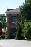
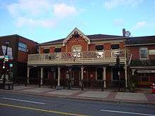
List of historic places in Regional Municipality of Peel

Brampton

Name Address Municipality PC Coordinates IDF IDP IDM Image
Armoury 2 Chapel Street Brampton 43°41′12″N 79°45′28″E / 43.6867°N 79.7579°E / 43.6867; 79.7579 (Armoury) 9726
Brampton GO Station and VIA Station, formerly a Canadian National Railways station 27 Church Street West Brampton L6X 43°41′13″N 79°45′54″E / 43.687°N 79.765°E / 43.687; 79.765 (Brampton GO Station and VIA Station, formerly a Canadian National Railways station) 4567
More images
Dominion Building 8 Queen Street East Brampton L6V 43°41′10″N 79°45′35″E / 43.686237°N 79.759672°E / 43.686237; 79.759672 (Dominion Building) 9743
More images

Caledon

Name Address Municipality PC Coordinates IDF IDP IDM Image
Melville White Church and Cemetery 15962 Mississauga Road Caledon 43°46′40″N 79°58′51″W / 43.7777°N 79.9809°W / 43.7777; -79.9809 (Melville White Church and Cemetery) 15540
Millcroft Inn 55 John Street Caledon 43°51′23″N 80°04′35″W / 43.8563°N 80.0764°W / 43.8563; -80.0764 (Millcroft Inn) 15530
Old Caledon Township Hall 18365 Hurontario Street Caledon 43°51′34″N 79°59′41″W / 43.8594°N 79.9947°W / 43.8594; -79.9947 (Old Caledon Township Hall) 15541
Patullo – McDiarmid Stone Fence 1043 The Grange Sideroad Caledon 43°47′05″N 79°58′51″W / 43.7846°N 79.9809°W / 43.7846; -79.9809 (Patullo – McDiarmid Stone Fence) 15340
Robinson-Schafer House 15024 Hurontario Street Caledon 43°47′37″N 79°54′20″W / 43.7935°N 79.9056°W / 43.7935; -79.9056 (Robinson-Schafer House) 15342
Rosehill Schoolhouse 20386 Kennedy Caledon 43°54′33″N 80°02′19″W / 43.9092°N 80.0385°W / 43.9092; -80.0385 (Rosehill Schoolhouse) 15670
St. Andrew's Presbyterian Church and Cemetery 17621 St. Andrew's Caledon 43°53′02″N 79°55′54″W / 43.8838°N 79.9318°W / 43.8838; -79.9318 (St. Andrew's Presbyterian Church and Cemetery) 15672
Silver Creek Schoolhouse 16419 Kennedy Caledon 43°49′50″N 79°55′54″W / 43.8305°N 79.9317°W / 43.8305; -79.9317 (Silver Creek Schoolhouse) 15671
Terra Cotta Community Hall 18 High Caledon 43°43′10″N 79°56′05″W / 43.7194°N 79.9347°W / 43.7194; -79.9347 (Terra Cotta Community Hall) 15373
True Blue Masonic Lodge No. 98 16 Nancy Caledon 43°52′41″N 79°44′16″W / 43.8781°N 79.7378°W / 43.8781; -79.7378 (True Blue Masonic Lodge No. 98) 15420
Ward-Dods-Millcroft House 55 John Street Caledon 43°51′21″N 80°04′36″W / 43.8557°N 80.0766°W / 43.8557; -80.0766 (Ward-Dods-Millcroft House) 15533
Wiggins-Armstrong House 15078 Kennedy Caledon 43°48′15″N 79°53′47″W / 43.8043°N 79.8963°W / 43.8043; -79.8963 (Wiggins-Armstrong House) 15684

Mississauga

Name Address Municipality PC Coordinates IDF IDP IDM Image
Abigail Street House c. 1850 27 Mill Street Mississauga L5M 43°34′54″N 79°42′40″E / 43.5817°N 79.711°E / 43.5817; 79.711 (Abigail Street House c. 1850) 13815
Adamson Estate - mansion c.1919 850 Enola Avenue Mississauga L5G 43°33′46″N 79°34′06″E / 43.5628°N 79.5683°E / 43.5628; 79.5683 (Adamson Estate) 9996
More images
Bamford House c.1875 292 Queen Street South Mississauga L5M 43°34′44″N 79°42′36″E / 43.5789°N 79.71°E / 43.5789; 79.71 (Bamford House c.1875) 13816
Benares c.1835 and 1857 1507 Clarkson Road North Mississauga L5J 43°31′38″N 79°38′14″E / 43.5271°N 79.6373°E / 43.5271; 79.6373 (Benares c.1835 and 1857) 13907
Bradley House, c. 1830 Bradley Museum, 1620 Orr Road Mississauga L5J 43°30′48″N 79°36′41″E / 43.5132°N 79.6113°E / 43.5132; 79.6113 (Bradley House, c. 1830) 14886
Britannia United Church and Cemetery c.1843 5961 Hurontario Mississauga 43°37′30″N 79°40′39″E / 43.625°N 79.6776°E / 43.625; 79.6776 (Britannia United Church and Cemetery c.1843) 15022
Brown/McCaughtery House 1614 Wintergrove Gardens Mississauga 43°35′09″N 79°42′05″E / 43.5857°N 79.7014°E / 43.5857; 79.7014 (Brown/McCaughtery House) 15023
Bussell House 7420 Ninth Mississauga 43°35′06″N 79°48′06″E / 43.5851°N 79.8016°E / 43.5851; 79.8016 (Bussell House) 16721
Canavan House 1173 Queen Victoria Avenue Mississauga 43°31′53″N 79°36′58″E / 43.5314°N 79.616°E / 43.5314; 79.616 (Canavan House) 15538
Cawthra-Elliot Estate 1507 Cawthra Road Mississauga L5G 43°34′47″N 79°34′47″E / 43.5797°N 79.5797°E / 43.5797; 79.5797 (Cawthra-Elliot Estate) 3024
More images
Charles Hamilton House 84 High Street East Mississauga 43°33′20″N 79°35′00″E / 43.5556°N 79.5834°E / 43.5556; 79.5834 (Charles Hamilton House) 15537
Cherry Hill House 680 Silver Creek Boulevard Mississauga 43°35′47″N 79°36′13″E / 43.5964°N 79.6036°E / 43.5964; 79.6036 (Cherry Hill House) 15539
Clarke Memorial Hall 161 Lakeshore Mississauga L5H 43°32′54″N 79°35′21″E / 43.5483°N 79.5891°E / 43.5483; 79.5891 (Clarke Memorial Hall) 14441
Cotton-Hawksworth House 1234 Old River Mississauga 43°33′34″N 79°35′19″E / 43.5594°N 79.5886°E / 43.5594; 79.5886 (Cotton-Hawksworth House) 14973
Credit Valley Railway Station 78, William Street Mississauga 43°35′04″N 79°43′09″E / 43.5845°N 79.7193°E / 43.5845; 79.7193 (Credit Valley Railway Station) 15595
Crozier Farmhouse 4265 Perivale Road Mississauga 43°34′36″N 79°40′01″E / 43.5768°N 79.667°E / 43.5768; 79.667 (Crozier Farmhouse) 15596
Derry House 875 Enola Avenue Mississauga 43°33′46″N 79°34′06″E / 43.5629°N 79.5682°E / 43.5629; 79.5682 (Derry House) 15491
Derry West Cemetery 25 Derry Road West Mississauga L5W 43°38′44″N 79°42′24″E / 43.6455°N 79.7068°E / 43.6455; 79.7068 (Derry West Cemetery) 13843
Eden Cemetery 2830 Derry Mississauga 43°35′27″N 79°46′04″E / 43.5909°N 79.7679°E / 43.5909; 79.7679 (Eden Cemetery) 14948
Elliott House 5732 Kennedy Road Mississauga 43°37′48″N 79°39′39″E / 43.63°N 79.6609°E / 43.63; 79.6609 (Elliott House) 15492
Franklin House 263 Queen Street South Mississauga L5M 43°34′47″N 79°42′40″E / 43.5798°N 79.7111°E / 43.5798; 79.7111 (Franklin House) 14102
Graydon House 62 Queen Street South Mississauga 43°35′07″N 79°43′07″E / 43.5854°N 79.7186°E / 43.5854; 79.7186 (Graydon House) 15494
Graydon-Atkinson House 157 Queen Street South Mississauga L5M 43°34′57″N 79°42′54″E / 43.5826°N 79.7149°E / 43.5826; 79.7149 (Graydon-Atkinson House) 14577
Howard Eaton Confectionary 228 Queen Street South Mississauga L5M 43°34′50″N 79°42′45″E / 43.5806°N 79.7124°E / 43.5806; 79.7124 (Howard Eaton Confectionary) 14578
Hyde Mill Ruins Ontario Street East Mississauga L5M 43°35′11″N 79°43′00″E / 43.5864°N 79.7167°E / 43.5864; 79.7167 (Hyde Mill Ruins) 13848
Leslie Log House 4415 Mississauga Road Mississauga 43°33′50″N 79°41′22″E / 43.5639°N 79.6895°E / 43.5639; 79.6895 (Leslie Log House) 15495
Bell Gairdner Estate (Holcim Waterfront Estate) c. 1937 2700 Lakeshore Road West Mississauga L5J 43°29′04″N 79°37′26″E / 43.484551°N 79.623750°E / 43.484551; 79.623750 (Bell Gairdner Estate (Holcim Waterfront Estate) c. 1937)

Unsorted

Name Address Municipality PC Coordinates IDF IDP IDM Image
Lislehurst 3369 Mississauga Road Mississauga 43°33′17″N 79°40′05″E / 43.5546°N 79.668°E / 43.5546; 79.668 (Lislehurst) 14962
McClure House 2075, Derry Road West Mississauga 43°36′22″N 79°45′07″E / 43.6061°N 79.752°E / 43.6061; 79.752 (McClure House) 15653
Meadowvale Village Hall 6970, Second Line West Mississauga 43°37′35″N 79°43′37″E / 43.6264°N 79.727°E / 43.6264; 79.727 (Meadowvale Village Hall) 15496
Meadowvale Village Heritage Conservation District Along Old Derry Road, from a visual narrowing of the road from the east and the Credit River from the west. The northern limit to the village occurs at the intersection of Pond Street and the southern limit is considered the Community Hall property. Mississauga 43°37′38″N 79°43′39″E / 43.6271°N 79.7276°E / 43.6271; 79.7276 (Meadowvale Village Heritage Conservation District) 15170
Middle Road Bridge 1700 Sherway Drive Mississauga L4X 43°36′25″N 79°34′08″E / 43.607°N 79.569°E / 43.607; 79.569 (Middle Road Bridge) 3026
More images
Montreal House 210 Queen Street South Mississauga L5M 43°34′51″N 79°42′47″E / 43.5809°N 79.713°E / 43.5809; 79.713 (Montreal House) 14584
Moore-Stanfield House 1295, Burnhamthorpe Mississauga 43°37′08″N 79°36′23″E / 43.6188°N 79.6065°E / 43.6188; 79.6065 (Moore-Stanfield House) 15158
Moore's Cemetery 2030, Derry Mississauga 43°41′07″N 79°39′46″E / 43.6854°N 79.6628°E / 43.6854; 79.6628 (Moore's Cemetery) 15132
Old Erindale Public School 3057 Mississauga Road Mississauga 43°32′39″N 79°39′42″E / 43.5443°N 79.6616°E / 43.5443; 79.6616 (Old Erindale Public School) 15110
Old Grammar School 327, Queen Street South Mississauga L5N 43°35′31″N 79°43′30″E / 43.592°N 79.725°E / 43.592; 79.725 (Old Grammar School) 14583
Old Port Credit Heritage Conservation District Bounded by Lakeshore Road West, Lake Ontario, Mississauga Road South, and the Credit River Mississauga 43°32′52″N 79°35′10″E / 43.5477°N 79.5862°E / 43.5477; 79.5862 (Old Port Credit Heritage Conservation District) 15169
Paterson Manning House 13 Thomas Street Mississauga L5M 43°34′47″N 79°42′45″E / 43.5798°N 79.7124°E / 43.5798; 79.7124 (Paterson Manning House) 14591
Riverwood 1447, Burnhamthorpe Road Mississauga L5C 43°33′47″N 79°40′15″E / 43.563°N 79.6709°E / 43.563; 79.6709 (Riverwood) 14143
More images
Robert Sloan House 831, Sunningdale Bend Mississauga 43°30′51″N 79°37′12″E / 43.5142°N 79.6201°E / 43.5142; 79.6201 (Robert Sloan House) 15655
Robinson-Adamson House 1921, Dundas Street West Mississauga 43°32′22″N 79°39′49″E / 43.5395°N 79.6635°E / 43.5395; 79.6635 (Robinson-Adamson House) 15498
Sayers/Larson Residence 1723, Birchwood Drive Mississauga 43°31′24″N 79°37′49″E / 43.5233°N 79.6304°E / 43.5233; 79.6304 (Sayers/Larson Residence) 16326
St. Andrew's Presbyterian Church 295 Queen Street South Mississauga L5M 43°34′44″N 79°42′35″E / 43.5788°N 79.7098°E / 43.5788; 79.7098 (St. Andrew's Presbyterian Church) 14593
St. Lawrence Starch Limited Administration Building 141, Lakeshore Road East Mississauga L5G 43°33′19″N 79°34′53″E / 43.5553°N 79.5815°E / 43.5553; 79.5815 (St. Lawrence Starch Limited Administration Building) 13846
St. Peter's Rectory 1556, Dundas Mississauga 43°32′46″N 79°39′10″E / 43.5462°N 79.6527°E / 43.5462; 79.6527 (St. Peter's Rectory) 15189
Streetsville Village Hall 280 Queen Street South Mississauga 43°34′44″N 79°42′38″E / 43.579°N 79.7105°E / 43.579; 79.7105 (Streetsville Village Hall) 15522
Sylvan Oaks 7564, Tenth Mississauga 43°35′51″N 79°47′42″E / 43.5974°N 79.7949°E / 43.5974; 79.7949 (Sylvan Oaks) 14983
The Kindree Family Cemetery 3790, Derry Road West Mississauga L5N 43°34′44″N 79°46′53″E / 43.579°N 79.7814°E / 43.579; 79.7814 (The Kindree Family Cemetery) 3027
Timothy Street House 41, Mill Street Mississauga 43°34′57″N 79°42′36″E / 43.5826°N 79.71°E / 43.5826; 79.71 (Timothy Street House) 15499
Tomlinson-Johnston House 16 Scarboro Street Mississauga L4T 43°42′21″N 79°38′52″E / 43.7057°N 79.6478°E / 43.7057; 79.6478 (Tomlinson-Johnston House) 13822
W. T. Gray House 90 High Street East Mississauga 43°33′22″N 79°34′59″E / 43.556°N 79.583°E / 43.556; 79.583 (W. T. Gray House) 15673
William Barber House 5155 Mississauga Road Mississauga L5M 43°34′17″N 79°41′58″E / 43.5714°N 79.6995°E / 43.5714; 79.6995 (William Barber House) 13821
William Cunningham House 19 Barry Avenue Mississauga L5M 43°34′44″N 79°42′42″E / 43.5788°N 79.7116°E / 43.5788; 79.7116 (William Cunningham House) 13817
16775 Centreville Creek Road 16775 Centreville Creek Road Caledon 43°53′19″N 79°50′43″W / 43.8886°N 79.8452°W / 43.8886; -79.8452 (16775 Centreville Creek Road) 15445
Alexander Smith Farm Complex 14650 Heart Lake Road Caledon 43°47′45″N 79°51′41″W / 43.7958°N 79.8614°W / 43.7958; -79.8614 (Alexander Smith Farm Complex) 15523
Alton Mechanics' Institute and Library 1456 Queen Street West Caledon 43°51′33″N 80°04′12″W / 43.8593°N 80.0699°W / 43.8593; -80.0699 (Alton Mechanics' Institute and Library) 15525
Alton Mill 1402 Queen Street Caledon L7K 43°51′N 80°04′W / 43.85°N 80.07°W / 43.85; -80.07 (Alton Mill) 2088
Balsam Villa 19179 Centreville Creek Caledon 43°57′02″N 79°55′48″W / 43.9506°N 79.93°W / 43.9506; -79.93 (Balsam Villa) 15446
Caledon Agricultural Society Building 18297 Hurontario Street Caledon 43°51′29″N 79°59′34″W / 43.858°N 79.9929°W / 43.858; -79.9929 (Caledon Agricultural Society Building) 15468
Cheltenham Store 14386 Creditview Road Caledon 43°45′07″N 79°55′16″W / 43.7519°N 79.9212°W / 43.7519; -79.9212 (Cheltenham Store) 15477
Claude Presbyterian Church 15175 Hurontario Street Caledon 43°47′47″N 79°54′35″W / 43.7965°N 79.9096°W / 43.7965; -79.9096 (Claude Presbyterian Church) 15470
Cunnington-Osborne Complex 5164 The Grange Sideroad Caledon 43°51′46″N 79°53′42″W / 43.8629°N 79.8951°W / 43.8629; -79.8951 (Cunnington-Osborne Complex) 15157
Graham Mill 104 Maple Avenue Caledon 43°47′38″N 79°55′33″W / 43.7939°N 79.9257°W / 43.7939; -79.9257 (Graham Mill) 15479
Greystone Farm 396 King Street Caledon 43°43′17″N 79°55′57″W / 43.7214°N 79.9326°W / 43.7214; -79.9326 (Greystone Farm) 15481
Haines-Lyons House 14318 Creditview Road Caledon 43°45′01″N 79°55′09″W / 43.7504°N 79.9193°W / 43.7504; -79.9193 (Haines-Lyons House) 15246
Laurel Hill Cemetery 389 Centennial Caledon 43°53′08″N 79°44′48″W / 43.8856°N 79.7466°W / 43.8856; -79.7466 (Laurel Hill Cemetery) 15482
Wikimedia Commons has media related to Cultural heritage monuments in Peel Regional Municipality.
This article is issued from Wikipedia - version of the 5/9/2016. The text is available under the Creative Commons Attribution/Share Alike but additional terms may apply for the media files.