List of historic places in Southwestern Ontario

This is a list of historic places in Southwestern Ontario, containing heritage sites listed on the Canadian Register of Historic Places (CRHP), all of which are designated as historic places either locally, provincially, territorially, nationally, or by more than one level of government.

The following subregions have separate listings:

List of historic places in other subregions

Bruce County

Name Address Municipality PC Coordinates IDF IDP IDM Image
Keeper's House Huron-Kinloss 44°04′47″N 81°45′00″W / 44.0796°N 81.75°W / 44.0796; -81.75 (Keeper's House) 4678
Point Clark Lighthouse National Historic Site of Canada Amberly Huron-Kinloss (Point Clark) 44°04′22″N 81°45′26″W / 44.0728°N 81.7573°W / 44.0728; -81.7573 (Point Clark Lighthouse National Historic Site of Canada) 16772
More images
Kincardine Lighthouse 236 Harbour Street Kincardine 44°10′38″N 81°38′18″W / 44.1771°N 81.6382°W / 44.1771; -81.6382 (Kincardine Lighthouse) 11095
More images
Lightstation: Annex Cove Island Northern Bruce Peninsula 45°19′37″N 81°44′06″W / 45.3269°N 81.735°W / 45.3269; -81.735 (Lightstation: Annex) 7035
More images
Chantry Island Lightstation Tower Lightstation, Chantry Island Saugeen Shores 44°28′59″N 81°24′00″W / 44.483°N 81.4°W / 44.483; -81.4 (Chantry Island Lighthouse) 3293
More images

Chatham-Kent

Name Address Municipality PC Coordinates IDF IDP IDM Image
Buxton Settlement National Historic Site of Canada 7th Concession, Dillon and Drake Roads Chatham-Kent N0P 42°16′00″N 82°11′00″W / 42.2667°N 82.1833°W / 42.2667; -82.1833 (Buxton Settlement National Historic Site of Canada) 1206
More images
Fairfield on the Thames National Historic Site of Canada Chatham-Kent 42°37′55″N 81°52′11″W / 42.632°N 81.8696°W / 42.632; -81.8696 (Fairfield on the Thames National Historic Site of Canada) 15726
Uncle Tom's Cabin - Harris House 29251 Uncle Tom's Road Chatham-Kent N0P 42°35′06″N 82°11′45″W / 42.585°N 82.1958°W / 42.585; -82.1958 (Uncle Tom's Cabin - Harris House) 8199
Uncle Tom's Cabin - Henson House 29251 Uncle Tom's Road Chatham-Kent N0P 42°35′08″N 82°11′45″W / 42.5856°N 82.1958°W / 42.5856; -82.1958 (Uncle Tom's Cabin - Henson House) 8200
Uncle Tom's Cabin - Pioneer Church 29251 Uncle Tom's Road Chatham-Kent N0P 42°35′07″N 82°11′46″W / 42.5854°N 82.196°W / 42.5854; -82.196 (Uncle Tom's Cabin - Pioneer Church) 8198

Elgin County

Name Address Municipality PC Coordinates IDF IDP IDM Image
Port Burwell Lighthouse 17 Robinson Bayham N0J 42°38′43″N 80°48′24″W / 42.6453°N 80.8068°W / 42.6453; -80.8068 (Port Burwell Lighthouse) 7787
More images
Port Stanley National Historic Site of Canada junction of Bridge, Main and Colbourne Streets Central Elgin (Port Stanley) 42°39′58″N 81°12′43″W / 42.6661°N 81.212°W / 42.6661; -81.212 (Port Stanley National Historic Site of Canada) 15722
Southwold Earthworks National Historic Site of Canada Southwold 42°40′27″N 81°21′37″W / 42.6741°N 81.3602°W / 42.6741; -81.3602 (Southwold Earthworks National Historic Site of Canada) 11706
More images
Canada Southern Railway Station 810 Talbot Street St. Thomas N5R 42°46′41″N 81°11′10″W / 42.778°N 81.186°W / 42.778; -81.186 (Canada Southern Railway Station) 6495
More images
St. Thomas City Hall National Historic Site of Canada 545 Talbot Street St. Thomas N5P 42°46′45″N 81°11′34″W / 42.7792°N 81.1927°W / 42.7792; -81.1927 (St. Thomas City Hall National Historic Site of Canada) 9166
More images
St. Thomas Pioneer Church 55 Walnut Street St. Thomas N5R 42°46′38″N 81°12′22″W / 42.7772°N 81.2062°W / 42.7772; -81.2062 (St. Thomas Pioneer Church) 10581

Grey County

Name Address Municipality PC Coordinates IDF IDP IDM Image
Tower Griffith Island Georgian Bluffs 44°51′04″N 80°53′24″W / 44.851°N 80.89°W / 44.851; -80.89 (Tower) 3292
Billy Bishop Boyhood Home National Historic Site of Canada 948 Third Avenue West Owen Sound N4K 44°33′59″N 80°56′54″W / 44.5663°N 80.9484°W / 44.5663; -80.9484 (Billy Bishop Boyhood Home National Historic Site of Canada) 4028
More images
Former Owen Sound Bus Terminal 1023 2nd Avenue East Owen Sound 44°34′06″N 80°56′34″W / 44.5682°N 80.9428°W / 44.5682; -80.9428 (Former Owen Sound Bus Terminal) 15128
Former Reitman's Store 992 2nd Avenue East Owen Sound 44°34′03″N 80°56′36″W / 44.5675°N 80.9434°W / 44.5675; -80.9434 (Former Reitman's Store) 15129

Haldimand County

Name Address Municipality PC Coordinates IDF IDP IDM Image
Caledonia Town Hall 80 Caithness Street East Haldimand N3W 43°04′23″N 79°56′56″W / 43.0731°N 79.9488°W / 43.0731; -79.9488 (Caledonia Town Hall) 18022 10808
Campbell-Pine House 396 Highway 3 Haldimand N0A 42°56′43″N 79°50′43″W / 42.9454°N 79.8454°W / 42.9454; -79.8454 (Campbell-Pine House) 10807
Charles Reicheld House 601 Regional Road 12 Haldimand N0A 42°50′28″N 79°53′17″W / 42.8411°N 79.888°W / 42.8411; -79.888 (Charles Reicheld House) 10900
Cook-Peart House 3355 River Road Haldimand N3W 43°00′12″N 79°52′44″W / 43.0034°N 79.8789°W / 43.0034; -79.8789 (Cook-Peart House) 10264
Cottonwood Mansion 740 Regional Road 53 Haldimand N0A 42°49′07″N 79°55′30″W / 42.8185°N 79.9251°W / 42.8185; -79.9251 (Cottonwood Mansion) 10896
Cranston Post Office 915 Regional Road 29 Haldimand N3W 43°00′27″N 79°57′04″W / 43.0075°N 79.9511°W / 43.0075; -79.9511 (Cranston Post Office) 10909
Dochstader Hotel 3220 River Road Haldimand N3W 43°00′17″N 79°52′44″W / 43.0048°N 79.879°W / 43.0048; -79.879 (Dochstader Hotel) 10954
Duff House 5 Mohawk Street East Haldimand N0A 42°57′08″N 79°51′19″W / 42.9523°N 79.8554°W / 42.9523; -79.8554 (Duff House) 15105
Edmondson-Weaver House 1613 Concession 13 Haldimand N0A 42°53′33″N 80°10′04″W / 42.8924°N 80.1679°W / 42.8924; -80.1679 (Edmondson-Weaver House) 10976
Empire School 3038 Regional Road 9 (York Road) Haldimand 43°02′12″N 79°56′38″W / 43.0368°N 79.9439°W / 43.0368; -79.9439 (Empire School) 15226
Enniskillen Lodge 39 Front Street Haldimand N3W 43°02′12″N 79°56′38″W / 43.0368°N 79.9439°W / 43.0368; -79.9439 (Enniskillen Lodge) 11108
Furry Tavern 2511 North Shore Road Haldimand N0A 42°55′26″N 79°28′40″W / 42.924°N 79.4779°W / 42.924; -79.4779 (Furry Tavern) 10089
Gibson-Alderson House 4830 Highway 6 Haldimand N3W 43°03′32″N 79°58′06″W / 43.059°N 79.9682°W / 43.059; -79.9682 (Gibson-Alderson House) 10834
Gibson-Bunn Building 19 Cayuga Street North Haldimand N0A 42°52′16″N 79°46′53″W / 42.871°N 79.7815°W / 42.871; -79.7815 (Gibson-Bunn Building) 10098
The Gore School 699 Haldimand Road 9 Haldimand N0A 42°57′42″N 79°58′18″W / 42.9616°N 79.9717°W / 42.9616; -79.9717 (The Gore School) 11177
Gypsum Mines School 1256 Regional Road 17 Haldimand N0A 42°55′22″N 79°47′25″W / 42.9227°N 79.7902°W / 42.9227; -79.7902 (Gypsum Mines School) 11000
Hoover Log House 95 Concession 4 Haldimand N0A 42°49′44″N 79°55′48″W / 42.829°N 79.9299°W / 42.829; -79.9299 (Hoover Log House) 11109
Jeffrey Residence 1615 Concession 13 Haldimand N0A 42°53′33″N 80°10′03″W / 42.8924°N 80.1675°W / 42.8924; -80.1675 (Jeffrey Residence) 11141
John Fry House 1915 Regional Road 3 Haldimand N1A 42°51′30″N 79°41′34″W / 42.8583°N 79.6927°W / 42.8583; -79.6927 (John Fry House) 11142
Jones-Doughty Residence 53 Talbot Street East Haldimand N0A 42°53′06″N 80°06′34″W / 42.8851°N 80.1094°W / 42.8851; -80.1094 (Jones-Doughty Residence) 11143
Kirkland House 3062 River Road Haldimand N0A 42°54′48″N 79°47′13″W / 42.9133°N 79.787°W / 42.9133; -79.787 (Kirkland House) 11144
Lalor Estate 241 Broad Street West Haldimand N1A 42°54′18″N 79°37′16″W / 42.9049°N 79.6212°W / 42.9049; -79.6212 (Lalor Estate) 11149
Lighthouse Mohawk Island National Wildlife Area Haldimand 42°50′04″N 79°31′21″W / 42.8345°N 79.5226°W / 42.8345; -79.5226 (Lighthouse) 9770
More images
McKinnon-Smith Residence 156 Caithness Street East Haldimand N3W 43°04′21″N 79°56′47″W / 43.0724°N 79.9465°W / 43.0724; -79.9465 (McKinnon-Smith Residence) 10931
Mooney Residence 210 Broad Street West Haldimand N1A 42°54′17″N 79°37′15″W / 42.9047°N 79.6207°W / 42.9047; -79.6207 (Mooney Residence) 11164
Murray-Walton House and Farm 266 Irish Line Haldimand N0A 42°55′43″N 79°51′56″W / 42.9287°N 79.8655°W / 42.9287; -79.8655 (Murray-Walton House and Farm) 11167
Nanticoke National Historic Site of Canada 38 Rainham Road Haldimand (Nanticoke) N0A 42°47′50″N 80°03′11″W / 42.7973°N 80.053°W / 42.7973; -80.053 (Nanticoke National Historic Site of Canada) 17701
Old Caledonia Mill 149 Forfar Street West Haldimand N3W 43°04′18″N 79°57′29″W / 43.0717°N 79.958°W / 43.0717; -79.958 (Old Caledonia Mill) 11169
Ruthven Gatehouse 243 Highway 54 Haldimand (Cayuga) 42°58′53″N 79°52′18″W / 42.981273°N 79.871679°W / 42.981273; -79.871679 (Ruthven Gatehouse) 10547
Ruthven Park 243 Highway 54 Haldimand (Cayuga) 42°58′53″N 79°52′24″W / 42.98134°N 79.873267°W / 42.98134; -79.873267 (Ruthven Park) 12099 10564 11134
St. John's Parish Hall Front Street Haldimand N3W 43°02′12″N 79°56′38″W / 43.0368°N 79.9439°W / 43.0368; -79.9439 (St. John's Parish Hall) 11176
Seneca Bridge 651 Caithness Street East Haldimand N3W 43°03′54″N 79°56′01″W / 43.065078°N 79.933487°W / 43.065078; -79.933487 (Seneca Bridge) 11173
Thompson-Colwell House 86 Sutherland Street East Haldimand N3W 43°04′27″N 79°56′52″W / 43.0743°N 79.9479°W / 43.0743; -79.9479 (Thompson-Colwell House) 11178
Toll House 4 Argyle Street North Haldimand N3W 43°04′24″N 79°57′06″W / 43.0734°N 79.9518°W / 43.0734; -79.9518 (Toll House) 10932
Upper Farm Cemetery 863 Keith Richardson Parkway Haldimand N0A 42°53′37″N 80°08′29″W / 42.8937°N 80.1413°W / 42.8937; -80.1413 (Upper Farm Cemetery) 10606
Vanderburgh House 4163 Highway 3 Haldimand N0A 42°52′16″N 79°46′53″W / 42.871°N 79.7815°W / 42.871; -79.7815 (Vanderburgh House) 10869
Wilson Pugsley MacDonald Museum 3513 Rainham Road Haldimand N0A 42°54′01″N 80°00′14″W / 42.9002°N 80.004°W / 42.9002; -80.004 (Wilson Pugsley MacDonald Museum) 10591

Huron County

Name Address Municipality PC Coordinates IDF IDP IDM Image
Carolinian Oak Tree 81340 Mill Place Ashfield–Colborne–Wawanosh 43°45′08″N 81°42′59″W / 43.7522°N 81.7163°W / 43.7522; -81.7163 (Carolinian Oak Tree) 15674
Acheson House 55 Nelson Goderich N7A 43°44′44″N 81°42′30″W / 43.7456°N 81.7083°W / 43.7456; -81.7083 (Acheson House) 14797
Captain Dancy House 108 East Street Goderich N7A 43°44′35″N 81°42′22″W / 43.743°N 81.7062°W / 43.743; -81.7062 (Captain Dancy House) 14145
The Cottage 135 Essex Street Goderich 43°44′15″N 81°43′26″W / 43.7376°N 81.724°W / 43.7376; -81.724 (The Cottage) 15293
Ford House 34 Wellington Street South Goderich 43°44′31″N 81°43′04″W / 43.742°N 81.7178°W / 43.742; -81.7178 (Ford House) 15252
Former Bank of Upper Canada Building 46 West Street Goderich N7A 43°44′34″N 81°42′47″W / 43.7429°N 81.713°W / 43.7429; -81.713 (Former Bank of Upper Canada Building) 14181
Garrow House 65 Montreal Street Goderich N7A 43°44′29″N 81°42′48″W / 43.7414°N 81.7134°W / 43.7414; -81.7134 (Garrow House) 14146
Garvey House 97 St. Patrick Goderich N7A 43°44′38″N 81°42′57″W / 43.7439°N 81.7157°W / 43.7439; -81.7157 (Garvey House) 14590
Gibbons Townhouse 33 Montreal Street Goderich N7A 43°44′32″N 81°42′45″W / 43.7422°N 81.7124°W / 43.7422; -81.7124 (Gibbons Townhouse) 14148
Goderich Canadian Pacific Railway Station 1 Ship Goderich N7A 43°44′41″N 81°43′33″W / 43.7446°N 81.7259°W / 43.7446; -81.7259 (Goderich Canadian Pacific Railway Station) 14594
More images
Goderich Public Library 52 Montreal Street Goderich N7A 43°44′29″N 81°42′49″W / 43.7414°N 81.7136°W / 43.7414; -81.7136 (Goderich Public Library) 14182
Goderich Town Hall 57 West Street Goderich N7A 43°44′35″N 81°42′51″W / 43.7431°N 81.7141°W / 43.7431; -81.7141 (Goderich Town Hall) 14162
Hands Bakery 169 West Street Goderich N7A 43°44′35″N 81°43′07″W / 43.743°N 81.7187°W / 43.743; -81.7187 (Hands Bakery) 14163
Henry Horton Cottage 156 East Street Goderich N7A 43°44′35″N 81°42′14″W / 43.743°N 81.7039°W / 43.743; -81.7039 (Henry Horton Cottage) 14721
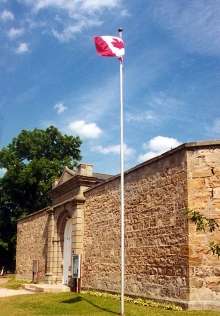
Huron County Gaol National Historic Site of Canada 181 Victoria Street North Goderich N7A 43°44′59″N 81°42′28″W / 43.7496°N 81.7079°W / 43.7496; -81.7079 (Huron County Gaol National Historic Site of Canada) 12027
Huron County Museum 110 North Street Goderich N7A 43°44′49″N 81°42′40″W / 43.747°N 81.7112°W / 43.747; -81.7112 (Huron County Museum) 14165
Hutchinson House 191 Britannia Goderich N7A 43°44′21″N 81°43′16″W / 43.7392°N 81.721°W / 43.7392; -81.721 (Hutchinson House) 14902
Judges' House 85 Essex Goderich N7A 43°44′24″N 81°43′27″W / 43.7401°N 81.7241°W / 43.7401; -81.7241 (Judges' House) 14589
Menesetung Bridge Goderich N7A 43°45′05″N 81°42′50″W / 43.7515°N 81.714°W / 43.7515; -81.714 (Menesetung Bridge) 15690
More images
Polley's Livery Stable 35 South Street Goderich N7A 43°44′29″N 81°42′40″W / 43.7415°N 81.7112°W / 43.7415; -81.7112 (Polley's Livery Stable) 14202
Samuel Platt House 148 Victoria Street North Goderich 43°44′53″N 81°42′28″W / 43.7481°N 81.7078°W / 43.7481; -81.7078 (Samuel Platt House) 14937
Seegmiller House 87 St. Patrick Street Goderich N7A 43°44′38″N 81°42′53″W / 43.7438°N 81.7147°W / 43.7438; -81.7147 (Seegmiller House) 14144
Sloane-Cooper House 80 Hamilton Street Goderich N7A 43°44′42″N 81°42′31″W / 43.745°N 81.7086°W / 43.745; -81.7086 (Sloane-Cooper House) 14166
The Square Goderich N7A 43°44′35″N 81°42′40″W / 43.743°N 81.7112°W / 43.743; -81.7112 (The Square) 7450
More images
Strachan House 20 Wellington Street South Goderich 43°44′33″N 81°43′04″W / 43.7424°N 81.7178°W / 43.7424; -81.7178 (Strachan House) 15251
Tom House 82 Wellesley Street Goderich N7A 43°44′25″N 81°43′16″W / 43.7404°N 81.7211°W / 43.7404; -81.7211 (Tom House) 14168
Wellesley House 203 Lighthouse Street Goderich N7A 43°44′32″N 81°43′15″W / 43.7421°N 81.7208°W / 43.7421; -81.7208 (Wellesley House) 14169
West Street Heritage Conservation District West Street Goderich N7A 43°44′34″N 81°42′47″W / 43.7429°N 81.7131°W / 43.7429; -81.7131 (West Street Heritage Conservation District) 14681
Whitely House 58 Elgin Avenue East Goderich 43°44′26″N 81°42′32″W / 43.7405°N 81.7089°W / 43.7405; -81.7089 (Whitely House) 14947
Box Residence 57 High Street Huron East N0K 43°33′08″N 81°23′45″W / 43.5523°N 81.3959°W / 43.5523; -81.3959 (Box Residence) 14563
Brussels Library 402 Turnberry Street Huron East 43°44′39″N 81°14′59″W / 43.7443°N 81.2497°W / 43.7443; -81.2497 (Brussels Library) 15405
More images
Cardno Block 39 Main Street South Huron East N0K 43°33′16″N 81°23′33″W / 43.5544°N 81.3926°W / 43.5544; -81.3926 (Cardno Block) 14565
Carnohan House 123 James Street Huron East N0K 43°33′25″N 81°23′55″W / 43.5569°N 81.3985°W / 43.5569; -81.3985 (Carnohan House) 14568
Carroll Residence 131 Goderich Street Huron East N0K 43°33′23″N 81°24′00″W / 43.5563°N 81.3999°W / 43.5563; -81.3999 (Carroll Residence) 14569
Cornish Residence 17 Helen Street Huron East N0K 43°33′24″N 81°23′54″W / 43.5568°N 81.3982°W / 43.5568; -81.3982 (Cornish Residence) 14850
Doig Residence 98 Goderich Street West Huron East N0K 43°33′20″N 81°23′53″W / 43.5555°N 81.3981°W / 43.5555; -81.3981 (Doig Residence) 14851
The Former Seaforth Public School 13 Church Street Huron East 43°33′18″N 81°23′43″W / 43.5551°N 81.3953°W / 43.5551; -81.3953 (The Former Seaforth Public School) 15421
Hansen Residence 23 Sparling Street Huron East N0K 43°33′20″N 81°24′00″W / 43.5555°N 81.4°W / 43.5555; -81.4 (Hansen Residence) 14566
Harpurhey Cemetery Harpurhey Road Huron East 43°33′37″N 81°24′59″W / 43.5602°N 81.4165°W / 43.5602; -81.4165 (Harpurhey Cemetery) 15408
Horthy House 87 Main Street North Huron East 43°33′24″N 81°23′27″W / 43.5566°N 81.3907°W / 43.5566; -81.3907 (Horthy House) 15409
McIver Residence 41 John Street Huron East N0K 43°33′12″N 81°23′42″W / 43.5532°N 81.3951°W / 43.5532; -81.3951 (McIver Residence) 14582
Moncrieff Church 83506 Livingston Line Huron East 43°38′36″N 81°09′14″W / 43.6434°N 81.1538°W / 43.6434; -81.1538 (Moncrieff Church) 15423
Mullen House 92 Goderich Street Huron East N0K 43°33′18″N 81°23′50″W / 43.5551°N 81.3971°W / 43.5551; -81.3971 (Mullen House) 14570
Pinkney House 31 Goderich Street West Huron East 43°33′23″N 81°24′00″W / 43.5563°N 81.3999°W / 43.5563; -81.3999 (Pinkney House) 15415
Pletsch Residence 19 Sparling Street Huron East N0K 43°33′21″N 81°23′59″W / 43.5558°N 81.3998°W / 43.5558; -81.3998 (Pletsch Residence) 14530
Seaforth Heritage Conservation District Main Street Huron East 43°33′06″N 81°23′42″W / 43.5516°N 81.3949°W / 43.5516; -81.3949 (Seaforth Heritage Conservation District) 15418
Seaforth Town Hall 72 Main Street Huron East N0K 43°33′06″N 81°23′42″W / 43.5516°N 81.3949°W / 43.5516; -81.3949 (Seaforth Town Hall) 14567
The Shepherd Residence 148 Goderich Street West Huron East 43°33′24″N 81°24′04″W / 43.5568°N 81.4011°W / 43.5568; -81.4011 (The Shepherd Residence) 15956
Van Egmond Residence 80 Kippen Road Huron East (Tuckersmith) 43°32′21″N 81°24′19″W / 43.5393°N 81.4053°W / 43.5393; -81.4053 (Van Egmond Residence) 15422
Vanastra Park Gate and Posts London Road Huron East 43°34′56″N 81°31′43″W / 43.5822°N 81.5286°W / 43.5822; -81.5286 (Vanastra Park Gate and Posts) 15424
W.J. Carling House 73 Huron Street West South Huron N0M 43°13′N 81°17′W / 43.21°N 81.29°W / 43.21; -81.29 (W.J. Carling House) 7790

Lambton County

Name Address Municipality PC Coordinates IDF IDP IDM Image
First Commercial Oil Field National Historic Site of Canada Oil Springs N0N 42°47′00″N 82°07′00″W / 42.7833°N 82.1167°W / 42.7833; -82.1167 (First Commercial Oil Field National Historic Site of Canada) 1148
More images
Independent Order Odd Fellows Ridgely Lodge #250 2594 Kelly Road Oil Springs N0N 42°47′03″N 82°07′12″W / 42.7841°N 82.1199°W / 42.7841; -82.1199 (Independent Order Odd Fellows Ridgely Lodge #250) 17941
Langbank Post Office 2423 Kelly Road Oil Springs N0N 42°46′27″N 82°07′12″W / 42.7741°N 82.1199°W / 42.7741; -82.1199 (Langbank Post Office) 17962
Oil Springs Community Hall 4596 Oil Springs Line Oil Springs N0N 42°46′27″N 82°07′12″W / 42.7741°N 82.1199°W / 42.7741; -82.1199 (Oil Springs Community Hall) 17961
Oil Springs Railway Station 2423 Kelly Road Oil Springs N0N 42°46′22″N 82°07′18″W / 42.7729°N 82.1216°W / 42.7729; -82.1216 (Oil Springs Railway Station) 18021
Petrolia Orange Hall 4224 Petrolia Line Petrolia N0N 42°52′55″N 82°08′42″W / 42.8819°N 82.1451°W / 42.8819; -82.1451 (Petrolia Orange Hall) 1505
Victoria Hall / Petrolia Town Hall National Historic Site of Canada 411 Greenfield Street Petrolia N0N 42°52′50″N 82°08′47″W / 42.8805°N 82.1464°W / 42.8805; -82.1464 (Victoria Hall / Petrolia Town Hall National Historic Site of Canada) 7551
More images

Norfolk County

Name Address Municipality PC Coordinates IDF IDP IDM Image
Backhouse Grist Mill National Historic Site of Canada RR 3 Norfolk N0E 42°37′00″N 80°28′00″W / 42.6167°N 80.4667°W / 42.6167; -80.4667 (Backhouse Grist Mill National Historic Site of Canada) 7554
More images
Cliff Site National Historic Site of Canada Brant Hill in Port Dover Norfolk N0A 42°47′08″N 80°11′46″W / 42.7856°N 80.1961°W / 42.7856; -80.1961 (Cliff Site National Historic Site of Canada) 13398
Fort Norfolk National Historic Site of Canada Norfolk 42°41′56″N 80°19′31″W / 42.6989°N 80.3252°W / 42.6989; -80.3252 (Fort Norfolk National Historic Site of Canada) 16785
Lynnwood/Campbell-Reid House National Historic Site of Canada 21 Lynnwood Avenue Norfolk N3Y 42°50′16″N 80°18′12″W / 42.8379°N 80.3034°W / 42.8379; -80.3034 (Lynnwood/Campbell-Reid House National Historic Site of Canada) 12402
Van Norman-Guiler House 2318 Front Road Norfolk (Normandale) 42°42′39″N 80°18′45″W / 42.7108°N 80.3125°W / 42.7108; -80.3125 (Van Norman-Guiler House) 15347

Oxford County

Name Address Municipality PC Coordinates IDF IDP IDM Image
African Methodist Episcopal Cemetery Church St (Pick Line), Otterville Norwich N0J 42°55′53″N 80°36′30″W / 42.931463°N 80.608332°W / 42.931463; -80.608332 (African Methodist Episcopal Cemetery) 10775
Annandale House 30 Tillson Avenue, Tillsonburg Tillsonburg N4G 42°51′44″N 80°43′18″W / 42.862284°N 80.721668°W / 42.862284; -80.721668 (Annandale House) 4178 18001
More images
Curries United Church 465003 Curries Road, Curries Norwich N0J 43°04′17″N 80°43′14″W / 43.071443°N 80.720418°W / 43.071443; -80.720418 (Curries United Church) 10925
Knox Presbyterian Church (Norwich) 67 Main Street West, Norwich Norwich N0J 42°59′13″N 80°36′04″W / 42.986948°N 80.601176°W / 42.986948; -80.601176 (Knox Presbyterian Church (Norwich)) 11678
Museum School 656 Main Street North, Burgessville Norwich N0J 43°01′39″N 80°39′18″W / 43.027463°N 80.654954°W / 43.027463; -80.654954 (Museum School) 11828
Norwich Gore United Church 89 Stover Street North, Norwich Norwich N0J 42°59′44″N 80°36′01″W / 42.995429°N 80.6003244°W / 42.995429; -80.6003244 (Norwich Gore United Church) 11848
Norwich United Church and Manse 80 Main Street West, Norwich Norwich N0J 42°59′14″N 80°36′05″W / 42.987211°N 80.601301°W / 42.987211; -80.601301 (Norwich United Church and Manse) 11849
Otter Creek Bridge Middletown Line (just west of Otterville) Norwich N0J 42°53′50″N 80°37′10″W / 42.897193°N 80.619385°W / 42.897193; -80.619385 (Otter Creek Bridge) 11865
More images
Otterville Mill Main St W, Otterville Norwich N0J 42°55′30″N 80°36′22″W / 42.925061°N 80.605988°W / 42.925061; -80.605988 (Otterville Mill) 11864
Otterville Park William St, Otterville Norwich N0J 42°55′43″N 80°36′11″W / 42.928722°N 80.603032°W / 42.928722; -80.603032 (Otterville Park) 11866
Otterville Railway Museum Main Street W, Otterville Norwich N0J 42°55′25″N 80°37′11″W / 42.923611°N 80.619742°W / 42.923611; -80.619742 (Otterville Railway Museum) 11867
Quaker Meeting House (Norwich Museum) 89 Stover Street North, Norwich Norwich N0J 42°59′42″N 80°36′00″W / 42.995066°N 80.600006°W / 42.995066; -80.600006 (Quaker Meeting House (Norwich Museum)) 11893
Quaker Street Burying Ground 8 Quaker Street (just north of Norwich village) Norwich N0J 43°00′06″N 80°36′24″W / 43.001532°N 80.606562°W / 43.001532; -80.606562 (Quaker Street Burying Ground) 11894
Woodlawn Place Main Street West, Otterville Norwich N0J 42°55′25″N 80°37′09″W / 42.923682°N 80.619205°W / 42.923682; -80.619205 (Woodlawn Place) 9941
Old St. Paul's Church (Anglican) 723 Dundas Street, Woodstock Woodstock N4S 43°07′56″N 80°44′47″W / 43.132356°N 80.746321°W / 43.132356; -80.746321 (Old St. Paul's Church (Anglican)) 10544
Woodstock Railway Station 94 Victoria Street South, Woodstock Woodstock N4S 43°07′35″N 80°45′07″W / 43.12639°N 80.752077°W / 43.12639; -80.752077 (Woodstock Railway Station) 4610
More images
Old Woodstock Town Hall 500 Dundas Street, Woodstock Woodstock N4S 43°07′46″N 80°45′27″W / 43.1295°N 80.7575°W / 43.1295; -80.7575 (Old Woodstock Town Hall) 4257 8207
More images

See also

Wikimedia Commons has media related to Cultural heritage monuments in Ontario.

References

    This article is issued from Wikipedia - version of the 8/20/2016. The text is available under the Creative Commons Attribution/Share Alike but additional terms may apply for the media files.