Livingston Island
 Topographic map of Livingston Island | |
 Livingston Location in Antarctica | |
| Geography | |
|---|---|
| Location | Antarctica |
| Coordinates | 62°36′S 60°30′W / 62.600°S 60.500°WCoordinates: 62°36′S 60°30′W / 62.600°S 60.500°W |
| Archipelago | South Shetland Islands |
| Area | 798 km2 (308 sq mi) |
| Length | 73 km (45.4 mi) |
| Width | 36 km (22.4 mi) |
| Highest elevation | 1,700.2 m (5,578.1 ft) |
| Highest point | Mt Friesland |
| Administration | |
|
None | |
| Demographics | |
| Population | Uninhabited |
| Pop. density | 0 /km2 (0 /sq mi) |
| Additional information | |
| Administered under the Antarctic Treaty System | |

Livingston Island (historical Russian name Smolensk, 62°36′S 60°30′W / 62.600°S 60.500°W) is an Antarctic island in the South Shetland Islands, Western Antarctica lying between Greenwich Island and Snow Islands. This island was the first land discovered south of 60° south latitude in 1819, and the name Livingston, although of unknown derivation, has been well established in international usage since the early 1820s.
Geography

Livingston is situated in the Southern Ocean 110 km (68 mi) to the northwest of Cape Roquemaurel on the Antarctic mainland, 809 km (503 mi) to the south-southeast of Cape Horn in South America, 796 km (495 mi) to the southeast of the Diego Ramirez Islands (the southernmost land of South America), 1,063 km (661 mi) due south of the Falkland Islands, 1,571 km (976 mi) to the southwest of South Georgia Islands, and 3,040 km (1,889 mi) from the South Pole.[1]
The island is part of the South Shetlands archipelago, an islands chain extending 510 km (317 mi) in east-northeast to west-southwest direction, and separated from the nearby Antarctic Peninsula by Bransfield Strait, and from South America by the Drake Passage. The South Shetlands cover a total land area of 3,687 km2 (1,424 sq mi) comprising (from east to west) Clarence Island, Elephant Island, King George Island, Nelson Island, Robert Island, Greenwich Island, Livingston Island, Deception Island, Snow Island, Low Island and Smith Island, as well as numerous smaller islets and rocks.
Livingston is separated from the neighbouring Greenwich Island to the east, Deception Island to the south and Snow Island to the west-southwest by McFarlane Strait, Smolensk Strait and Morton Strait respectively. Deception Island, located barely 18 km (11.2 mi) southwest of Livingston’s Barnard Point in the Bransfield Strait, is a volcano whose caldera forms the sheltered harbour of Port Foster entered by a single 540 metres (1,770 feet) wide passage known as Neptune's Bellows.[1]
The island extends 73 km (45 mi) from Start Point in the west to Renier Point in the east, its width varying from 5 km (3.1 mi) at the neck between South Bay and Hero Bay to 36 km (22 mi) between Botev Point to the south and Williams Point to the north, with surface area of 798 square kilometres (308 sq mi).[2][3] There are many islets and rocks in the surrounding waters, particularly off the north coast. More sizable among the adjacent smaller islands are Rugged Island off Byers Peninsula (which also contain a small freshwater lake named Basalt Lake), Half Moon Island in Moon Bay, Desolation Island in Hero Bay and Zed Islands to the north.


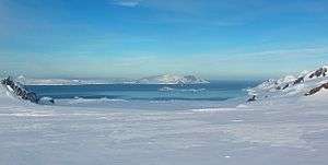
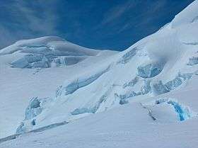
Ice cliffs, often withdrawing during recent decades to uncover new coves, beaches and points, form most of the coastline. Except for isolated patches, the land surface is covered by an ice cap, highly crevassed in certain segments, with ice domes and plateaus in the central and western areas, and a number of valley glaciers formed by the more mountainous relief of eastern Livingston. Typical of the island’s glaciology are the conspicuous ash layers originating from volcanic activity on the neighbouring Deception Island.[4]
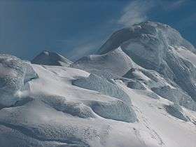
Apart from the extensive Byers Peninsula (61 km2 or 24 sq mi) forming the west extremity of Livingston, the ice-free part of the island includes certain coastal areas at Cape Shirreff, Siddins Point, Hannah Point, Williams Point, Hurd Peninsula and Rozhen Peninsula, as well as slopes in the mountain ranges, and ridges and heights in eastern Livingston that are too precipitous to keep snow. The principal mountain formations include Tangra Mountains (30 km or 19 mi long, with Mt Friesland rising to 1,700 m or 5,577 ft), Bowles Ridge (6.5 km or 4 mi, elevation 822 m or 2,697 ft), Vidin Heights (8 km or 5 mi, 604 m or 1,982 ft), Burdick Ridge (773 m or 2,536 ft), Melnik Ridge (696 m or 2,283 ft) and Pliska Ridge (667 m or 2,188 ft) in the eastern part of the island, and Oryahovo Heights (6 km or 4 mi, 340 m or 1,115 ft), and Dospey Heights (6 km or 4 mi, 265 m or 869 ft).[1]
The coastline of the island is irregular, with the more significant indentations of South Bay, False Bay, Moon Bay, Hero, Barclay, New Plymouth, Osogovo and Walker, and the peninsulas of Hurd (extension 10 km or 6.2 mi), Rozhen (9 km or 5.6 mi), Burgas (10.5 km or 6.5 mi), Varna (13 km or 8.1 mi), Ioannes Paulus II (12.8 km or 8.0 mi) and Byers (15 km or 9.3 mi).[1]
The local variety of the Antarctic Peninsula weather is particularly changeable, windy, humid and sunless. Says Australian mountaineer Damien Gildea: ‘Livingston got just about the worst weather in the world’. A US seasonal field camp on Byers Peninsula was wrecked by storm and emergency evacuated in February 2009.[5] Whiteouts are common, and blizzards can occur at any time of the year. Temperatures are rather constant, rarely exceeding 3 °C (37.4 °F) in summer or falling below −11 °C (12.2 °F) in winter, with wind chill temperatures up to 5 to 10 °C (9 to 18 °F) lower.
Below are the average temperatures of the warmest month, coldest month, yearly average, and the average annual rainfall of Livingston Island.[6]
| Place | Average: Warmest month | Average: Coldest month | Annual average | Average annual rainfall mostly in snow | ||||
|---|---|---|---|---|---|---|---|---|
| °C | °F | °C | °F | °C | °F | mm | in | |
| Livingston Island (coastal areas) | 2.6 | 36.7 | −4.6 | 23.7 | −1 | 30.2 | 377 | 14.8 |
History

It was only during the nineteenth century that any land was discovered in what are now the ‘political’ territories of Antarctica, and that land happened to be Livingston Island. Captain William Smith in the English merchant brig Williams, while sailing to Valparaíso during 1819 deviated from his route south of Cape Horn, and on 19 February sighted the northeast extremity of Livingston, Williams Point. That was the first land ever discovered south of 60° south latitude, in the present Antarctic Treaty area.[7]

A few months later Smith revisited the South Shetlands to land on King George Island on 16 October 1819 and claim possession for Britain. In the meantime, a Spanish vessel had been damaged by severe weather in the Drake Passage and sunk off the north coast of Livingston in September 1819. The 74-gun ship San Telmo commanded by Captain Rosendo Porlier was the flagship of a Spanish naval squadron. The more than 600 persons killed when the San Telmo sank were the first recorded people to die in Antarctica. While no one survived, parts of her wreckage were found subsequently by sealers on Half Moon Beach, Cape Shirreff.[1]
During December 1819 William Smith returned with his ship to the South Shetlands. This time he was chartered by Captain William Shirreff, British commanding officer in the Pacific stationed in Chile, and accompanied by Lieutenant Edward Bransfield who was tasked to survey and map the new lands. On 30 January 1820 they sighted the mountains of the Antarctic Peninsula, unaware that three days earlier the continent had already been discovered by the Russian Antarctic expedition of Fabian Gottlieb Thaddeus von Bellingshausen and Mihail Lazarev.
One year later, the Russians had circumnavigated Antarctica and arrived in the South Shetlands region during January 1821 to find over 50 American and English sealing vessels and 1000 men taking hundreds of thousands of fur seal skins. While sailing between Deception Island and Livingston (named Smolensk by the Russians) Bellingshausen met the American Captain Nathaniel Palmer, yet another pioneer of Antarctic exploration who is alleged to have sighted the mainland himself during the previous November.
Toponymy

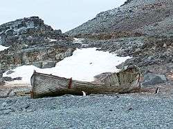
Remains of huts and sealer artefacts are still found on Livingston, which possesses the second greatest concentration of historical sites in Antarctica (after South Georgia). The names of many geographical features on the island also refer to its early history. Among the commemorated are ship captains such as the Americans Christopher Burdick, Charles Barnard, Robert Johnson, Donald MacKay, Robert Inott, David Leslie, Benjamin Brunow, Robert Macy, Prince Moores and William Napier, the Britons William Shirreff, M’Kean, John Walker, Ralph Bond, Christopher MacGregor, T. Binn and William Bowles, the Australian Richard Siddins, people like the New York shipowner James Byers, the American whaling merchants William and Francis Rotch, British Admiralty hydrographer Thomas Hurd, and John Miers, publisher of the first chart of the South Shetland Islands based on the work of William Smith, or sealing vessels like Huron, Williams, Samuel, Gleaner, Huntress, Charity, Hannah, Henry, John, Hero and others.
Some of the place names given by the nineteenth century sealers are descriptive, such as Devils Point, Hell Gates and Neck or Nothing Passage, hazardous places where ships and people were lost; Inept Cove, Needle Peak, or the Robbery Beaches where American sealers were robbed of their sealskins by the British. However, names like Livingston, Mount Friesland and Renier Point also became established during the first few seasons after the discovery of the islands, yet their particular origins remain unknown.
Livingston was the third name of the island, introduced in a 1821 publication by sealer Robert Fildes,[8] following the popular early name Friesland Island (in a variety of spellings) and the name Smolensk given by Bellingshausen in commemoration of one of the great battles of the Napoleonic Wars. The toponyms Friesland and Smolensk are now preserved as Mount Friesland and Smolensk Strait respectively.[1] The name Livingston has nothing to do with the Scotsman David Livingstone though, who was an 8-year-old boy in 1821, yet to become a cotton mill worker and still later a missionary and famous explorer of Africa.[3]
Scientific bases

The first modern, 'post-sealer' habitation facility on Livingston Island was the British base camp Station P that operated in Hannah Point area during the 1957/58 summer season. The permanent scientific bases of Juan Carlos I (Spain) and St. Kliment Ohridski (Bulgaria) were established in 1988 at South Bay. Other base facilities are the small Shirreff Base (or Guillermo Mann, Chile and the U.S.) on Cape Shirreff since 1991, and the summer base Cámara (Argentina) on nearby Half Moon Island since 1953.

Occasional field camps support research in remote areas of the island. Camp Byers (Spain) operates regularly near Nikopol Point on Byers Peninsula, the seasonal Camp Livingston (Argentina) is also situated on Byers Peninsula, and the Camp Academia site situated at elevation 541 m (1,775 ft) in upper Huron Glacier, Wörner Gap area served as a base camp of the Tangra 2004/05 topographic survey. Camp Academia is accessible by 11–12.5 km (6.8–7.8 mi) routes from St. Kliment Ohridski and Juan Carlos I respectively, and offers convenient overland access to Tangra Mountains to the south; Bowles Ridge, Vidin Heights, Kaliakra Glacier and Saedinenie Snowfield areas to the north; Huron Glacier to the east; and Perunika Glacier and Huntress Glacier to the west. Camp Academia was named for the Bulgarian Academy of Sciences in appreciation of Academy’s contribution to the Antarctic exploration, and has been designated as the summer post office Tangra 1091 of the Bulgarian Posts since 2004. Field work done out of Camp Academia during the 2004/05 season has been noted by Discovery Channel as a timeline event in Antarctic exploration.[9]
Protected areas and sites

In order to protect Antarctica, the Antarctic Treaty system enforces a strict general regime regulating human presence and activities on the continent, and designates certain protected territories where access is allowed only for scientific purposes, and with special permission.
There have been two such nature reserves on Livingston Island since 1966, comprising respectively the extensive Byers Peninsula, and the small peninsula of Cape Shirreff together with San Telmo Island and adjacent waters.
Subject of protection are the fossils demonstrating the link between Antarctica and other austral continents, a variety of abundant flora and fauna including colonies of seals and penguins that are the subject of scientific study and monitoring, as well as numerous historical monuments dating from the nineteenth century.
There are two Historic Sites or Monuments of Antarctica on the island. San Telmo Cairn (HSM 59) at Cape Shirreff commemorates the 644 officers, soldiers and seamen lost when the Spanish warship San Telmo sank nearby in September 1819. The Lame Dog Hut (HSM 91) at St. Kliment Ohridski base is the oldest preserved building on Livingston Island considered, together with its associated artefacts, as part of the cultural and historic heritage of the island and Antarctica. The hut hosts the Livingston Island Museum, a branch of the National Museum of History in Sofia.
Tourism

Antarctic shipborne tourism on the South Shetland Islands was initiated in 1958. Since then the number of tourists visiting Antarctica has grown to tens of thousands annually. Over 95% tour the South Shetlands and the nearby Antarctic Peninsula, Hannah Point on the south coast of Livingston. Half Moon Island off the east coast as well as the nearby Deception Island and the Aitcho Islands near Greenwich Island are among the most popular destinations frequented by cruise ships, offering walks amidst spectacular scenery and wildlife.
The northeasternmost slopes of Tangra Mountains between Elena Peak and Renier Point together with the adjacent portion of Sopot Ice Piedmont are a popular site for backcountry skiing and climbing, with skiers landed by Zodiac rigid inflatable boats from cruise ships visiting the Half Moon Island area.[10][11]
Honours
Several squares and streets in Bulgarian towns and cities are named after Livingston Island, such as Livingston Island Square in Samuil and Kula, and Livingston Island Street in Gotse Delchev, Yambol, Petrich, Sofia, Lovech and Vidin.[12][13][14][15]
See also
 Livingston Island and Greenwich Island |
Maps
- South Shetland Islands. Scale 1:200000 topographic map No. 5657. DOS 610 – W 62 60. Tolworth, UK, 1968.
- Islas Livingston y Decepción. Mapa topográfico a escala 1:100000. Madrid: Servicio Geográfico del Ejército, 1991.
- Isla Livingston: Península Hurd. Mapa topográfico de escala 1:25000. Madrid: Servicio Geográfico del Ejército, 1991.
- Península Byers, Isla Livingston. Mapa topográfico a escala 1:25000. Madrid: Servicio Geográfico del Ejército, 1992.
- L.L. Ivanov. St. Kliment Ohridski Base, Livingston Island. Scale 1:1000 topographic map. Sofia: Antarctic Place-names Commission of Bulgaria, 1996. (The first Bulgarian Antarctic topographic map, in Bulgarian)
- L.L. Ivanov. Livingston Island: Central-Eastern Region. Scale 1:25000 topographic map. Sofia: Antarctic Place-names Commission of Bulgaria, 1996.
- S. Soccol, D. Gildea and J. Bath. Livingston Island, Antarctica. Scale 1:100000 satellite map. The Omega Foundation, USA, 2004.
- L.L. Ivanov et al., Antarctica: Livingston Island and Greenwich Island, South Shetland Islands (from English Strait to Morton Strait, with illustrations and ice-cover distribution), 1:100000 scale topographic map, Antarctic Place-names Commission of Bulgaria, Sofia, 2005
- L.L. Ivanov. Antarctica: Livingston Island and Greenwich, Robert, Snow and Smith Islands. Scale 1:120000 topographic map. Troyan: Manfred Wörner Foundation, 2010. ISBN 978-954-92032-9-5 (First edition 2009. ISBN 978-954-92032-6-4)
- Antarctic Digital Database (ADD). Scale 1:250000 topographic map of Antarctica. Scientific Committee on Antarctic Research (SCAR), 1993–2016.
Notes
- 1 2 3 4 5 6 Ivanov, L. General Geography and History of Livingston Island. In: Bulgarian Antarctic Research: A Synthesis. Eds. C. Pimpirev and N. Chipev. Sofia: St. Kliment Ohridski University Press, 2015. pp. 17–28. ISBN 978-954-07-3939-7
- ↑ L.L. Ivanov. Antarctica: Livingston Island and Greenwich, Robert, Snow and Smith Islands. Scale 1:120000 topographic map. Troyan: Manfred Wörner Foundation, 2010. ISBN 978-954-92032-9-5 (First edition 2009. ISBN 978-954-92032-6-4)
- 1 2 Ivanov, L. and N. Ivanova. Livingston Island. In: Antarctic: Nature, History, Utilization, Geographic Names and Bulgarian Participation. Sofia: Manfred Wörner Foundation, 2014. pp. 16–20. (in Bulgarian) ISBN 978-619-90008-1-6 (Second revised and updated edition, 2014. 411 pp. ISBN 978-619-90008-2-3)
- ↑ López Martínez, J., Ed. 1992. Geología de la Antártida Occidental. Simposios T3. Salamanca: III Congreso Geológico de España y VIII Congreso Latinoamericano de Geología. 358 p.
- ↑ Antarctic Sun, March 6, 2009
- ↑ Labajo, A. 2008. Updated Information on Spain’s Antarctic and Sub-Antarctic “Weather-Forecasting” Interests. For The International Antarctic Weather Forecasting Handbook: IPY 2007–08 Supplement.
- ↑ Headland, R. 2009. A Chronology of Antarctic Exploration: A Synopsis of Events and Activities From the Earliest Times Until the International Polar Years, 2007–09. London: Bernard Quaritch. 722 pp.
- ↑ Purdy, J. 1855. Laurie’s Sailing Directory of the Ethiopic or Southern Atlantic Ocean; Including the Coasts of Brasil etc. to the Rio de la Plata, the Coast thence to Cape Horn, and the African Coast to the Cape of Good Hope etc; Including the Islands between the Two Coasts. 4th ed. London: Richard Laurie. p. 173.
- ↑ 14 November 2004: Tangra. Discovering Antarctica Timeline. Discovery Channel UK website, 2012.
- ↑ S. Romeo. IceAxe.TV Antarctic Peninsula Ski Cruise Update 4. TetonAT website, 2009.
- ↑ T. Crocker. Livingston Island, South Shetlands. Liftlines Skiing and Snowboarding Forums, 17 November 2011.
- ↑ Vidin Info
- ↑ Gotse Delchev Municipality site
- ↑ Razgrad News
- ↑ Gradski Vestnik
Bibliography
- Ivanov, L. General Geography and History of Livingston Island. In: Bulgarian Antarctic Research: A Synthesis. Eds. C. Pimpirev and N. Chipev. Sofia: St. Kliment Ohridski University Press, 2015. pp. 17–28. ISBN 978-954-07-3939-7
- Ivanov, L.L. Livingston Island: Tangra Mountains, Komini Peak, west slope new rock route; Lyaskovets Peak, first ascent; Zograf Peak, first ascent; Vidin Heights, Melnik Peak, Melnik Ridge, first ascent. The American Alpine Journal, 2005. pp. 312–315.
- Gildea, D. Mountaineering in Antarctica: complete guide: Travel guide. Primento and Editions Nevicata, 2015. ISBN 978-2-51103-136-0
External links
| Wikimedia Commons has media related to Livingston Island. |
- South Shetland Islands. 70south, 2005. Information on the South Shetland Islands including Livingston Island.
- Expedition Tangra 2004/05.
- Spanish base Juan Carlos I.
- Expedition Omega Livingston 2003. The Omega Foundation, USA, 2003.
- Protected area Byers Peninsula. Management Plan and Map.
- Protected area Cape Shirreff. Management Plan and Map.
![]() This article incorporates public domain material from the United States Geological Survey document "Livingston Island" (content from the Geographic Names Information System).
This article incorporates public domain material from the United States Geological Survey document "Livingston Island" (content from the Geographic Names Information System).

