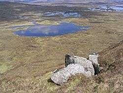
Loch Buidhe, Rannoch Moor
| Loch Buidhe | |
|---|---|
 View of Loch Buidhe, from Meall Beag | |
| Location | Rannoch Moor |
| Coordinates | 56°35′42″N 4°46′30″W / 56.595°N 4.775°WCoordinates: 56°35′42″N 4°46′30″W / 56.595°N 4.775°W |
| Type | Loch |
| Primary inflows | River Bà |
| Max. length | 500 m |
| Surface elevation | 300 m |
| Settlements | Bridge of Orchy |
Loch Buidhe is a fresh water loch on Rannoch Moor, within Highland council area, Scotland. It is situated about 9 km (6 mi) north of Bridge of Orchy. It lies to the south of Lochan na Stainge, and to the west of Lochan na h-Achlaise. The A82 road crosses Rannoch Moor to the west of the loch, while the West Highland Way long-distance path passes by to the west.[1]
The name is Gaelic for yellow loch.
References
| Wikimedia Commons has media related to Loch Buidhe. |
This article is issued from Wikipedia - version of the 12/1/2016. The text is available under the Creative Commons Attribution/Share Alike but additional terms may apply for the media files.