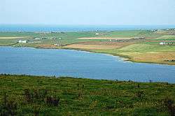
Loch of Boardhouse
| Loch of Boardhouse | |
|---|---|
| Boardhouse loch | |
 | |
| Coordinates | 59°6′42″N 3°16′35″W / 59.11167°N 3.27639°WCoordinates: 59°6′42″N 3°16′35″W / 59.11167°N 3.27639°W |
| Type | Freshwater loch |
| Primary inflows | Burn of Kirbuster [1] |
| Primary outflows | Burn of Boardhouse[2] |
| Basin countries | Scotland |
| Max. length | 2 mi (3.2 km)[1] |
| Max. width | 0.66 mi (1.06 km)[1] |
| Surface area | 1 sq mi (2.6 km2)[1] |
| Average depth | 2 m (6.6 ft)[3] |
| Max. depth | 3.2 m (10 ft)[3] |
| Water volume | 150,000,000 cu ft (4,200,000 m3)[1] |
| Surface elevation | 15 m (49 ft)[3] |
The Loch of Boardhouse is a freshwater loch in the parish of Birsay in the north west of the mainland of Orkney. It acts as a reservoir for public water supply and is popular for trout fishing.[4] Nearby are the Loch of Hundland and the Loch of Swannay.
The loch was surveyed[1] in 1906 by Sir John Murray and later charted[5] as part of the Bathymetrical Survey of Fresh-Water Lochs of Scotland 1897-1909. [6]
References
- 1 2 3 4 5 6 "Bathymetrical Survey of the Fresh-Water Lochs of Scotland, 1897-1909, Lochs of Orkney". National Library of Scotland. Retrieved 2013-07-27.
- ↑ "Gazetteer for Scotland". Gazetteer for Scotland. 2013. Retrieved 2013-07-27.
- 1 2 3 "Macrophyte survey of the Loch of Boardhouse, Orkney" (PDF). Scottish Natural Heritage. 2004. Retrieved 2013-07-27.
- ↑ "The Lochs of Orkney". Orkney Trout Fishing. Retrieved 2013-10-26.
- ↑ "View: Lochs of Boardhouse, Hundland and Swannay - Bathymetrical Survey, 1897-1909 - National Library of Scotland". maps.nls.uk. Retrieved 2013-07-27.
- ↑ Murray, John; Pullar, Laurence (1910). Bathymetrical Survey of Fresh-Water Lochs of Scotland during the years 1897 to 1909: report on scientific results. Edinburgh.
This article is issued from Wikipedia - version of the 6/18/2016. The text is available under the Creative Commons Attribution/Share Alike but additional terms may apply for the media files.