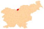
Logar Valley (Slovenia)
| Logar Valley Landscape Park | |
|---|---|
| Krajinski park Logarska dolina | |
|
IUCN category V (protected landscape/seascape) | |
|
Logar Valley | |
 | |
| Location | Slovenia |
| Coordinates | 46°23′1.03″N 14°37′17.92″E / 46.3836194°N 14.6216444°ECoordinates: 46°23′1.03″N 14°37′17.92″E / 46.3836194°N 14.6216444°E |
| Area | 24.75 km2 (9.56 sq mi) |
| Established | 1987[1][2] |
_02.jpg)
The Logar Valley (Slovene: Logarska dolina, Logarjeva dolina[3]) is a valley in the Kamnik Alps, in the Municipality of Solčava, Slovenia. The Slovene name for the valley is of relatively recent coinage[3] and is derived from the Logar Farm, which in turn is derived from log (literally, 'swampy meadow'). In 1987, the valley received protected status as a landscape park encompassing 24.75 square kilometres (9.56 sq mi).[4]
Geography
The Logar Valley is a typical U-shaped glacial valley. It is divided into three parts. The lower part is named Log, the middle part Plest or Plestje[3] (it is a mostly wooded area), and the upper part Kot (literally 'cirque') or Ogradec[3] (it is a wooded area with scree slopes). Altogether 35 people live on the isolated farmsteads in the valley.
Peaks

.ogv.jpg)
The Logar Valley is ringed by the following peaks: Strelovec (1,763 m or 5,784 ft), Krofička (2,083 m or 6,834 ft), Ojstrica (2,350 m or 7,710 ft), Lučka Baba (2,244 m or 7,362 ft), Planjava (2,394 m or 7,854 ft), Brana (2,252 m or 7,388 ft), Turska Gora (2,251 m or 7,385 ft), and Mrzla Gora (2,203 m or 7,228 ft). It terminates in a head wall beneath the Okrešelj Cirque, where the Savinja River starts at an ice-cold spring at an elevation of 1,280 meters and flows to Rinka Falls.
Climate
Although the Logar Valley is not particularly narrow (about 500 m at its narrowest), inversions are very common due to the influence of a northern anticyclone. Temperature distributions on the slopes are greatly influenced by differences between the sunny and shady areas, which is seen in different snow and ice conditions in the winter.
A walking path (2–3 hours) through the valley leads past a number of points of interest: the source of Black Creek (Črna), wooden logging chutes, a burl-covered ash tree, a charcoal-maker’s hut, and other sights.
References
- ↑ "Predstavitev Krajinskega parka Logarska dolina". Retrieved 5 May 2013.
- ↑ "Data on ProtectedPlanet.net". World Database on Protected Areas (WDPA). Retrieved 5 May 2013.
- 1 2 3 4 Mišič, Franc. 1938. "O ledinskih in hišnih imenih okoli Solčave." Časopis za zgodovino in narodopisje 33(3/4): 191–201, p. 197.
- ↑ Hrvatin, Mauro. "Logarska dolina" [Logar Valley]. In Šmid Hribar, Mateja; Golež, Gregor; Podjed, Dan; Kladnik, Drago; Erhartič, Bojan; Pavlin, Primož; Ines, Jerele. Enciklopedija naravne in kulturne dediščine na Slovenskem – DEDI [Encyclopedia of Natural and Cultural Heritage in Slovenia] (in Slovenian). Retrieved 19 February 2013.
External links
 Media related to Logar Valley (Slovenia) at Wikimedia Commons


